Daulo District

Last updated
Daulo District
Papua New Guinea location map.svg
Red pog.svg
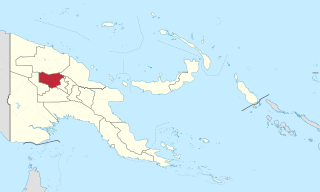
Daulo District
Location within Papua New Guinea
Coordinates: 5°59′39″S145°19′31″E / 5.9943°S 145.3252°E / -5.9943; 145.3252
Country Papua New Guinea
Province Eastern Highlands
Capital Asaro
Area
  Total625 km2 (241 sq mi)
Population
 (2011 census)
  Total45,783
  Density73/km2 (190/sq mi)
Time zone UTC+10 (AEST)

Daulo District [1] is part of the Eastern Highlands Province in Papua New Guinea. It is along the Highlands highway (Okuk Highway) leading to the other Highlands provinces, namely Simbu Province, Western Highlands, Southern Highlands and Enga Province. Daulo District shares geographical border with Simbu Province and Madang Province. Part of Daulo District's Upper Asaro Constituency is a walking distance to Mt. Wilhelm, Papua New Guinea's highest mountain in Simbu Province. Daulo is the real home of the famous Asaro Mudmen . It has a total population of over 45,000 people. It has a small district office administered by the District Administrator who is a representative of the provincial government. The electoral member for Daulo, with the help of the governor for the province, is responsible for the set up and running of Daulo District similarly with the other districts in the Eastern Highlands Province. The district was partly the implementation of the reform initiative undertaken by the Morauta government in 1995.

District administration functions very much depend on government funds as there are not much of District profit-making undertakings. Daulo District continues to upgrade the road systems on an ad hoc basis due to lack of funding. There are three constituencies and they are: Upper Asaro local level government council, Lower Asaro local level government council and Watabung local level government council. Languages spoken differs from clan to clan but the major spoken language is known as "Dano". Most of the population speaks English and Tok Pisin.

The main cash crop in Daulo is coffee. Recently in 2002, inland fishing was introduced by Hon. Ron Ganarafo, member for Daulo 1997–2002, who return his seat again in 2012 general election. His aim to assist school children and generate more human resources. As of July 2013 he was the fourth M.P. to hand the district five-year plan to minister for Planning Hon. Charles Able. However, most people live a subsistence living. As people begin to learn about marketing in other parts of Papua New Guinea, many have gone into agriculture to supply local markets around the country, specifically Lae, Port Moresby, Madang and Rabaul.

The people are now divided into various types of economic activities, 50% still in coffee, 40% in agriculture, 7% inland fishing and the rest other activities. Even though people tend to produce bags of Kaukau (sweet potato), carrot, cabbage and other commodities, yet live a poverty life.

The land is fertile and most Daulo people are hard workers. In 20 years time, Daulo district aims to export coffee and fish to other parts of the world with the help of Coffee Industry Corporation (CIC) based in Goroka and National Fisheries Authority (NFA).

Daulo is venturing into tourism industry due to beautiful landscapes, rich cultural performances such as the unique and globally famous Asaro Mudmen. Apart from Asaro Mudmen, Daulo have Nokondi Cultural performance, sing-sing groups beautifully and colorfully dressed in their traditional attires among others. Daulo is annually receiving tourists from Japan, Australia including other counties.

Related Research Articles

<span class="mw-page-title-main">Demographics of Papua New Guinea</span>

The indigenous population of Papua New Guinea is one of the most heterogeneous in the world. Papua New Guinea has several thousand separate communities, most with only a few hundred people. Divided by language, customs, and tradition, some of these communities have engaged in endemic warfare with their neighbors for centuries. It is the second most populous nation in Oceania, with a total population estimated variously as being between 9.5 and 10.1 million inhabitants.

<span class="mw-page-title-main">Provinces of Papua New Guinea</span> First-level administrative divisions of Papua New Guinea

For administrative purposes, Papua New Guinea is divided into administrative divisions called provinces. There are 22 provincial-level divisions, which include 20 provinces, the Autonomous Region of Bougainville, and the National Capital District of Port Moresby.

<span class="mw-page-title-main">Enga Province</span> Place in Papua New Guinea

Enga is one of the provinces in Papua New Guinea (PNG). It is located in the north most region of the highlands of PNG, having been divided from the Western Highlands to become a separate province when the provinces were created at the time of independence in 1975. The people of Enga are called Engans—they are a majority ethnic group—speaking one language in all its five districts: approximately 500,000 people. A small minority of Engans' land on the eastern side of the region remained in the Western Highlands, their territory being accessible by road from Mount Hagen but not directly from elsewhere in Enga territory.

The United Party is a political party in Papua New Guinea. As of May 2019, it has one seat in the National Parliament and is led by Minister for Foreign Affairs, Rimbink Pato.

<span class="mw-page-title-main">Highlands Highway</span> Main land highway in Papua New Guinea

The Highlands Highway, sometimes known as the Okuk Highway, is the main land highway in Papua New Guinea. It connects several major cities and is vital for the movement of people and goods between the populous Highlands region and the coast.

<span class="mw-page-title-main">Chimbu Province</span> Province in Papua New Guinea

Chimbu, more frequently spelled Simbu, is a province in the Highlands Region of Papua New Guinea. The province has an area of 6,112 km2 and a population of 376,473. The capital of the province is Kundiawa. Mount Wilhelm, the tallest mountain in Papua New Guinea is on the border of Eastern part of Simbu and the Western part of Madang Province.

<span class="mw-page-title-main">Eastern Highlands Province</span> Place in Papua New Guinea

Eastern Highlands is a highlands province of Papua New Guinea. The provincial capital is Goroka. The province covers an area of 11,157 km², and has a population of 579,825. The province shares a common administrative boundary with Madang Province to the north, Morobe Province to the east, Gulf Province to the south, and Simbu Province to the west. The province is the home of the Asaro mud mask that is displayed at shows and festivals within the province and in the country. The province is reachable by air, including Goroka Airport, and road transport, including the main Highlands Highway.

Kundiawa is the capital of Simbu Province, Papua New Guinea, with a population of 8,147. It lies along the Highlands Highway approximately halfway between Goroka and Mount Hagen, respectively the capitals of the Eastern Highlands and Western Highlands provinces.

<span class="mw-page-title-main">Asaro Mudmen</span> Tradition of an ethnic group of Papua New Guinea

The "Mudmen" of Papua New Guinea's Asaro tribe, also known as the Holosa, are those who wear a traditional costume centered around masks made of mud. They live nearby the village of Goroka in the Eastern Highlands Province of Papua New Guinea.

<span class="mw-page-title-main">Regions of Papua New Guinea</span> List of the regions of Papua New Guinea

Papua New Guinea is divided into four regions, which are its broadest administrative divisions of Papua New Guinea. While the 22 provincial-level divisions are the primary administrative divisions of PNG, the regions are quite significant in daily life, as they are often the basis for organisation of government services, corporate operations, sporting competitions, and even the machinations of politics.

Asaro River is a river in Eastern Highlands province, Papua New Guinea, located at 6.3666667°S 145.2°E. The Asaro is a tributary of the Tua.

<span class="mw-page-title-main">Districts of Papua New Guinea</span> Second-level administrative division

This page is a list of districts of Papua New Guinea.

For administrative purposes, Papua New Guinea (PNG) is divided into administrative divisions called regions and provinces. Papua New Guinea is divided into four regions and 22 province-level divisions: 20 provinces plus the autonomous region (Bougainville) and the National Capital District.

Kerowagi District is one of six districts of the Simbu Province in Papua New Guinea. Its capital is Kerowagi and the district has three Local Level Government (LLG) areas: Gena-Waugla Rural, Kerowagi Rural, and Kup Rural.

Mauwake (Mawake), or Ulingan, is a Papuan language spoken in Almami Rural LLG, Madang Province, Papua New Guinea. It is spoken in several villages along the north coast of Madang province, which lies in the north-east of Papua New Guinea.

<span class="mw-page-title-main">Yalu, Papua New Guinea</span> Village in Morobe Province, Papua New Guinea

Yalu is a large village in Wampar Rural LLG, located in the Markham Valley of Morobe Province, Papua New Guinea. It lies along the Highlands Highway 21.5 kilometres (13.4 mi) north-west of Lae, 7 kilometres (4.3 mi) southeast of Nadzab. The landscape is typically lowland rainforest.

<span class="mw-page-title-main">Lower Asaro Rural LLG</span> Local-level government in Papua New Guinea

Lower Asaro Rural LLG is a local-level government (LLG) of Eastern Highlands Province, Papua New Guinea. The Tokano language is spoken in the LLG.

<span class="mw-page-title-main">Upper Asaro Rural LLG</span> Local-level government in Papua New Guinea

Upper Asaro Rural LLG is a local-level government (LLG) of Eastern Highlands Province, Papua New Guinea. The Dano language, also known as Upper Asaro, is spoken in the LLG.

Betty Higgins is an entrepreneur from Papua New Guinea (PNG) who developed and runs a trout farm and hotel in the Mount Wilhelm area. In 2009 she was awarded the overall Women in Business Award at the Westpac Outstanding Women Awards for PNG.

References

  1. Koma, Michael (May 25, 2017). "Daulo DSIP sees development". postcourier.com. POST COURIER. Retrieved 17 August 2023.

5°59′39″S145°19′31″E / 5.9943°S 145.3252°E / -5.9943; 145.3252