Davenport Creek

Last updated

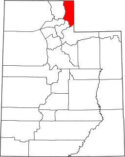
Davenport Creek is a stream in Cache County, Utah, United States. [1] It is also located within the Uinta-Wasatch-Cache National Forest and its mouth is about 2 miles (3.2 km) southeast of Avon. [2]

Stream A body of surface water flowing down a channel

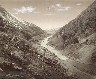
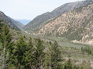
A stream is a body of water with surface water flowing within the bed and banks of a channel. The stream encompasses surface and groundwater fluxes that respond to geological, geomorphological, hydrological and biotic controls.

Cache County, Utah County in the United States

Cache County is a county located on the northern edge of Utah, United States. As of the 2010 Census the population was 112,656. Its county seat and largest city is Logan. The county was created in 1856 and organized the next year. It was named for the fur stashes, known in French as Caches, made by many of the Rocky Mountain Fur Company trappers.

Utah A state of the United States of America

Utah is a state in the western United States. It became the 45th state admitted to the U.S. on January 4, 1896. Utah is the 13th-largest by area, 31st-most-populous, and 10th-least-densely populated of the 50 United States. Utah has a population of more than 3 million according to the Census estimate for July 1, 2016. Urban development is mostly concentrated in two areas: the Wasatch Front in the north-central part of the state, which contains approximately 2.5 million people; and Washington County in Southern Utah, with over 160,000 residents. Utah is bordered by Colorado to the east, Wyoming to the northeast, Idaho to the north, Arizona to the south, and Nevada to the west. It also touches a corner of New Mexico in the southeast.

The creek rises in the Bear River Mountains (at a point about 500 feet [150 m] west of the border with Weber County) and flows briefly southwest. It then turns northwest and runs in that direction for most of its course before emptying into the South Fork Little Bear River at a point immediately west of Utah State Route 162. [2] (The Little Bear River in turn, flows roughly north-northeast, through the Hyrum Reservoir, until it reaches the Bear River in the Cutler Reservoir. The Bear River then flows south to the Great Salt Lake.) The main tributaries of Davenport Creek are Pole Creek, Bald Head Creek, Smith Creek, and Fish Creek.

Borders are geographic boundaries of political entities or legal jurisdictions, such as governments, sovereign states, federated states, and other subnational entities. Borders are established through agreements between political or social entities that control those areas; the creation of these agreements is called boundary delimitation.

Weber County, Utah County in the United States

Weber County is a county in the U.S. state of Utah. As of the 2010 census, the population was 231,236, making it Utah's fourth-most populous county. Its county seat and largest city is Ogden, the home of Weber State University. The county was formed in 1850 and named after the Weber River, which in turn was named for John Henry Weber (1779–1859), a fur trapper and trader in the area in the mid-1820s.

Davenport Creek was named for James Davenport, a lumberman. [3]

See also

Related Research Articles

Rich County, Utah County in the United States

Rich County is a county located in the U.S. state of Utah. As of the 2010 census, the population was 2,264, making it the third-least populous county in Utah. Its county seat is Randolph, and the largest town is Garden City. The county was created in 1864. It was named for an early LDS apostle, Charles C. Rich.

Bear River (Great Salt Lake) river in southwestern Wyoming, southeastern Idaho, and northern Utah

The Bear River is the largest tributary of the Great Salt Lake, draining a mountainous area and farming valleys northeast of the lake and southeast of the Snake River Plain. It flows through southwestern Wyoming, southeastern Idaho, and northern Utah, in the United States. Approximately 350 miles (560 km) long it is the largest river in North America that does not ultimately reach the sea.

Cache Valley valley in Grand County, Utah, United States

Cache Valley is an agricultural valley of northern Utah and southeast Idaho, United States, that includes the Logan metropolitan area. The valley was used by 19th century mountain men and was the site of the 1863 Bear River Massacre.

Feather River river in the United States of America

The Feather River is the principal tributary of the Sacramento River, in the Sacramento Valley of Northern California. The river's main stem is about 73 miles (117 km) long. Its length to its most distant headwater tributary is just over 210 miles (340 km). The main stem Feather River begins in Lake Oroville, where its four long tributary forks join together—the South Fork, Middle Fork, North Fork, and West Branch Feather Rivers. These and other tributaries drain part of the northern Sierra Nevada, and the extreme southern Cascades, as well as a small portion of the Sacramento Valley. The total drainage basin is about 6,200 square miles (16,000 km2), with approximately 3,604 square miles (9,330 km2) above Lake Oroville.

Weber River river in Utah, United States

The Weber River is a c. 125-mile (201 km) long river of northern Utah, United States. It begins in the northwest of the Uinta Mountains and empties into the Great Salt Lake. The Weber River was named for American fur trapper John Henry Weber.

Cache Creek (Sacramento River tributary) river in the United States of America

Cache Creek is an 87-mile-long (140 km) stream in Lake, Colusa and Yolo counties, California.

Shenango River river in the United States of America

The Shenango River is a principal tributary of the Beaver River, approximately 100 mi (160 km) long, in western Pennsylvania in the United States. It also briefly flows through small portions of northeastern Ohio. Via the Beaver and Ohio Rivers, it is part of the watershed of the Mississippi River.

Cache National Forest

Cache National Forest is a 533,840-acre area of National Forest System land in Idaho and Utah which was established on July 1, 1908 by the U.S. Forest Service. The majority of its area is in Utah, and was initially created when the Bear River National Forest was disbanded. On July 1, 1915, all of Pocatello National Forest was added. In 1973 the Idaho portion was transferred to the administration of Caribou National Forest, while the Utah portion was combined administratively with Wasatch National Forest, creating the Wasatch-Cache National Forest. In descending order of forestland area, the Cache National Forest portion is located in Cache, Bear Lake, Franklin, Weber, Rich, Box Elder, Caribou, and Morgan counties. The forest has a current area of 701,453 acres (2,838.68 km2), which comprises 43.56% of the combined Wasatch-Cache's total acreage. The forest is administered from Salt Lake City, Utah as part of the Wasatch-Cache National Forest, but there are local ranger district offices in Logan and Ogden. From circa 1911 until August 1923, the area was roamed by Old Ephraim.

The Little Bear River is a 36.4-mile-long (58.6 km) tributary of the Bear River in northern Utah in the United States. It rises in the mountains east of Brigham City, where three forks join at Avon, then flows north to Paradise. At Paradise it spills out into the broad flats of Cache Valley, passing north by Hyrum, where it is impounded by the Hyrum Reservoir, then meandering generally west by Wellsville. It meanders north again, receiving the Logan River in the Cutler Marsh, and eventually draining into the Bear River, although the junction is now submerged by the Cutler Reservoir.

Box Elder Canyon is a canyon located within the western slopes of the Wellsville Mountains, a branch of the Wasatch Range of the Rocky Mountains in Utah, United States.

Juab Valley valley in Utah, United States

The Juab Valley is a 40-mile (64 km) long valley located on the eastern edge of Juab County, Utah, United States.

Newton Dam

Newton Dam is an earthen dam about a mile north of Newton, in Cache County, Utah, United States.

Porcupine Dam is a dam in East Canyon in Cache County, Utah, United States.

Camas Creek (Big Wood River tributary) river in Emore, Camas, and Blaine counties in Idaho, United States

Camas Creek is a 64-mile (103 km) long river in southern Idaho, United States, that is a tributary of the Big Wood River.

Crescent Lake is a lake in northeastern Cache County, Utah, United States.

Curtis Creek is a stream in Cache County, Utah, United States.

Dalton Creek is a stream in Morgan County, Utah, United States. It is also located within the Uinta-Wasatch-Cache National Forest and its mouth is about 1.75 miles (2.82 km) southeast of Peterson.

Currant Creek (Juab and Utah counties, Utah)

Currant Creek is a stream in eastern Juab County and southern Utah County in northern Utah, United States.

References

  1. U.S. Geological Survey Geographic Names Information System: Davenport Creek
  2. 1 2 Davenport Creek, Cache County, UT, United States (Map). Trimble Navigation, Ltd. Retrieved 30 Mar 2016.
  3. Cott, John W. Van (1990). Utah Place Names: A Comprehensive Guide to the Origins of Geographic Names : a Compilation. Salt Lake City: University of Utah Press. p. 103. ISBN   978-0-87480-345-7.

Coordinates: 41°30′15″N111°48′56″W / 41.5041028°N 111.8154963°W / 41.5041028; -111.8154963

Geographic coordinate system Coordinate system

A geographic coordinate system is a coordinate system that enables every location on Earth to be specified by a set of numbers, letters or symbols. The coordinates are often chosen such that one of the numbers represents a vertical position and two or three of the numbers represent a horizontal position; alternatively, a geographic position may be expressed in a combined three-dimensional Cartesian vector. A common choice of coordinates is latitude, longitude and elevation. To specify a location on a plane requires a map projection.