Grand Canyon National Park, located in northwestern Arizona, is the 15th site in the United States to have been named as a national park. The park's central feature is the Grand Canyon, a gorge of the Colorado River, which is often considered one of the Wonders of the World. The park, which covers 1,217,262 acres of unincorporated area in Coconino and Mohave counties, received more than six million recreational visitors in 2017, which is the second highest count of all American national parks after Great Smoky Mountains National Park. The Grand Canyon was designated a World Heritage Site by UNESCO in 1979. The park celebrated its 100th anniversary on February 26, 2019.

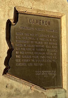
Cameron is a census-designated place (CDP) in Coconino County, Arizona, United States, on the Navajo Nation. The population was 885 at the 2010 census. Most of the town's economy is tourist food and craft stalls, restaurants, and other services for north–south traffic from Flagstaff and Page. There is a ranger station supplying information and hiking permits for the Navajo Nation as well as a small selection of books for sale. There is also a large craft store run by the Nation itself; most vendors in the area operate from small private stalls. It is named after Ralph H. Cameron, Arizona's first senator.

Navajo Bridge is the name of twin steel spandrel arch bridges that cross the Colorado River in the Grand Canyon National Park in northern Coconino County, Arizona, United States. The newer of the two spans carries vehicular traffic on U.S. Route 89A (US 89A) over Marble Canyon between Bitter Springs and Jacob Lake, allowing travel into a remote Arizona Strip region north of the Colorado River including the North Rim of Grand Canyon National Park.

Northern Arizona is an unofficial, colloquially-defined region of the U.S. state of Arizona. Generally consisting of Apache, Coconino, Mohave, Navajo, and Gila counties, the region is geographically dominated by the Colorado Plateau, the southern border of which in Arizona is called the Mogollon Rim.

U.S. Route 89A is a 91.74-mile (147.64 km) north–south auxiliary U.S. highway in southwestern Kane County, Utah and northeastern Coconino County, Arizona in the southwestern United States. The highway is an old routing of U.S. Route 89 from Bitter Springs, Arizona to Kanab, Utah. The state of Arizona has designated this highway the Fredonia-Vermilion Cliffs Scenic Road. The highway is used to access the North Rim of Grand Canyon National Park and is known for the Navajo Bridge. Until 2008, the Utah portion was signed State Route 11. The route provides the only direct road connection between the Arizona Strip and the rest of Arizona.

The Arizona Strip is the part of Arizona lying north of the Colorado River. Despite being larger in area than several U.S. states, the entire region has a population of fewer than 10,000 people. Consisting of northeastern Mohave County and northwestern Coconino County, the largest settlements in the Strip are Colorado City, Fredonia, and Beaver Dam, with smaller communities of Scenic, Littlefield and Desert Springs. The Kaibab Indian Reservation lies within the region. Lying along the North Rim of the Grand Canyon creates physical barriers to the rest of Arizona. Only three major roads traverse the region, I-15 crosses the northwestern corner while Arizona State Route 389 and U.S. Route 89A crosses the northeastern part of the strip, US 89A crosses the Colorado River via the Navajo Bridge, providing the only direct road connection between the strip and the rest of the state. The nearest metropolitan area is the St. George, Utah metro area, to which the region is more connected than to the rest of Arizona.

State Route 64 (SR 64) is a 108.31-mile-long (174.31 km) state highway in the northern part of the US state of Arizona. It travels from its western terminus in Williams to its intersection with U.S. Route 89 (US 89) in Cameron.

U.S. Route 89 in the U.S. state of Arizona is a U.S. Highway that begins in Flagstaff and heads north to the Utah border northwest of Page.

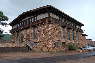
Grand Canyon Power House is a former electric power plant that served National Park Service and concessioner facilities at the South Rim of the Grand Canyon in Grand Canyon National Park. It is significant for its architecture, which masks the building's industrial function behind a veneer of rustic design. It has been designated a National Historic Landmark on the basis of its design quality and the level of preservation of its equipment.

Grand Canyon Village Historic District comprises the historic center of Grand Canyon Village, on the South Rim of the Grand Canyon in Grand Canyon National Park, Arizona. The district includes numerous landmark park structures, many of which are National Historic Landmarks themselves, or are listed on the National Register of Historic Places. The town design as a whole is also significant for its attention to integration with the Grand Canyon landscape, its incorporation of National Park Service Rustic design elements, and for the idiosyncratic design of park concessioner structures such as the El Tovar Hotel.

The Cedar Canyon Bridge is a steel arch highway bridge on US 60 near Show Low, Arizona. The 180-foot (55 m) span ribbed girder arch bridge was built in 1937–38 with a total length of 250 feet (76 m). The 24-foot-wide (7.3 m) bridge was substantially widened and upgraded in 1994, using the identical arch from the Corduroy Creek Bridge to double the width of the bridge while rehabilitating the deck structure.

The Corduroy Creek Bridge was a steel arch highway bridge on US 60, located near Show Low in Navajo County, Arizona.

The Grand Canyon North Rim Headquarters is a historic district on the North Rim of the Grand Canyon in Grand Canyon National Park, Arizona. Established from 1926 through the 1930s, the district includes examples of rustic architecture as applied to employee residences, administrative facilities and service structures.

The Zion – Mount Carmel Highway is a 25-mile (40 km) long road in Washington and Kane counties in southern Utah, United States, that is listed on the National Register of Historic Places and is a National Historic Civil Engineering Landmark.

The Cameron Suspension Bridge crosses the Little Colorado River at Cameron, Arizona, United States.

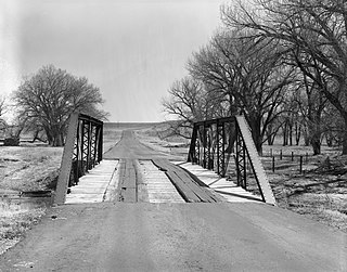
The AJX Bridge is a historic Pratt truss bridge in southwestern Johnson County, Wyoming. The bridge was built in 1931 across the South Fork of the Powder River near Kaycee, Wyoming. AJX Bridge was built to provide a river crossing for U.S. Route 87. It was placed on the National Register of Historic Places in 1985 as part of a Multiple Property Submission devoted to historic bridges in Wyoming.

The EWZ Bridge over East Channel of Laramie River is a Pratt pony truss bridge that was located near Wheatland, Wyoming, which carried Platte County Road CN8-204 over the East Channel of the Laramie River. The bridge was built from 1913 to 1914 by the Pueblo Bridge Company. The single-span bridge was 71 feet 2 inches (21.69 m) long. The bridge's five-panel Pratt pony truss design with steel pin connections was used fairly frequently in Wyoming highway bridges, and the bridge was one of the older examples of the style.

The Rockville Bridge spans the east fork of the Virgin River in Rockville, Utah, United States. The bridge was built for the National Park Service in 1924 to provide a link between Zion National Park and the North Rim area of Grand Canyon National Park. The new bridge allowed motorists to take a circular tour of the national parks in southern Utah and northern Arizona. The Rockville route was superseded in 1928 by the construction of the Zion-Mount Carmel Highway.

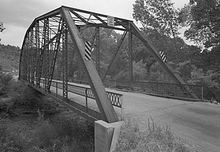
The Allentown Bridge is a bridge spanning the Puerco River near Houck, Arizona, located in Apache County. The existing structure was completed in 1923 and is listed on the National Register of Historic Places.
The Black River Bridge near Carrizo, Arizona was funded in 1911 and built in 1912. It was listed on the National Register of Historic Places in 1988. It spans the Black River, bringing an army road, now Indian Route 9, over the river from Fort Apache to the railroad at the former town of Rice, Arizona.


