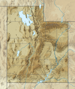
Rocky Ridge is a town on the northeastern edge of Juab County, Utah, United States. As of the 2010 census it had a population of 733, and in 2018 the estimated population was 833.

Utah Lake State Park is a state park in west Provo, Utah, United States. The park is located at the west end of Provo Center Street on the east shore of Utah Lake immediately northwest of the Provo Municipal Airport.

Cache Valley is a valley of northern Utah and southeast Idaho, United States, that includes the Logan metropolitan area. The valley was used by 19th century mountain men and was the site of the 1863 Bear River Massacre. The name, Cache Valley is often used synonymously to describe the Logan Metropolitan Area, one of the fastest growing metro areas in the US per capita — both in terms of economic GDP and population.

Fremont River is 95-mile (153 km) long river in southeastern Utah, United States that flows from the Johnson Valley Reservoir, which is located on the Wasatch Plateau near Fish Lake, southeast through Capitol Reef National Park to the Muddy Creek near Hanksville where the two rivers combine to form the Dirty Devil River, a tributary of the Colorado River.

Keetley is a ghost town located in northeastern Wasatch County, Utah, United States.

Hanksville is a small town in Wayne County, Utah, United States, at the junction of State Routes 24 and 95. The population was 219 at the 2010 census.

The Roan Cliffs are a series of desert mountains and cliffs in eastern Utah and western Colorado, in the western United States that are distinct from the Book Cliffs.

Beryl is an unincorporated community in west-central Iron County, Utah, United States.

Eskdale is an unincorporated community in western Millard County, Utah, United States, just east of the Nevada border.

Hanna is an unincorporated community in western Duchesne County, Utah, United States, on the Uintah and Ouray Indian Reservation.

Deer Creek State Park a state park in south western Wasatch County, Utah, United States, featuring large Deer Creek Dam and Reservoir. The park is located near the town of Charleston in the southwest corner of the Heber Valley.

Trout Creek is an unincorporated community, in far western Juab County, Utah, United States.

Wah Wah Valley is an endorheic valley within the Basin and Range of west-central Utah, United States.

Beaver Dam is an unincorporated community on the northeastern edge of Box Elder County, Utah, United States.

Crescent Lake is a lake in northeastern Cache County, Utah, United States.
Crouse Creek is a stream in the Uinta Mountains near the eastern edge of Daggett County, Utah, United States.
Davis Lakes is a group of lakes near the northern edge of Duchesne County, Utah, United States.
Dead Ox Canyon is a canyon in southern Morgan County, Utah, United States.

Deadman Lake is a lake near the northern edge of Uintah County, Utah, United States.

Diamond is a ghost town in eastern Juab County, Utah, United States. The Diamond Cemetery is listed on the National Register of Historic Places.


