Related Research Articles

The United States Postal Service (USPS), also known as the Post Office, U.S. Mail, or Postal Service, is an independent agency of the executive branch of the United States federal government responsible for providing postal service in the United States, its insular areas, and its associated states. It is one of the few government agencies explicitly authorized by the Constitution of the United States. As of 2023, the USPS has 525,469 career employees and 114,623 non-career employees.

A postal code is a series of letters or digits or both, sometimes including spaces or punctuation, included in a postal address for the purpose of sorting mail.

A ZIP Code is a system of postal codes used by the United States Postal Service (USPS). The term ZIP was chosen to suggest that the mail travels more efficiently and quickly when senders use the code in the postal address.

Postal codes used in the United Kingdom, British Overseas Territories and Crown dependencies are known as postcodes. They are alphanumeric and were adopted nationally between 11 October 1959 and 1974, having been devised by the General Post Office . The system uses alphanumeric codes to designate geographic areas. A full postcode, also known as a "postcode unit", identifies a group of addresses or a major delivery point. It consists of an outward code and inward code. The outward code indicates the area and district, while the inward code specifies the sector and delivery point, typically encompassing about 15 addresses.
Canada Post Corporation, trading as Canada Post, is a Crown corporation that functions as the primary postal operator in Canada.
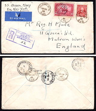
Registered mail is a postal service in many countries which allows the sender proof of mailing via a receipt and, upon request, electronic verification that an article was delivered or that a delivery attempt was made. Depending on the country, additional services may also be available, such as:
POSTNET is a barcode symbology used by the United States Postal Service to assist in directing mail. The ZIP Code or ZIP+4 code is encoded in half- and full-height bars. Most often, the delivery point is added, usually being the last two digits of the address or PO box number.
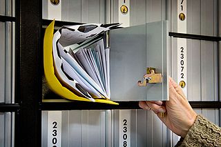
A post office box is a uniquely addressable lockable box located on the premises of a post office.
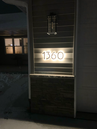
An address is a collection of information, presented in a mostly fixed format, used to give the location of a building, apartment, or other structure or a plot of land, generally using political boundaries and street names as references, along with other identifiers such as house or apartment numbers and organization name. Some addresses also contain special codes, such as a postal code, to make identification easier and aid in the routing of mail.

PostBar, also known as CPC 4-State, is the black-ink barcode system used by Canada Post in its automated mail sorting and delivery operations. It is similar to other 4 State barcode systems used by Australia Post and the United Kingdom's Royal Mail, but uses an obscured structure and encoding system unique to Canada Post. This particular bar code system is used on "flats" and parcels.
Address geocoding, or simply geocoding, is the process of taking a text-based description of a location, such as an address or the name of a place, and returning geographic coordinates, frequently latitude/longitude pair, to identify a location on the Earth's surface. Reverse geocoding, on the other hand, converts geographic coordinates to a description of a location, usually the name of a place or an addressable location. Geocoding relies on a computer representation of address points, the street / road network, together with postal and administrative boundaries.
The Coding Accuracy Support System (CASS) enables the United States Postal Service (USPS) to evaluate the accuracy of software that corrects and matches street addresses. CASS certification is offered to all mailers, service bureaus, and software vendors that would like the USPS to evaluate the quality of their address-matching software and improve the accuracy of their ZIP+4, carrier route, and five-digit coding.
The Postal Alpha Numeric Encoding Technique (PLANET) barcode was used by the United States Postal Service to identify and track pieces of mail during delivery – the Post Office's "CONFIRM" services. It was fully superseded by Intelligent Mail Barcode by January 28, 2013.

The Intelligent Mail Barcode (IMb) is a 65-bar barcode for use on mail in the United States. The term "Intelligent Mail" refers to services offered by the United States Postal Service for domestic mail delivery. The IM barcode is intended to provide greater information and functionality than its predecessors POSTNET and PLANET. An Intelligent Mail barcode has also been referred to as a One Code Solution and a 4-State Customer Barcode, abbreviated 4CB, 4-CB or USPS4CB. The complete specification can be found in USPS Document USPS-B-3200. It effectively incorporates the routing ZIP Code and tracking information included in previously used postal barcode standards.

Postcodes in Australia are used to more efficiently sort and route mail within the Australian postal system. Postcodes in Australia have four digits and are placed at the end of the Australian address, before the country. Postcodes were introduced in Australia in 1967 by the Postmaster-General's Department and are now managed by Australia Post, Australia's national postal service. Postcodes are published in booklets available from post offices or online from the Australia Post website.
National Change of Address (NCOALink) is "a secure dataset of approximately 160 million permanent change-of-address (COA) records consisting of the names and addresses of individuals, families and businesses who have filed a change-of-address with the USPS". It is a postal address verification system maintained by the United States Postal Service, and access to it is licensed to service providers and made available to mailers. There are six licenses available including Full Service Providers and Limited Service Providers. The use of NCOALink is required in order to obtain bulk mail rates, as it minimizes the number of UAA mailpieces saving the mailer money and reducing the USPS's processing of this type of mail.
Mail sorting refers to the methods by which postal systems determine how and where to route mail for delivery. Once accomplished by hand, mail sorting is now largely automated through the aid of specialized machines. The first widely adopted mail sorting machine was the Transorma, first made operational in Rotterdam in 1930.
Postal address verification is the process used to check the validity and deliverability of a physical mailing address. According to the United States Postal Service, an address is valid if it is CASS-certified, meaning that it exists within the comprehensive list of mailable addresses in their Address Management System. This is different from the credit card Address Verification System (AVS), which is the method used by credit card processors to authenticate ownership of a credit card by verifying that the account on the credit card matches the billing address on file. Credit card AVS does not determine deliverability of an address.

Package tracking or package logging is the process of localizing shipping containers, mail and parcel post at different points of time during sorting, warehousing, and package delivery to verify their provenance and to predict and aid delivery.
Semaphore Corporation was a company notable for being the first to provide public access to selected U.S. Postal Service databases, and for its early computer publications in the 1980s.
References
- ↑ "United States Postal Service Publication 32 - Glossary of Postal Terms". United States Postal Service. Retrieved 20 March 2019.
- ↑ "US Postal Service CASS Technical Guide" (PDF). United States Postal Service. January 2018. p. 36. Retrieved 12 April 2021.
- ↑ "New Zealand Address Dataset (NZAD)". New Zealand Post. Retrieved 23 December 2016.
- ↑ "Address data for data partners". Australia Post. Retrieved 23 December 2016.