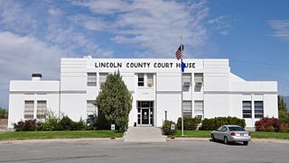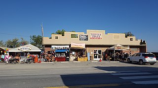
Lincoln County is a county in the U.S. state of Nevada. As of the 2020 census, the population was 4,499, making it the fourth-least populous county in Nevada. Its county seat is Pioche. Like many counties in Nevada, it is dry and sparsely populated, though notable for containing the Area 51 government Air Force base.

Fallon is a city in Churchill County in the U.S. state of Nevada. The population was 9,327 at time of the 2020 census. Fallon is the county seat of Churchill County and is located in the Lahontan Valley. Fallon is known for being home to Naval Air Station Fallon, located southeast of town.

Elko is a city in the U.S. state of Nevada and the county seat of Elko County. As of the official 2020 U.S. Census, the city has a population of 20,564. Elko serves as the center of the Ruby Valley, a region with a population of over 55,000. Elko is 21 miles (34 km) from Lamoille Canyon and the Ruby Mountains, providing year round access to recreation including hiking, skiing, hunting, and more than 20 alpine lakes. The city straddles the Humboldt River. Spring Creek, Nevada, serves as a bedroom community 6 miles (10 km) from the city with a population of 13,805.

Fernley is a city in Lyon County, Nevada, United States, and part of the Reno–Tahoe-Sparks metropolitan area CSA. The city was incorporated in 2001. The population of the city was 22,895 at the 2020 census, making it the 7th most populous city in Nevada.

Empire is an unincorporated community and census-designated place (CDP) in Washoe County, Nevada, with a population estimated at 65 (2021). Prior to the 2010 census it was part of the Gerlach–Empire census-designated place, it is now part of the Reno–Sparks Metropolitan Statistical Area. The nearest town, Nixon, is 60 miles (97 km) to the south on a reservation owned by the Pyramid Lake Paiute Tribe.

Pioche is an unincorporated town in Lincoln County, Nevada, United States, approximately 180 miles (290 km) northeast of Las Vegas. U.S. Route 93 is the main route to Pioche and bypasses the town center just to the east, with Nevada State Route 321 and Nevada State Route 322 providing direct access. Its elevation is 6,060 feet (1,850 m) above sea level. Pioche is the county seat of Lincoln County. Pioche is named after François Louis Alfred Pioche, a San Francisco financier and land speculator originally from France. The town's population was 1,002 at the 2010 census.

Panaca is an unincorporated town in eastern Lincoln County, Nevada, United States, on State Route 319, about 1 mile east of U.S. Route 93, near the border with Utah. Its elevation is 4,729 feet above sea level. As of the 2010 census, it had a population of 963. It is one of only two cities in Nevada that prohibits gambling, the other being Boulder City.

Alamo is an unincorporated town in Lincoln County, Nevada, United States, about 90 miles (140 km) north of Las Vegas along U.S. Route 93. Its elevation is 3,449 feet (1,051 m). As of the 2010 census it had a population of 1,080.

Paradise Valley is a census-designated place (CDP) in Humboldt County, Nevada, United States, near the Santa Rosa Ranger District of Humboldt National Forest. It is located at the northern terminus of Nevada State Route 290, about 19 miles (31 km) northeast of U.S. Highway 95 and a total of 40 miles (64 km) north of Winnemucca. The town is located in a broad valley, with the Santa Rosa Range of mountains just to the northwest. At the 2010 census, the population of the CDP was 109.

Hiko is a small, agrarian community in the Tonopah Basin on State Route 318 in Lincoln County, Nevada, United States. It is a census-designated place, with a population of 119 at the 2010 census.
Carp, Nevada is an extinct town in Lincoln County, Nevada, United States located 35 miles (56 km) south of Caliente. It sits on the Meadow Valley Wash, which empties into Lake Mead.

San Jacinto is a ghost town in along Salmon Falls Creek in northern Elko County, Nevada, United States. It is part of the Elko Micropolitan Statistical Area.

Crystal Springs is a ghost town in the Pahranagat Valley region of Lincoln County, Nevada in the United States. The ghost town is located at the junction of State Route 318 and State Route 375, just northwest of U.S. Route 93. It is a popular destination for passersby who want to visit the towns of Hiko and Rachel. The namesake of the ghost town, the Crystal Springs, lies nearby; it is a large group of marshes and springs along the White River. Crystal Springs provides irrigation for multiple nearby ranches and farms, some of which lie over 5 miles away from the springs.
Etna is former railroad station in Lincoln County, in the U.S. state of Nevada.

Sunnyside is a small unincorporated community in the White River Valley of eastern Nevada, near the southern terminus of the Egan Range. The site is located on State Route 318 approximately 31 miles by road south of Lund in White Pine County, the closest town, and 63 miles by road north of Hiko in Lincoln County.
Schellbourne, formerly known as Fort Schellbourne and Schell Creek Station is a ghost town located in the Schell Creek Range in White Pine County in Nevada, United States, located 43 miles (69 km) north of Ely. The town was a stopover along the Central Overland Route, Pony Express and original routing of the Lincoln Highway. It is today Nevada Historical Marker number 51. The site was listed on the National Register of Historic Places in 1972. Its boundaries were increased in 1977.
Dry Valley is a census-designated place in Lincoln County, Nevada, United States. As of the 2020 census it had a population of 49.
Mount Wilson is a census-designated place in Lincoln County, Nevada, United States. As of the 2010 census it had a population of 33.
Stine is an extinct town in Lincoln County, in the U.S. state of Nevada.
Eightmile is a locale on the Goshute Indian Reservation in White Pine County, Nevada. It is located along Spring Creek.


