Deobahal, also known as Debahal and Debabahal, is a village situated in Nuapada District (Khariar Block), Odisha, India. The word Deobahal consists of two parts, Deo, which means "Deva" or "God", and Bahal, which means "land". Thus the actual meaning of Deobahal is "God's land".
Budharaja is a forest. Thongo Pakhaan is at the hill top. Thongo Pakhaan is a rock cave with a height of about 100ft and a radius around 50ft. Pradhaani Pathar is a large parallel surface. Makar Chuaan is a small stream.
Chaka Dongor is another forest where NH 353 gone through. A temple is there called Chaka Dongren Gudi, where Maa Chaka Dongren is worshipped.
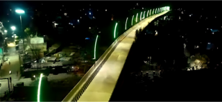
Tikhali Dam, 3km from Deobahal, is a major tourist attraction. Places to visit include Baba Jaleswar Temple, dam site, parks and gardens.
Education
Colleges:-
Khariar Junior College (8km)
Khariar Autonomous College (8km)
Women's College, Khariar (11km)
LCAT, Khariar (10km)
Parikhit Tiger Junior College, Khariar (9km)
Mahatma Gandhi Junior College, Chindaguda (13km)
Junior College, Komna (18km)
Degree College, Komna (18km)
Junior College, Boden (25km)
Biju Pattnaik Degree College, Boden (25km)
Overview
As per 2011 Census
Particulars
Total
Male
Female
Number of households
136
Total population
603
314
289
Total children (0–6)
98
52
46
Total SC population
128
66
62
Total ST population
278
144
134
Total literate population
73.27%
88.55%
56.79%
Worker population
217
171
46
Main worker population
163
Marginal workers
54
Females per 1000 males
920
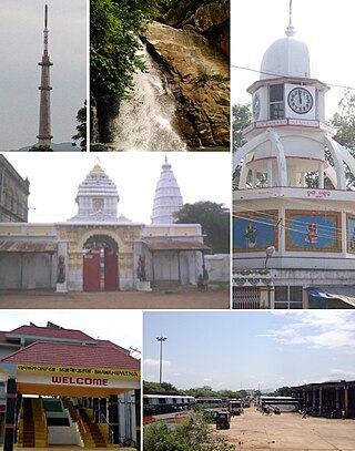
Bus stand, Deobahal
Deobahal is a small village with a total of 136 families residing. Deobahal village has a population of 603, 314 of whom are males while 289 are females as per the Population Census of 2011. The population of children aged 0–6 is 98 which makes up 16.25% of the total population of the village. The average sex ratio of Debahal village is 920 which is lower than the Odisha state average of 979. The child sex ratio for the Deobahal as per census is 885, lower than Odisha average of 941. Debahal village has a higher literacy rate than Odisha. In 2011, the literacy rate of Deobahal village was 73.27% compared to 72.87% of Odisha. In Deobahal male literacy stoof at 88.55% while the female literacy rate was 56.79%. As per the constitution of India and Panchyati Raaj Act, Deobahal village is administrated by Sarpanch (Head of Panchayat) with Ward Member who is the elected representative of the village.
Caste factor
In Debahal village, most of the population is from Schedule Tribe (ST). ST constitutes 46.10% while Schedule Caste (SC) were 21.23% of the total population.
Work profile
In Deobahal village out of the total population, 217 were engaged in work activities. 75.12% of workers described their work as main work (employment or earning for more than six months) while 24.88% were involved in marginal activity providing livelihood for less than six months. Of the 217 workers engaged in main work, 60 were cultivators (owner or co-owner) while 89 were agricultural labourers.
Chhattisgarh is a landlocked state in Central India. It is the ninth largest state by area, and with a population of roughly 30 million, the seventeenth most populous. It borders seven states – Uttar Pradesh to the north, Madhya Pradesh to the northwest, Maharashtra to the southwest, Jharkhand to the northeast, Odisha to the east, Andhra Pradesh and Telangana to the south. Formerly a part of Madhya Pradesh, it was granted statehood on 1 November 2000 with Raipur as the designated state capital.
Nuapada district is an area of Odisha state in India. Nuapada town is the headquarters of the district. It has one subdivision: Nuapada, and five blocks: Khariar, Sinapali, Boden, Komna, and Nuapada. Nuapada District has three Notified Area Councils: Khariar, Khariar Road, and Nuapada, six tehsils and more villages such as Gandabahali, Tukla, Hatibandha, Duajher, Bargaon, Tarbod, Udyanbandh, and Larka.
Mahasamund is a city in Mahasamund District in the Indian state of Chhattisgarh.It is situated on the Mumbai-Kolkata and Raipur-Vishakhaptnam National Highways. It is one of the largest and most important cities in the State. The city is divided into 30 wards and 5 zones and is also the biggest city in the Trans-Mahanadi area. It is also the administrative headquarters of the Mahasamund District and part of the proposed new Mahasamund Municipal Corporation. The current mayor is Prakash Chandrakar. Reliance Trends, Vishal Megamart, Reliance Jio Smart Point, B mart and Zee Sale are prominent Shopping Centers of the City.
Bhawanipatna is a city and the headquarter of Kalahandi district in the state of Odisha, India. Bhawanipatna has numerous temples dedicated to different deities of the Hindu pantheon. It is named after the presiding deity, Bhawani-Shankar, and Patna, which means "place" in Odia.
Nuapada is a town in western region of Odisha state of eastern India. It is the headquarter of Nuapada district. Nuapada district was carved out of the undivided Kalahandi district on 27 March 1993. It is on the western border of Odisha with Chhattisgarh. The district is part of Odisha both linguistically and culturally. It is one of the most underdeveloped districts of Odisha and India as well.
Khariar is a city and a Notified Area Council in Nuapada District of the Indian state of Odisha.
Khariar Road is a city in India. It is located at Odisha-Chhattisgarh border. It is 120 km (75 mi) from Raipur, capital of Chhattisgarh and is one of the fastest growing economic centers of India. It is also one of the key railway stations of the East Coast Railway.
Titilagarh, is a Municipality located in the Indian state of Odisha. It is a known summer hotspot in India due its extreme heatwaves.
Mahasamund district is a district in Chhattisgarh state in central India. The city of Mahasamund is the district headquarters. The district is particularly famous for the historical temple town of Sirpur besides the Mahanadi river.
Dharamsagar is a village in Nuapada district in the state of Odisha in India.
Bhunjias, are an ethnic group found in India mainly reside in Sunabeda plateau in Odisha and Chhattisgarh. They are mostly found in Nuapada district, which is roughly between 22° 55′ N and 21° 30′ N latitude and 82° 35′ E longitude. It was a part of Khariar Zamindari, which formed the eastern and the southeastern region of Raipur district of Chhattisgarh division in Central Province till 1 April 1936, when it was transferred to Odisha on its creation. It is now in Komna block of Nuapada district in Orissa. In Chhattisgarh they are found in Raipur district.
Ampani is a town in the Kalahandi district of the state of Odisha, in India. It is a gram panchayat that comes under Kokasara tehsil. It is 15 km from its main town and blocks Kokasara.
Komna is a town and block in Nuapada district of Odisha, India. Komna is the biggest block or taluk in Nuapada district. Komna is 39 km distance from its District Main City Nuapada, and 330 km distant from its State Main City, Bhubaneswar. This town is situated in western side of Odisha and near the border of Chhattisgarh state.
Sagunbhadi is a village in Nuapada district, Odisha, India. The village is situated in the bank of river Udanti.
Anda is a village located in Durg Tehsil of Durg district in the Indian state of Chhattisgarh. The village population is estimated to be at 4,169.
Tikhali Dam is a major irrigation project of the Government of Odisha, and part of the Lower Indra Irrigation Project. The dam is located on the Indra River, a tributary of the Tel River, near the village of Dargoan, in Khariar block of Nuapada district. The areas affected are located in Balangir, and Nuapada districts. Construction began in 1997 and was completed in 2019 at a cost of 1624.49 Cr INR Scheduled date of Completion was March 2004 but Completed on 3 December 2019. The project costs escalated 10 times due to the delay.
Bargaon or Baragan is a village under Khariar Tahasil in Nuapada district of Odisha state in India. It is situated 10 km away from sub-district headquarters Khariar and 63 km towards south from district headquarters Nuapada. The word "Bargaon" is composed of two words, "Bara" means 'Divine' and "gaan" means 'village'. On the 150th birth anniversary of Mahatma Gandhi, the village was recognised as "Lok Kala Gram" of Nuapada district by the Dept. Of Language, Literature, and Culture, Government of Odisha.
Boden is one of the five blocks in the Nuapada District in the Indian state of Odisha. The five blocks are Khariar, Nuapada, Komna, Boden and Sinapali. The main town is Boden, 27 kilometres from Khariar, and 97 kilometres from Nuapada district headquarters. Fourteen Gram Panchayats and eighty-nine Revenue Villages make up in Boden block.
Gandabahali is a village in Sinapali Block in the south of Nuapada District in Odisha, India.
Pendren, officially known as Pendraban and also referred to as Peren, is a village in the Indian state of Odisha. According to the Indian government's population census of 2011, there are 723 people living in Pendren. The village is located near the Chhattisgarh border to the south of Nuapada district.
This page is based on this Wikipedia article Text is available under the CC BY-SA 4.0 license; additional terms may apply. Images, videos and audio are available under their respective licenses.