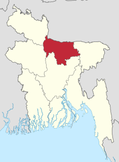
Tangail formerly an Upzilla of Greater Mymensingh district is a district (zila) in the central region of Bangladesh. It is the largest district of Dhaka division by area and second largest by population. The population of Tangail zila is about 3.8 million and its area is 3,414.28 square kilometres (1,318.26 sq mi). The main city of the district is Tangail. It is surrounded by Jamalpur District on the north, the Dhaka and Manikganj Districts on the south, the Mymensingh and Gazipur on the east, and the Sirajganj on the west.

Tangail, formerly Arail, is a major city within the Dhaka Division in central Bangladesh. It sits on the bank of the Louhajang River, 98 kilometres (61 mi) north-west of Dhaka, the nation's capital. It is considered to be the main urban area of the Tangail District, and is the 13th-largest city by population in Bangladesh.

Mymensingh is a district in Mymensingh Division, Bangladesh, and is bordered on the north by Meghalaya, a state of India and the Garo Hills, on the south by Gazipur District, on the east by the districts of Netrokona and Kishoreganj, and on the west by the districts of Sherpur, Jamalpur and Tangail. Mymensingh town is the district headquarters.

Mymensingh is the capital of Mymensingh Division, Bangladesh. Located on the bank of Brahmaputra River, about 120 km (75 mi) north from Dhaka, it is a major financial centre and educational hub of north central Bangladesh. The city, constituted by the British East India Company on 1 May 1787, is currently the country's fourth-largest city.
Bhuyanpur is an upazila of Tangail District in the Division of Dhaka, Bangladesh.
Ghatail is an upazila located in Tangail District, Bangladesh. The upazila is bounded by Gopalpur and Madhupur upazilas on the north, Fulbaria and Bhaluka upazilas on the east, Kalihati and Sakhipur upazilas on the south, Bhuapur and Gopalpur upazilas on the west. Main rivers are Bangshai, Jhinai, Toak.
Gopalpur is an upazila of Tangail District in the Division of Dhaka, Bangladesh.

Kalihati is an upazila of Tangail District, Dhaka Division, Bangladesh.
Madhupur is an upazila of Tangail District in the Division of Dhaka, Bangladesh.
Mirzapur is an upazila of Tangail District in the division of Dhaka, Bangladesh.
Sakhipur is an upazila of Tangail District in the division of Dhaka, Bangladesh.

Tangail Sadar is an upazila of Tangail District in the Division of Dhaka, Bangladesh.

Louhajang River is located in central Bangladesh. It branches out from the Jamuna near Gabsain at Bhuapur, Tangail District. Thereafter it splits into two parts before the parts meet up again. It flows past Tangail city, Karotia and Jamurki before joining the Bangshi. The Louhajang is linked with the Dhaleshwari.
Dhangara is a village of Kalihati Upazila of Tangail District in the Division of Dhaka Division, Bangladesh. It stands on the Bangshi River.

The divisions of Bangladesh are divided into 64 districts or zila. The downtown of a district is called a district city, which translates to "District Downtown". The districts are further subdivided into 492 sub-districts or upazila.
Dhanbari is a newly formed upazila of Tangail District in the Division of Dhaka, Bangladesh.
Mymensingh Division is one of the eight administrative divisions of Bangladesh. It has an area of 10,485 square kilometres (4,048 sq mi) and a population of 11,370,000 as of the 2011 census. It was created in 2015 from districts previously composing the northern part of Dhaka Division. Its headquarters are in Mymensingh city in Mymensingh District.
Deopara Union is a union of Ghatail Upazila, Tangail District, Bangladesh. It is situated 10 km southeast of Ghatail and 31 km northeast of Tangail, The District Headquarter.
Kalukhali is an Upazila, or sub-district, of the Rajbari District in Dhaka Division, Bangladesh.

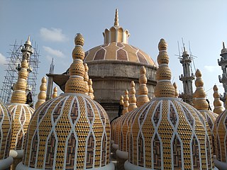
Tangail District is quite famous for it's zamindari rule with three of the largest zamindars in the region believed to have been established during the Mughal period. In addition, several small zamindar classes developed in this area, whose reputation is still evident. One of such zamindar is Mohera Zamindar Bari. Mohera Zamindar Bari is a 19th-century Zamidari residence in Mirzapur, Tangail District, Bangladesh. It is used as a police training school.The zamindar house was established in the mirzapur before the 1890s.Mohera zamindar Bari is the most preserved and maintained zamindari Bari of Bangladesh locally. There is no such zamindari Bari as preserved and maintained as it is in the country. The zamindari Bari represents our culture, lifestyle, and history during British time.