The Halvergate Marshes are an area of grazing marsh in the east of the English county of Norfolk. They form part of the area of The Broads and lie between the River Bure and the River Yare, bordering Breydon Water on the east. The marshes cover an area of around 2,642 hectares An area of 1,432.7-hectare (3,540-acre) is a biological Site of Special Scientific Interest. Some areas are also in the Breydon Water Local Nature Reserve, the Broadland and Breydon Water Ramsar sites, The Broads Special Area of Conservation, and The Broads and Breydon Water Special Protection Areas.
Derbyshire Wildlife Trust is one of 46 local Wildlife Trusts around the UK working to promote and protect local wildlife. It covers the whole of Derbyshire and was founded in 1962 in response to environmental threats to the local countryside, since when it has continued to grow. The trust is now based at East Mill on the River Derwent in the town of Belper, Derbyshire. It is a registered charity, supported by more than 14,000 members and over 500 volunteers.
Redgrave and Lopham Fens is a 127 hectare biological Site of Special Scientific Interest between Thelnetham in Suffolk and Diss in Norfolk. It is a national nature reserve, a Ramsar internationally important wetland site, a Nature Conservation Review site, Grade I, and part of the Waveney and Little Ouse Valley Fens Special Area of Conservation. It is managed by the Suffolk Wildlife Trust.

The Derwent is a river in Yorkshire in the north of England. It flows from Fylingdales Moor in the North York Moors National Park, east then southwards as far as its confluence with the River Hertford then westwards through the Vale of Pickering, south through Kirkham Gorge and the Vale of York, joining the River Ouse at Barmby on the Marsh. The confluence is unusual in that the Derwent converges on the Ouse at a shallow angle in an upstream direction.

The Swale is a tidal channel of the Thames estuary that separates the Isle of Sheppey from the rest of Kent. On its banks is a 6,509.4-hectare (16,085-acre) biological Site of Special Scientific Interest which stretches from Sittingbourne to Whitstable in Kent. It is also a Ramsar internationally important wetland site and a Special Protection Area under the European Union Directive on the Conservation of Wild Birds. Parts of it are a Nature Conservation Review site, Grade I, National Nature Reserves, a Kent Wildlife Trust nature reserve and a Local Nature Reserve.
Walmore Common is a 57.78-hectare (142.8-acre) nature reserve on the flood-plain of the River Severn, west of the city of Gloucester in England and north of the village of Chaxhill. It was notified as a biological Site of Special Scientific Interest in 1966. The site is listed in the 'Forest of Dean Local Plan Review' as a Key Wildlife Site (KWS).

The Great Fen is a habitat restoration project being undertaken on The Fens in the county of Cambridgeshire in England. It is one of the largest restoration projects in the country, and aims to create a 3,700 hectare wetland and aims to connect Woodwalton Fen National Nature Reserve (NNR), Holme Fen NNR and other nature reserves to create a larger site with conservation benefits for wildlife and socio-economic benefits for people.

Oare Marshes is a 71.4-hectare (176-acre) Local Nature Reserve north of Faversham in Kent. It is owned and managed by Kent Wildlife Trust. It is part of The Swale Nature Conservation Review site, Grade I, National Nature Reserve, Ramsar internationally important wetland site, Special Protection Area under the European Union Directive on the Conservation of Wild Birds, and Site of Special Scientific Interest.

Sulham and Tidmarsh Woods and Meadows is a 75.7-hectare (187-acre) biological Site of Special Scientific Interest west of Reading in Berkshire. Previously known as Pang Valley SSSI, the site is mostly sandwiched between the River Pang and the Sulham Road and includes Broom Copse, Herridge's Copse, Hogmoor Copse, Park Wood, Moor Copse and Barton's Copse. Much of the southern part of the site is the Berkshire, Buckinghamshire and Oxfordshire Wildlife Trust's Moor Copse Nature Reserve. The whole site lies within the North Wessex Downs Area of Outstanding Natural Beauty.

Acaster South Ings is a Site of Special Scientific Interest, or SSSI, near York, England. It consists of two alluvial flood-meadows, and was designated in 1988 because it supports diverse fauna and flora, some of which is rare in the Vale of York area. One of the rarities is the tansy beetle, which feeds on the leaves of the tansy plant.

Herts and Middlesex Wildlife Trust manages over 40 nature reserves covering nearly 810 hectares north of London, in Hertfordshire and the historic county of Middlesex, part of which is divided between the London boroughs of Barnet, Enfield, Harrow and Hillingdon. It has over 21,000 members, and is one of 46 Wildlife Trusts across the UK. It is a Registered Charity, with its Registered Office in St Albans, and had an income in the year to 31 March 2014 of over £1.5 million.

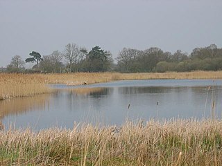
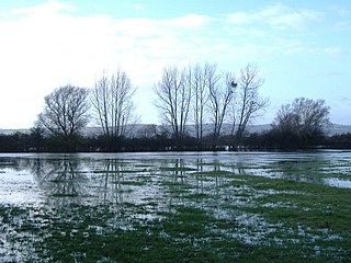
Barn Hill Meadows is a Site of Special Scientific Interest (SSSI) in the East Riding of Yorkshire, England. It is located close to the town of Howden. The site, which was designated a SSSI in 1987, lies on the flood plain of the Old Derwent river. The site is important for its herb-rich, unimproved, neutral grassland. Several of the fields have been traditionally managed for hay and some retain remnant ridge and furrow features. The dominant grasses are red fescue and sweet vernal-grass. There is also an abundance of great burnet, pepper saxifrage and meadow cranes bill.
Beckhead Plantation is a Site of Special Scientific Interest (SSSI) and nature reserve in the East Riding of Yorkshire, England. It is located close to the village of Great Givendale on the Yorkshire Wolds. The site, which was designated a SSSI in 1968, is managed as a nature reserve by the Yorkshire Wildlife Trust. It lies on chalk land in Given Dale. The site is important because it demonstrates many of the characteristic features of a northern ash woodland on chalk. The tree canopy is dominated by ash with some wych elm, field maple and rowan while the understorey contains shrub species including hazel, guelder rose, elder, gooseberry and fly honeysuckle.

Rye Meads is a 58.5-hectare (145-acre) biological Site of Special Scientific Interest (SSSI) in Rye House, Hoddesdon, Hertfordshire. It is one of series of wetlands and reservoirs situated along the River Lea, to the north-east of London. It is part of the Lea Valley Ramsar site and a Special Protection Area.

Barnby Broad and Marshes is a Site of Special Scientific Interest (SSSI) in the Waveney district of the English county of Suffolk. The site is 189.6 hectares in size. It is in the parishes of North Cove and Barnby, located between Beccles and Lowestoft in the north of the county. The site is bordered on its southern edge by the East Suffolk railway line and to the north by the River Waveney. It is a Special Area of Conservation, a Special Protection Area under the EC Birds Directive, and a Ramsar internationally important wetland site. There are two Suffolk Wildlife Trust nature reserves in the site, Castle Marshes and North Cove.

Upper Nene Valley Gravel Pits is a 1,382.4 hectare biological Site of Special Scientific Interest in a chain of flooded gravel pits along 35 kilometres of the valley of the River Nene between Northampton and Thorpe Waterville in Northamptonshire. It is a Ramsar wetland site of international importance, a Special Protection Area under the European Communities Birds Directive and part of the Nene Valley Nature Improvement Area. It is also part of the River Nene Regional Park. Two areas are managed by the Wildlife Trust for Bedfordshire, Cambridgeshire and Northamptonshire, Summer Leys and Titchmarsh Nature Reserve.

Stodmarsh SSSI is a 623.2-hectare (1,540-acre) biological Site of Special Scientific Interest near Stodmarsh, north-east of Canterbury in Kent. Parts of it are a Nature Conservation Review site, Grade I, a National Nature Reserve, a Ramsar internationally important wetland site, a Special Area of Conservation and a Special Protection Area under the European Union Directive on the Conservation of Wild Birds.

Bishop Monkton Ings is a Site of Special Scientific Interest, or SSSI, situated east of Bishop Monkton village in North Yorkshire, England. It consists mostly of marshy, calcareous grassland, with some broadleaved woodland, and some fen alongside the two watercourses which run through the site. This varied wetland forms a habitat for a variety of plants, including the semi-parasitic marsh lousewort (Pedicularis palustris).