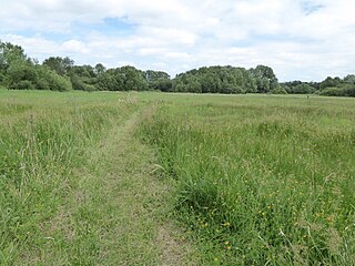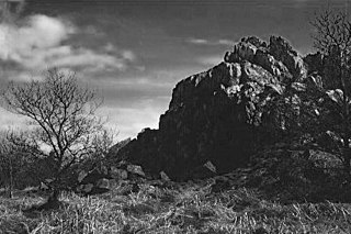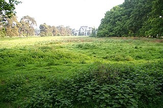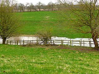
Deben Estuary SSSI is a 981.1-hectare (2,424-acre) biological Site of Special Scientific Interest (SSSI) covering the River Deben and its banks 12 kilometres from its mouth north of Felixstowe to Woodbridge in Suffolk. It is a Ramsar internationally important wetland site and a Special Protection Area under the European Union Directive on the Conservation of Wild Birds. It is also in the Suffolk Coast and Heaths Area of Outstanding Natural Beauty. It partly overlaps two geological SSSIs, Ferry Cliff, Sutton and Ramsholt Cliff.

Stones Road Pond is a 0.5-hectare (1.2-acre) biological Site of Special Scientific Interest (SSSI) in Epsom in Surrey.

Castor Hanglands is an 89.8-hectare (222-acre) biological Site of Special Scientific Interest west of Peterborough in Cambridgeshire. The site is also a National Nature Reserve, and it is a Nature Conservation Review site, Grade I for its woodlands and Grade 2 for its grassland. It is common land managed by Natural England.

Twywell Gullet is a 17.1-hectare (42-acre) biological Site of Special Scientific Interest east of Kettering in Northamptonshire. It is part of the 54.6 hectare Twywell Hills and Dales nature reserve, which is managed by a partnership of the Woodland Trust and the Rockingham Forest Trust. The site is in turn a small part of the former royal hunting Rockingham Forest.

Wangford Warren and Carr is a 67.8-hectare (168-acre) biological Site of Special Scientific Interest between Brandon and Lakenheath in Suffolk. It is a Nature Conservation Review site, Grade I, and part of the Breckland Special Area of Conservation, and Special Protection Area An area of 15 hectares is managed as a nature reserve by the Suffolk Wildlife Trust

Monewden Meadows is a 3.7-hectare (9.1-acre) biological Site of Special Scientific Interest south-west of Monewden in Suffolk. It is a Nature Conservation Review site, Grade I, and it is managed by the Suffolk Wildlife Trust under the name Martins' Meadows.

Blo' Norton and Thelnetham Fens are a 21.3-hectare (53-acre) biological Site of Special Scientific Interest (SSSI) on the Norfolk/Suffolk border. Blo' Norton Fen is in the parish of Blo' Norton in Norfolk and Thelnetham Fen is in Thelnetham parish in Suffolk. It is a Nature Conservation Review site, Grade 2, and part of the Waveney and Little Ouse Valley Fens Special Area of Conservation, Thelnetham Fen is managed by the Suffolk Wildlife Trust and Blo' Norton Fen by the Little Ouse Headwaters Project (LOHP).

Orton Pit is a 145.8-hectare (360-acre) biological Site of Special Scientific Interest on the southern outskirts of Peterborough in Cambridgeshire. It is also a Special Area of Conservation

Breckland Farmland is a 13,392.4 hectare biological Site of Special Scientific Interest (SSSI) in many separate areas between Swaffham in Norfolk and Bury St Edmunds in Suffolk. It is part of the Breckland Special Protection Area under the European Union Directive on the Conservation of Wild Birds.

Sandlings Forest is a 2,483.8 hectare biological Site of Special Scientific Interest in two large blocks, Rendlesham Forest and Tunstall Forest, and two small ones, between Woodbridge and Aldeburgh in Suffolk. It is partly in the Sandlings Special Protection Area under the European Union Directive on the Conservation of Wild Birds. It is in the Suffolk Coast and Heaths Area of Outstanding Natural Beauty.

Beacon Hill, Hangingstone and Outwoods is a 147.5-hectare (364-acre) biological and geological Site of Special Scientific Interest (SSSI) south of Loughborough in Leicestershire. It is also a Geological Conservation Review and a Nature Conservation Review site. The Outwoods and Beacon Hill are part of The National Forest. Two areas in the SSSI, Beacon Hill and Jubilee Woods are country parks managed by Leicestershire County Council, and The Outwoods is managed by Charnwood Borough Council.

River Eye SSSI is a 6.0 hectares biological Site of Special Scientific Interest covering a stretch of the River Eye between Ham Bridge, north-west of Stapleford, and the eastern outskirts of Melton Mowbray in Leicestershire. It is a Nature Conservation Review site.

River Mease SSSI is a 23.0 hectares biological Site of Special Scientific Interest. It is a stretch of the River Mease and its tributary Gilwiskaw Brook, running between Alrewas in Staffordshire and Packington in Leicestershire. It is also a Special Area of Conservation The river goes through private land, but it is crossed by roads and footpaths.

Ant Broads and Marshes is a 745.3-hectare (1,842-acre) biological Site of Special Scientific Interest north-east of Norwich in Norfolk. Most of it is a Nature Conservation Review site, Grade 1, and it is part of the Broadland Ramsar and Special Protection Area, and The Broads Special Area of Conservation. Part of it is the Barton Broad nature reserve, which is managed by the Norfolk Wildlife Trust, and two areas are National Nature Reserves.

Stanford Training Area SSSI is part of the British Army Stanford Training Area. It is a 4,678-hectare (11,560-acre) biological and geological Site of Special Scientific Interest north of Thetford in Norfolk. It is a Nature Conservation Review site and part of it is a Geological Conservation Review site. It is also part of the Breckland Special Area of Conservation and Special Protection Area.

Kirk Deighton SSSI is a Site of Special Scientific Interest (SSSI) in Alton's Field, Kirk Deighton, North Yorkshire, England. This site has been recognised as having one of the largest known breeding populations of great crested newts in the United Kingdom. It is a Special Area of Conservation, and is listed for protection under a number of directives. This ordinary-looking grassland field, with a couple of ponds in it, is ideal habitat for the newts, which use the grassland for foraging, the ponds for breeding, and surrounding walls, hedges and woodpiles for hibernation. The site is not accessible to the public, and it is not permissible to survey the ponds without a licence.

Little Wittenham SSSI is a 68.9-hectare (170-acre) biological Site of Special Scientific Interest north-east of Didcot in Oxfordshire. It is also a Special Area of Conservation.

Hurst Castle and Lymington River Estuary is a 1,077.3-hectare (2,662-acre) biological and geological Site of Special Scientific Interest near Lymington in Hampshire. It is a Nature Conservation Review site and two areas are Geological Conservation Review sites. Three areas are local nature reserves, Boldre Foreshore, Sturt Pond and Lymington and Keyhaven Marshes; the latter site is managed by the Hampshire and Isle of Wight Wildlife Trust. Part of it is North Solent National Nature Reserve. It is part of Solent and Southampton Water Ramsar site and Special Protection Area. Parts of it are in Solent Maritime and Solent and Isle of Wight Lagoons Special Areas of Conservation.


