The Central Artery/Tunnel Project, commonly known as the Big Dig, was a megaproject in Boston that rerouted the Central Artery of Interstate 93 (I-93), the chief highway through the heart of the city, into the 1.5-mile (2.4 km) tunnel named the Thomas P. O'Neill Jr. Tunnel. The project also included the construction of the Ted Williams Tunnel, the Leonard P. Zakim Bunker Hill Memorial Bridge over the Charles River, and the Rose Kennedy Greenway in the space vacated by the previous I-93 elevated roadway. Initially, the plan was also to include a rail connection between Boston's two major train terminals. Planning began in 1982; the construction work was carried out between 1991 and 2006; and the project concluded on December 31, 2007, when the partnership between the program manager and the Massachusetts Turnpike Authority ended.

Interstate 93 (I-93) is an Interstate Highway in the New England states of Massachusetts, New Hampshire, and Vermont in the United States. Spanning approximately 190 miles (310 km) along a north–south axis, it is one of three primary Interstate Highways located entirely within New England; the other two are I-89 and I-91. The largest cities along the route are Boston, Massachusetts, and Manchester, New Hampshire; it also travels through the New Hampshire state capital of Concord.

A frontage road is a local road running parallel to a higher-speed, limited-access road. A frontage road is often used to provide access to private driveways, shops, houses, industries or farms. Where parallel high-speed roads are provided as part of a major highway, these are also known as local-express lanes.

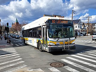
The Silver Line is a system of bus routes in Boston and Chelsea, Massachusetts, operated by the Massachusetts Bay Transportation Authority (MBTA). It is operated as part of the MBTA bus system, but branded as bus rapid transit (BRT) as part of the MBTA subway system. Six routes are operated as part of two disconnected corridors. As of 2019, weekday ridership on the Silver Line was 39,000.

Route 1A is a north–south state highway in Massachusetts. It is an alternate route to U.S. 1 with three signed sections and two unsigned sections where the highway is concurrent with its parent. Due to the reconfiguration of tunnel interchanges brought on by the completion of the Big Dig, Route 1A is discontinuous in the downtown Boston area. Vehicles entering Downtown Boston via the Sumner Tunnel must take I-93 north to the exit for Government Center and make a U-turn to access the entrance ramp to I-93 south and vice versa.

South Station, officially The Governor Michael S. Dukakis Transportation Center at South Station, is the largest railroad station and intercity bus terminal in Greater Boston and New England's second-largest transportation center after Logan International Airport. Located at the intersection of Atlantic Avenue and Summer Street in Dewey Square, Boston, Massachusetts, the historic station building was constructed in 1899 to replace the downtown terminals of several railroads. Today, it serves as a major intermodal domestic transportation hub, with service to the Greater Boston region and the Northeastern and Midwestern United States. It is used by thousands of commuter rail and intercity rail passengers daily. Connections to the rapid transit Red Line and bus rapid transit Silver Line are made through the adjacent subway station.

Harvard station is a rapid transit and bus transfer station in Cambridge, Massachusetts. Located at Harvard Square, it serves the MBTA's Red Line subway system as well as MBTA buses. Harvard averaged 18,528 entries each weekday in FY2019, making it the third-busiest MBTA station after Downtown Crossing and South Station. Five of the fifteen key MBTA bus routes stop at the station.
The Massachusetts Bay Transportation Authority (MBTA) operates 170 bus routes in the Greater Boston area. The MBTA has a policy objective to provide transit service within walking distance for all residents living in areas with population densities greater than 5,000 inhabitants per square mile (1,900/km2) within the MBTA's service district. Much of this service is provided by bus. In 2021, the system had a ridership of 64,728,000, or about 267,100 per weekday as of the second quarter of 2022.

The Rose Fitzgerald Kennedy Greenway is a linear park located in several Downtown Boston neighborhoods. It consists of landscaped gardens, promenades, plazas, fountains, art, and specialty lighting systems that stretch over one mile through Chinatown, the Financial District, the Waterfront, and North End neighborhoods. Officially opened in October 2008, the 17-acre Greenway sits on land created from demolition of the John F. Fitzgerald Expressway as part of the Big Dig project.

The Inner Belt in Boston was a planned six-lane, limited-access highway that would have run through parts of Boston, Brookline, Cambridge, and Somerville.
Atlantic Avenue is a street in downtown Boston, Massachusetts, partly serving as a frontage road for the underground Central Artery (I-93) and partly running along the Boston Harbor. It has a long history, with several relocations along the way.
Dewey Square is a square in downtown Boston, Massachusetts which lies at the intersection of Atlantic Avenue, Summer Street, Federal Street, Purchase Street and the John F. Kennedy Surface Road, with the Central Artery (I-93) passing underneath in the Dewey Square Tunnel and Big Dig. South Station is on the southeast corner of the square, with Amtrak and MBTA Commuter Rail services, as well as Red Line subway trains and Silver Line bus rapid transit underneath.
The Central Artery is a section of freeway in downtown Boston, Massachusetts; it is designated as Interstate 93, US 1 and Route 3.

Tufts Medical Center station is an underground Massachusetts Bay Transportation Authority (MBTA) rapid transit station in Boston, Massachusetts. It serves the MBTA subway Orange Line, as well as two Silver Line bus rapid transit routes on the surface. It is named for the Tufts Medical Center and is built under a wing of the facility that crosses over Washington Street in downtown Boston between Kneeland Street in Chinatown and the Massachusetts Turnpike. The accessiblestation has two side platforms for the Orange Line, while Silver Line buses stop along the sidewalks on the surface next to the station entrance on Washington Street. A secondary entrance is available on Tremont Street one block to the west.

Route 3 is a state-numbered route in the U.S. state of Massachusetts, maintained by the Massachusetts Department of Transportation (MassDOT). Spanning approximately 56 miles (90 km) along a north–south axis, it is inventoried with U.S. Route 3 as a single route by the state. The state-numbered Route 3 travels from Bourne in the south to Cambridge in the north, while US 3 continues from Cambridge and crosses the New Hampshire state line in Tyngsborough. Mileposts on US 3 continue from those on the state-numbered Route 3.

Interstate 95 (I-95) is a part of the Interstate Highway System that parallels the East Coast of the United States from Miami, Florida in the south to Houlton, Maine, in the north. In the U.S. state of Massachusetts, it spans 91 miles (146 km) along a north–south axis. It is the third-longest Interstate Highway in Massachusetts, behind I-90 and I-495, while I-95 in full is the longest north–south Interstate, and sixth-longest Interstate Highway in the United States.

The Thomas P. "Tip" O'Neill Jr. Tunnel is a highway tunnel built as part of the Big Dig in Boston, Massachusetts. It carries the Central Artery underneath downtown Boston, and is numbered as Interstate 93 (I-93), U.S. Route 1 (US 1), and Route 3. It roughly follows the route of the old elevated Central Artery, though the northbound entrance, at the corner of Kneeland Street and Atlantic Avenue, is somewhat east of the southbound exit to allow for a reconfigured interchange with the Massachusetts Turnpike. It runs from the Zakim Bunker Hill Bridge at its north portal—barely 165 feet (50 m) east of the TD Garden sports facility's eastern corner—to Boston's Chinatown at its south portal. The tunnel is named for Tip O'Neill, former Speaker of the United States House of Representatives, whose constituency included several of the surrounding communities in Metro Boston.
The South Bay Interchange is a massive interchange in downtown Boston, Massachusetts, in the US. The interchange consists of Interstate 90, the Mass Pike Extension, and the Interstate 93 concurrency with US 1 and MA 3 south of the Thomas P. O'Neill Jr. Tunnel.

The Leverett Circle Connector Bridge is a highway bridge over the Charles River, carrying two lanes each of northbound and southbound traffic. It connects to Interstate 93 (I-93) in Somerville, Massachusetts at the northern end and splits at the southern end, providing direct access to both Storrow Drive and Leverett Circle in Boston. Going northbound, there is also a fork which provides access to the City Square Tunnel under Charlestown to proceed on U.S. Route 1 (US 1) northbound via the Tobin Bridge.

South Station is a transfer station on the MBTA rapid transit Red Line and bus rapid transit Silver Line, located at Summer Street and Atlantic Avenue in downtown Boston, Massachusetts. It is a part of the South Station complex, the second busiest transportation center in New England. Eight MBTA Commuter Rail and three Amtrak intercity rail services terminate at South Station; many of those passengers then transfer to the rapid transit lines to reach other destinations in the city. With 24,639 daily boardings in 2019, South Station is the busiest station on the MBTA rapid transit system.
