
John Speed was an English cartographer, chronologer and historian of Cheshire origins. The son of a citizen and Merchant Taylor in London, he rose from his family occupation to accept the task of drawing together and revising the histories, topographies and maps of the Kingdoms of Great Britain as an exposition of the union of their monarchies in the person of King James I and VI. He accomplished this with remarkable success, with the support and assistance of the leading antiquarian scholars of his generation. He drew upon and improved the shire maps of Christopher Saxton, John Norden and others, being the first to incorporate the hundred-boundaries into them, and he was the surveyor and originator of many of the town or city plans inset within them. His work helped to define early modern concepts of British national identity. His Biblical genealogies were also formally associated with the first edition of the King James Bible. He is among the most famous of English mapmakers.

The M61 is a motorway in North West England between Manchester and Preston, linking the M60 Manchester orbital motorway with the M6 motorway.

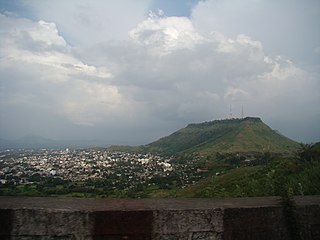
Gujrat is a city in the Punjab Province of Pakistan. It is the capital of Gujrat District and it is the 21st largest city of Pakistan by population. Along with the nearby cities of Sialkot and Gujranwala, Gujrat forms part of the Golden Triangle of industrial cities with export-oriented economies.

Chaudhry Shujaat Hussain (Punjabi: چوہدری شجاعت حسین; Urdu: چودھری شجاعت حسین; is a senior Pakistani politician from a Punjabi Jat family of Gujrat who previously served as 16th prime minister of Pakistan. Hussain is the party president of the Pakistan Muslim League from 2003 until 2022.
Satara is a city located in the Satara District of Maharashtra state of India, near the confluence of the river Krishna and its tributary, the Venna. The city was established in the 16th century and was the seat of the Chhatrapati of Maratha Empire, Shahu I. It is the headquarters of Satara Tehsil, as well as the Satara District. The city gets its name from the seven forts (Sat-Tara) which are around the city. The city is known as a Soldier's city as well as Pensioner's city.

Torrey Pines Golf Course is a 36-hole municipal golf facility on the west coast of the United States, owned by the city of San Diego, California. It sits on the coastal cliffs overlooking the Pacific Ocean in the community of La Jolla, just south of Torrey Pines State Reserve. Opened in 1957, it was built on the site of Camp Callan, a U.S. Army installation during World War II.
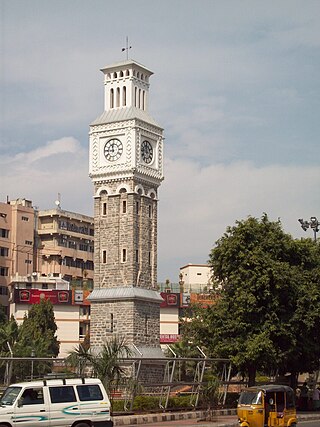
Secunderabad, also spelled as Sikandarabad, is a twin city of Hyderabad and one of the six zones of the Greater Hyderabad Municipal Corporation (GHMC) in the Indian state of Telangana. It is the headquarters of the South Central Railway zone. Named after the Mir Akbar Ali Khan Sikander Jah, Asaf Jah III, Nizam of the Asaf Jahi dynasty, Secunderabad was established in 1806 as a British cantonment. Although both the cities are together referred to as the twin cities, Hyderabad and Secunderabad have different histories and cultures, with Secunderabad having developed directly under British rule until 1948, and Hyderabad as the capital of the Nizams' princely state of Hyderabad.

Mandi Bahauddin is a city in northern Punjab, Pakistan. It is also the capital of Mandi Bahauddin District. It is the 41st largest city of Pakistan by population according to the 2017 census. It has exellent agricultural land. The city is about 220 metres above sea level and is located in central Punjab, between the rivers Jhelum and Chenab.
Gujrat, is a district of Punjab Province in Pakistan.

Sialkot District, is one of the districts of Punjab province of Pakistan. It is located in the Majha region of Panjab, otherwise the northeast of the province. The city of Sialkot is the capital of the district. The Sialkot Cantonment was established in 1852.
Chakdina, also called Dinachak, is a village in Kharian Tehsil of Gujrat District, Punjab, Pakistan. It is situated at about five km westwards from the town of Lalamusa. It is located at 32°42'0N 73°53'0E with an altitude of 233 metres.
Lala Musa, is a city located in the Gujrat District of the Punjab province of Pakistan with a population of 91,500 in 2018.
Kotla Sarang Khan is a village located in Kharian Tehsil, Gujrat District in Punjab Province of Pakistan.
Chakswari, also known as Chaksawari, is a Tehsil in the Mirpur District of Azad Kashmir, Pakistan. It comprises 15 Union councils including the Islamgarh Municipal Committee. Amongst the primary affectees of the Mangla Dam upraising project were Chakswari and Islamgarh. Chakswari is 26 miles or 41.84 km from Mirpur. The political constituency code for Chakswari and Islamgarh is LA-2.

The All Jammu and Kashmir Muslim Conference also shortly referred as Muslim Conference (MC) is a major political party in Pakistan administrated territory of Azad Jammu and Kashmir. The party was founded by Chaudhry Ghulam Abbas in the former princely state of Jammu and Kashmir as a splinter group of the Jammu & Kashmir National Conference.

Karnana or Akhtar Karnana is a town and Union Council 73rd of Gujrat District in the Punjab Province of Pakistan and has a population of over 20000, It is located at 32°39'35"N, 73°52'0"E and has an altitude of 233 metres (767 feet).
Sikeryali is a town and union council of Gujrat District, in the Punjab province of Pakistan. It is part of Kharian Tehsil and is located at 32°37'0N 73°49'0E with an altitude of 223 metres.
Bhago is a village of Kharian Tehsil, Gujrat District in the Punjab province of Pakistan. It is located at 32°44'0N 73°49'0E with an altitude of 240 metres, and is situated near the Dinga Road about 10 miles away from the city of Kharian. The population of the village is about 5,000, most of inhabitants rely on foreign remittances and agriculture as their occupation and the main crop is wheat. This village has 4 roads attached in other villages. Two of them are accessible from Dinga Road. Bhago village has three Mosques, PTCL exchange, School for boys and girls and government hospital.
Uganda Air Cargo Corporation (UACC),, is an airline based in Kampala, Uganda. It operates scheduled and charter services for both passengers and cargo.
Gunja(Urdu: گنجه ) is a town and a union council of Kharian Tehsil and Gujrat District, in the Punjab province of Pakistan. It is part of Kharian Tehsil. Other villages in the union council are Chak Ikhlas, Mughli, Dhalla, Chak Rajjadi, Jataria Khurd, Jataria Kalan, Chatta and Shahsar mast.