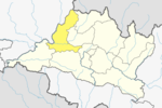
Dhading District, a part of Bagmati Province, is one of the seventy-seven districts of Nepal. The district, with Dhading Besi as its district headquarters, covers an area of 1,926 square kilometres (744 sq mi), had a population of 338,658 in 2001 and 336,067 in 2011.
Gorkha District, a part of Gandaki Province, is one of the 77 districts of Nepal, and the fourth largest district of Nepal in terms of area. It is historically linked with the creation of modern Nepal and the name of the legendary Gorkha soldiers. The district, with Gorkha Municipality as its district headquarters, covers an area of 3,610 km2 (1,390 sq mi) and has a population of 252,201 according to the 2021 Nepal census. Gorkha district is the site of the Manakamana Temple. The temples of Gorakh Nath and Gorakh Kali are found in the district. Several major rivers—the Chepe, Daraudi, Marsyangdi, Budi Gandaki, and Trishuli—run through the district.

Mustang District is one of the eleven districts of Gandaki Province and one of seventy-seven districts of Nepal which was a Kingdom of Lo-Manthang that joined the Federation of Nepal in 2008 after abolition of the Shah dynasty. The district covers an area of 3,573 km2 (1,380 sq mi) and in 2011 had a population of 13,452. The headquarters is located at Jomsom. Mustang is the fifth largest district of Nepal in terms of area.

Sindhupalchowk District is a part of Bagmati Province and one of the seventy-seven districts of Nepal, with an area of 2,542 km2 (981 sq mi). The district's headquarters is in Chautara. In 2006, 336,478 people resided in 79 village development committees, in 2011 there were 287,798.

Tamang is a term used to collectively refer to a dialect cluster spoken mainly in Nepal, Sikkim, West Bengal (Darjeeling) and North-Eastern India. It comprises Eastern Tamang, Northwestern Tamang, Southwestern Tamang, Eastern Gorkha Tamang, and Western Tamang. Lexical similarity between Eastern Tamang and other Tamang languages varies between 81% and 63%. For comparison, lexical similarity between Spanish and Portuguese, is estimated at 89%.

Birtamod is a municipality in Jhapa District of Nepal. It is the commercial, educational and transport hub of Jhapa District. Sarnamati Bazar, Dhulabari Bazar, Dhaijan Bazar, Charali Bazar, Shivasatakshi Bazar, Kamatoli Bazar, Chakchaki Bazar and Surunga Bazar are some of the nearest local towns/settlements connected to Birtamod. It is one of the fastest growing cities in Nepal. Birtamod is one of the largest city of Jhapa.
Siraha is the headquarters and municipality of Siraha District, a part of Madhesh Province, Nepal. Siraha had a population of 28,442 according to the census of 2011. and a population of 82,531 as of 2015. The current population of Siraha municipality as of census 2022, is 96,543. It has a male population of 47,306 and female population of 49,237. The present mayor of Siraha Municipality is Dr. Nabin Kumar Yadav and Deputy Mayor is Babita Kumari Sah. Both assumed office on 25 May 2022. His predecessor mayor was Asheswor Yadav and the deputy mayor was Dr. Namita Yadav. Both assumed office on 25 September 2017 and their last working day was on 24 May 2022. The town is at 80 metres (260 ft) altitude, 29 kilometres (18 mi) ESE of Janakpur.
Amalachaur is a village development committee in Baglung District in the Dhaulagiri Zone of central Nepal. At the time of the 1991 Nepal census it had a population of 5,055 and had 943 houses.

Bahrabise is an urban municipality located in Sindhupalchok District of Bagmati Province of Nepal.
Dhusha, now Benighat Rorang is a Rural Municipality in Dhading District in the Bagmati Zone of central Nepal. At the time of the 1991 Nepal census it had a population of 6350. The Dhusha VDC office is located at Charaundi Bazar, which is one of the Commencing place of the White Water Rafting in Trishuli River which started longway back. The bazar is also the main business area for the whole VDC which is located along the Prithvi Highway. Like the general geographical status of the whole country, Dhusha rises from low altitude to medium - high altitude region. Charaundi Khola, flows very close to the bazar.
Gajuri(Nepali: गजुरी ; gajuri) is a Gaupalika in Dhading District in the Bagmati Zone of central Nepal. It has a literacy rate of 64.28%. The city hosts as one of the city with highest literacy rate in the Dhading district. The local body was formed by merging three VDCs namely Gajuri, Pida, Nepal, Kiranchok.
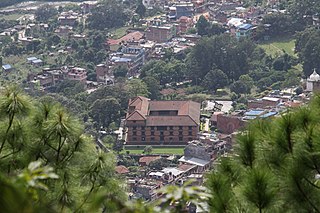
Sunaula Bazar is a town in Nilkantha Municipality in Dhading District in the Bagmati Zone of central Nepal. The formerly Village development committee was merged to form municipality on 18 May 2014 merging along with Nilkantha, Sunaula Bazar, Murali Bhanjyang, Sangkosh Village development committees. At the time of the 1991 Nepal census it had a population of 6480 and had 1233 houses in it. Formerly it was the headquarter of Dhading District.

Sundarijal is a village and former Village Development Committee that is now part of Gokarneshwar Municipality in Kathmandu district in Province No. 3 of central Nepal.
Bhumlichok is a village development committee in Gorkha District in the Gandaki Zone of northern-central Nepal. At the time of the 1991 Nepal census it had a population of 2,964 and had 518 houses in the town.
Lamatar is a village and former Village Development Committee that is now part of Mahalaxmi Municipality in Province No. 3 of central Nepal.

Lalbandi is a municipality in Sarlahi district in Madhesh Province of Nepal. The municipality was established on 18 May 2014 by merging the existing Parwanipur VDC, Netragunj VDC, Jabdi, Lalbandi and Pattharkot VDCs. At the time of the 2021 Nepal Census, it had a population of 66,419 living in 14,873 individual households. There are 17 wards in this municipality. It is the largest municipality in Sarlahi district. The office of this municipality is in ward no.6 Located in Lalbandi. Lalbandi Bazar, located on the East West or Mahendra highway, is one of the main trading areas within the municipality. Bordering Ishwarpur Municipality to the east and south, Haripur Municipality to the west and south, Sindhuli district to the north and Hariwan to the west, Lalbandi is the main trading site of the district.

Tahoon is a village very development committee in Palpa District in the Lumbini Zone of southern Nepal. At the time of the 1991 Nepal census it had a population of 3776.

Previously Ugarachandi Nala was a village development committee located in Kavrepalanchok District of Nepal. It is named after the temple of goddess Ugrachandi Bhagawati located in Nala Bazaar. But now in the year 2017 AD it has been changed and divided into ward no. 3 and 4 of Banepa municipality. According to the 1991 Nepal census, the population of the VDC is 6,327 in 1,035 individual households.

Malekhu (मलेखु) is a small town situated in Dhading district, halfway between Kathmandu and Narayangadh. It is situated in the bank of Trishuli River. It is famous for various types of fish species and its product. Malekhu is widely popular for adventurous sports such as rafting, trekking, kayaking and so on. It is one of the most exciting and dangerous rafting sites of the world. It is situated near by the famous Manakamana Temple which is at the distance of 30 km from the town. It is also famous for hiking. The main attraction of Malekhu also includes the geological researches and geological minerals present there. International as well as national Geology students get to there for geological studies, the availability of different minerals is also gathered in small area in there. The larger portion of the population consists mostly of Tripathis, Silwals and Kadels and Barakotis.

Bagmati Province is one of the seven provinces of Nepal established by the constitution of Nepal. Bagmati is Nepal's second-most populous province and fifth largest province by area. It is bordered by Tibet Autonomous Region of China to the north, Gandaki Province to the west, Koshi Province to the east, Madhesh Province and the Indian state of Bihar to the south. With Hetauda as its provincial headquarters, the province is also the home to the country's capital Kathmandu, is mostly hilly and mountainous, and hosts mountain peaks including Gaurishankar, Langtang, Jugal, and Ganesh.