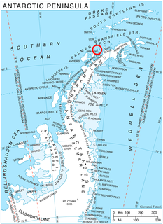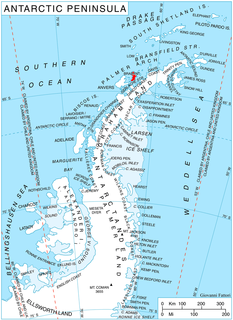
Charlotte Bay is a bay on the west coast of the Antarctic Peninsula indenting the west coast of Graham Land in a southeast direction for 12 nautical miles (22 km), between Reclus Peninsula and Cape Murray. Its head is fed by the glaciers Nobile, Bozhinov, Krebs, Wellman and Renard.
Leonardo Glacier is a glacier flowing into Wilhelmina Bay between Sadler Point and Café Point, on the west coast of Graham Land, Antarctica. It was charted by the Belgian Antarctic Expedition under Gerlache, 1897–99, and was named by the UK Antarctic Place-Names Committee in 1960 for Leonardo da Vinci, artist, musician, architect and the first aeronautical scientist.
Flandres Bay is a large bay lying between Cape Renard and Cape Willems, along the west coast of Graham Land, Antarctica. It was explored in 1898 by the Belgian Antarctic Expedition under Gerlache, who named it, probably after the historical area of Flandres.

Andersson Peak is an ice-capped peak, 1,230 metres (4,040 ft) high, with rocky exposures on its east side, lying 9 nautical miles (17 km) north of Cape Fairweather on the east coast of Graham Land, Antarctica. It was charted in 1947 by the Falkland Islands Dependencies Survey, and named by them for Karl Andreas Andersson, a zoologist with the Swedish Antarctic Expedition, who had explored along this coast in 1902.

Apéndice Island, also known as Isla Telegrafista Rivera or Sterneck Island, is an island in Hughes Bay lying north of Renzo Point on Relyovo Peninsula and west of Sucia Point on Sladun Peninsula, Graham Land in Antarctica. The name appears on an Argentine government chart of 1957. It forms part of the Cierva Point and offshore islands Important Bird Area and ASPA 134.
Boxing Island is a small island lying in Charlotte Bay east of Harris Peak, off the west coast of Graham Land. It was first charted by the Belgian Antarctic Expedition under Gerlache, 1897–99, and so named by members of the Falkland Islands Dependencies Survey because they first saw it on Boxing Day 1956.

The Brugmann Mountains, rising to 850 metres (2,800 ft), are steep and rugged on the east slopes but are icecapped and descend gently toward the west, extending in a northeast–southwest arc along the east side of Liège Island, in the Palmer Archipelago. Their principal peaks are Mount Vesalius, Pavlov Peak, Mishev Peak, Mount Kozyak, Vazharov Peak and Balkanov Peak.
Café Point is a headland lying 2 nautical miles (4 km) south of Zapato Point and 2 nautical miles east of Nansen Island on the west coast of Graham Land. It was charted by the Belgian Antarctic Expedition under Gerlache 1897–99. The name appears on an Argentine government chart of 1954.
Wellman Glacier is a glacier flowing into the northeast part of Recess Cove, Charlotte Bay, on the west coast of Graham Land. Charted by the Belgian Antarctic Expedition under Gerlache, 1897-99. Named by the United Kingdom Antarctic Place-Names Committee (UK-APC) in 1960 for Walter Wellman (1858–1934), American Arctic explorer who attempted unsuccessfully to reach the North Pole in a semi-rigid airship in 1907 and 1909.

Cape Sterneck is a bold, black cliff on a projecting point forming the west extremity of Chavdar Peninsula on the west coast of Graham Land, Antarctica. It is situated on the north side of the entrance to Hughes Bay and the west side of the entrance to Curtiss Bay, and separating Davis Coast to the northeast from Danco Coast to the southwest.
Delaite Island is an island 1 nautical mile (2 km) long, lying 3 nautical miles (6 km) northeast of Emma Island in the north-central portion of Wilhelmina Bay, off the west coast of Graham Land. It was discovered by the Belgian Antarctic Expedition, 1897–99, under Gerlache, and named by him for J. Delaite, a supporter of the expedition.
Krebs Glacier is a glacier flowing west into the head of Charlotte Bay on the west coast of Graham Land, Antarctica. It was charted by the Belgian Antarctic Expedition under Gerlache, 1897–99, and was named by the UK Antarctic Place-Names Committee in 1960 for Arthur Constantin Krebs, who, with Charles Renard, constructed and flew the first dirigible airship capable of steady flight under control, in 1884.
Midas Island is an island lying north-west of Apéndice Island in Hughes Bay, off the west coast of Graham Land, Antarctica. It was first seen by the Belgian Antarctic Expedition under Gerlache in 1898 and described as an island with two summits "like the ears of an ass". The name, given by the UK Antarctic Place-Names Committee in 1960, derives from this description; Midas, King of Phrygia, was represented in Greek satyric drama with the ears of an ass.

Hidden Bay is a bay 3 nautical miles (6 km) long, lying between Cape Renard and Aguda Point on the northeast coast of Kiev Peninsula, on the west coast of Graham Land. It was first charted by the Belgian Antarctic Expedition under Gerlache 1897–99, and was so named by the UK Antarctic Place-Names Committee in 1958 because from the north the bay is hidden by the Screen Islands.

Mackenzie Glacier is a glacier 4 nautical miles (7 km) long flowing eastward from Mount Parry to join Malpighi Glacier at the east coast of Brabant Island, in the Palmer Archipelago, Antarctica. It was first roughly charted by the Belgian Antarctic Expedition, 1897–99, under Gerlache, was photographed by Hunting Aerosurveys Ltd in 1956–57, and was mapped from these photos in 1959. The glacier was named by the UK Antarctic Place-Names Committee for English physician Sir James Mackenzie, a pioneer of studies of heart disease.
Renard Glacier is a glacier flowing into the southernmost part of Charlotte Bay, on the west coast of Graham Land. Charted by the Belgian Antarctic Expedition under Gerlache, 1897-99. Named by the United Kingdom Antarctic Place-Names Committee (UK-APC) in 1960 for Charles Renard (1847–1905), who, with A.C. Krebs, constructed and flew the first dirigible airship capable of steady flight under control, in 1884.
Röntgen Peak is a peak 1 nautical mile (1.9 km) southeast of Cape Cockburn in the northeast part of Pasteur Peninsula, Brabant Island, in the Palmer Archipelago. Shown on an Argentine government chart in 1953, but not named. Photographed by Hunting Aerosurveys Ltd. in 1956-57, and mapped from these photos in 1959. Named by the United Kingdom Antarctic Place-Names Committee (UK-APC) for Wilhelm Röntgen (1845–1923), German physicist who discovered X-rays in 1895.

Lemaire Island is an island 4.5 nautical miles (8 km) long and 1.5 nautical miles (3 km) wide, lying 1 nautical mile (2 km) west of Duthiers Point off the west coast of Graham Land, Antarctica. It was discovered by the Belgian Antarctic Expedition, 1897–99, under Adrien de Gerlache, who named it for Charles Antoine Lemaire. The island is bordered by the Aguirre Passage which separates it from the Danco Coast.
Emma Island is an island 2.4 km (1.5 mi) long, with bare jagged peaks projecting through an icecap, lying 1.6 km (1 mi) east of Louise Island and 6.4 km (4 mi) west of Nansen Island in the southwestern half of the entrance to Wilhelmina Bay, off the west coast of Graham Land. It was discovered by the Belgian Antarctic Expedition, 1897–99, under Lieutenant Adrien de Gerlache, and named after his mother, Emma de Gerlache de Gomery.

Bryde Island is an island 10 km (6 mi) long and 5 km (3 mi) wide, lying immediately south-west of Lemaire Island, off the west coast of Graham Land, Antarctica. It was discovered by the Belgian Antarctic Expedition (BelgAE) under Adrien de Gerlache, 1897–99, and named for Ingvald Bryde, Norwegian agent who arranged the purchase of the expedition ship Belgica.


