| Dibon Forest | |
|---|---|
IUCN category IV (habitat/species management area) | |
| Location | |
| Area | km2 |
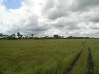
Dibon Forest is a protected forest in Burkina Faso. It is located in Tuy Province.
This protected reserve is located at an altitude of about 254 meters. [1]
| Dibon Forest | |
|---|---|
IUCN category IV (habitat/species management area) | |
| Location | |
| Area | km2 |
Dibon Forest is a protected forest in Burkina Faso. It is located in Tuy Province.
This protected reserve is located at an altitude of about 254 meters. [1]

Burkina Faso is a landlocked country in West Africa. It covers an area of 274,223 km2 (105,878 sq mi), bordered by Mali to the northwest, Niger to the northeast, Benin to the southeast, Togo and Ghana to the south, and Ivory Coast to the southwest. As of 2021, the country had an estimated population of 23,674,480. Previously called Republic of Upper Volta (1958–1984), it was renamed Burkina Faso by President Thomas Sankara. Its citizens are known as Burkinabè, and its capital and largest city is Ouagadougou.

Burkina Faso is a landlocked Sahel country that shares borders with six nations. It lies between the Sahara desert and the Gulf of Guinea, south of the loop of the Niger River, mostly between latitudes 9° and 15°N, and longitudes 6°W and 3°E. The land is green in the south, with forests and fruit trees, and semi-arid in the north. Most of central Burkina Faso lies on a savanna plateau, 198–305 metres (650–1,001 ft) above sea level, with fields, brush, and scattered trees. Burkina Faso's game preserves – the most important of which are Arly, Nazinga, and W National Park—contain lions, elephants, hippopotamus, monkeys, common warthogs, and antelopes. Previously the endangered painted hunting dog, Lycaon pictus occurred in Burkina Faso, but, although the last sightings were made in Arli National Park, the species is considered extirpated from Burkina Faso.

Arli National Park, often called Arly, is a national park located in Tapoa Province, southeastern Burkina Faso. It adjoins Benin's Pendjari National Park in the south and the Singou Reserve in the west.
Bougouriba is one of the 45 provinces of Burkina Faso and is in Sud-Ouest Region. In 2019 the population of Bougouriba was 153,606. The capital of Bougouriba is Diébougou. The 127 km2 Bontioli Reserve is located in the province.

The Mare aux Hippopotames is a lake and national park in Burkina Faso, created in 1937 and designated in 1977 as the only UNESCO Biosphere Reserve in the nation. The park was created around a freshwater lake and includes surrounding pools and marches in the flood plain of the Black Volta River, and surrounding forests. The park is home to about 100 hippos; about 1000 eco-tourists visit each year. It is located about 60 kilometers (37 mi) north of Bobo-Dioulasso, and is itself about 163 square kilometres (63 sq mi) in size.

Burkina Faso is largely wild bush country with a mixture of grass and small trees in varying proportions. The savanna region is mainly grassland in the rainy season and semi desert during the harmattan period. Fauna, one of the most diverse in West Africa, includes the elephant, hippopotamus, buffalo, monkey, lions, crocodile, giraffe, various types of antelope, and a vast variety of bird and insect life. The country has 147 mammal species, 330 aquatic species including 121 species of fish and 2067 different plant species. Of the plant species, the dominant endemic species are shea tree and the baobab, the former plant species has immense economic value to the country.

Bontioli Reserve is a complete reserve in Burkina Faso. Established in 1957 it is located in Bougouriba Province and covers an area of 127 km2 (49 sq mi).

Pama Reserve is a partial reserve in Burkina Faso. Established in 1955, it is located in Kompienga Province and covers an area of 2237 km2. Its eastern border is the Singou river, separating it from two other reserves, Singou and Arli. The western border is the national road N18 from Fada N'Gourma to Porga. In the South the reserve reaches the Pendjari river, being Burkina Faso's border with Benin. The reserve is home to elephants, hippopotamuses, lions, leopards, and 450 species of flowering plants.
Laba Forest is a protected forest in Burkina Faso. It is located in Sanguié Province.
Diéfoula Forest is a protected forest in Burkina Faso. It is located in Comoé Province.
Logoniégué Forest is a protected forest in Burkina Faso. It is located in Comoé Province.
Koflandé Forest is a protected forest in Burkina Faso. It is located in Comoé Province.
Boulon Forest is a protected forest in Burkina Faso. It is located in Comoé Province.
Dida Forest is a protected forest in Burkina Faso. It is located in Comoé Province.
Pâ Forest is a protected forest in Burkina Faso. It is located in Balé Province.
Mou Forest is a protected forest in Burkina Faso. It is located in Tuy Province.

The Oti Valley Faunal Reserve is a protected area in northeastern Togo, one of four Important Bird Areas (IBA) in the country. The site is mainly savanna and seasonally inundated floodplains on either side of the Oti River. It has a total area of 147,840 hectares and is located at 10°35'N and 0°40'E.
Events in the year 2013 in Burkina Faso.
Events in the year 2006 in Burkina Faso.
| | This Tuy Province location article is a stub. You can help Wikipedia by expanding it. |
| | This Africa protected areas related article is a stub. You can help Wikipedia by expanding it. |