| Mou Forest | |
|---|---|
IUCN category IV (habitat/species management area) | |
| Location | |
| Area | km² |
Mou Forest is a protected forest in Burkina Faso. It is located in Tuy Province.
| Mou Forest | |
|---|---|
IUCN category IV (habitat/species management area) | |
| Location | |
| Area | km² |
Mou Forest is a protected forest in Burkina Faso. It is located in Tuy Province.

A biome is a biogeographical unit consisting of a biological community that has formed in response to the physical environment in which they are found and a shared regional climate. Biomes may span more than one continent. Biome is a broader term than habitat and can comprise a variety of habitats.

Deforestation or forest clearance is the removal of a forest or stand of trees from land that is then converted to non-forest use. Deforestation can involve conversion of forest land to farms, ranches, or urban use. The most concentrated deforestation occurs in tropical rainforests. About 31% of Earth's land surface is covered by forests at present. This is one-third less than the forest cover before the expansion of agriculture, a half of that loss occurring in the last century. Between 15 million to 18 million hectares of forest, an area the size of Bangladesh, are destroyed every year. On average 2,400 trees are cut down each minute.

A forest is an area of land dominated by trees. Hundreds of definitions of forest are used throughout the world, incorporating factors such as tree density, tree height, land use, legal standing, and ecological function. The United Nations' Food and Agriculture Organization (FAO) defines a forest as, "Land spanning more than 0.5 hectares with trees higher than 5 meters and a canopy cover of more than 10 percent, or trees able to reach these thresholds in situ. It does not include land that is predominantly under agricultural or urban use." Using this definition, Global Forest Resources Assessment 2020 found that forests covered 4.06 billion hectares, or approximately 31 percent of the world's land area in 2020.

The leopard is one of the five extant species in the genus Panthera, a member of the cat family, Felidae. It occurs in a wide range in sub-Saharan Africa, in some parts of Western and Central Asia, Southern Russia, and on the Indian subcontinent to Southeast and East Asia. It is listed as Vulnerable on the IUCN Red List because leopard populations are threatened by habitat loss and fragmentation, and are declining in large parts of the global range. The leopard is considered locally extinct in Hong Kong, Singapore, South Korea, Jordan, Morocco, Togo, the United Arab Emirates, Uzbekistan, Lebanon, Mauritania, Kuwait, Syria, Libya, Tunisia and most likely in North Korea, Gambia, Laos, Lesotho, Tajikistan, Vietnam and Israel. Contemporary records suggest that the leopard occurs in only 25% of its historical global range.

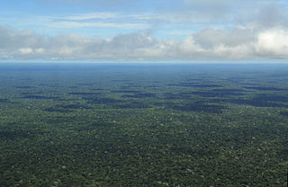
The Amazon rainforest, also called Amazon jungle or Amazonia, is a moist broadleaf tropical rainforest in the Amazon biome that covers most of the Amazon basin of South America. This basin encompasses 7,000,000 km2 (2,700,000 sq mi), of which 5,500,000 km2 (2,100,000 sq mi) are covered by the rainforest. This region includes territory belonging to nine nations and 3,344 formally acknowledged indigenous territories.

In graph theory, a tree is an undirected graph in which any two vertices are connected by exactly one path, or equivalently a connected acyclic undirected graph. A forest is an undirected graph in which any two vertices are connected by at most one path, or equivalently an acyclic undirected graph, or equivalently a disjoint union of trees.

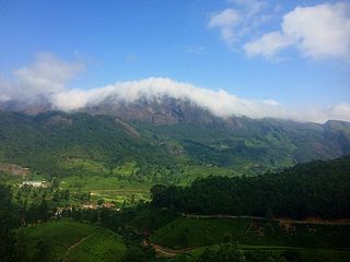
The Western Ghats, also known as the Sahyadri mountain range, is a mountain range that covers an area of 160,000 km2 (62,000 sq mi) in a stretch of 1,600 km (990 mi) parallel to the western coast of the Indian peninsula, traversing the states of Gujarat, Maharashtra, Goa, Karnataka, Kerala and Tamil Nadu. It is a UNESCO World Heritage Site and is one of the 36 biodiversity hotspots in the world. It is sometimes called the Great Escarpment of India. It contains a very large proportion of the country's flora and fauna, many of which are endemic to this region. According to UNESCO, the Western Ghats are older than the Himalayas. They influence Indian monsoon weather patterns by intercepting the rain-laden monsoon winds that sweep in from the south-west during late summer. The range runs north to south along the western edge of the Deccan Plateau and separates the plateau from a narrow coastal plain called the Western Coastal Plains along the Arabian Sea. A total of 39 areas in the Western Ghats, including national parks, wildlife sanctuaries and reserve forests, were designated as world heritage sites in 2012 – twenty in Kerala, ten in Karnataka, six in Tamil Nadu and four in Maharashtra.

The Ramapo Mountains are a forested chain of the Appalachian Mountains in northeastern New Jersey and southeastern New York, in the United States. They range in height from 900 to 1,200 feet in New Jersey, and 900 to 1,400 feet in New York.

The William B. Bankhead National Forest is one of Alabama's four National Forests, covering 181,230 acres (733 km2). It is home to Alabama's only National Wild and Scenic River, the Sipsey Fork. It is located in northwestern Alabama, around the town of Double Springs. It is named in honor of William B. Bankhead, a longtime U.S. Representative from Alabama.

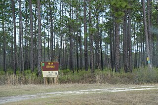
Florida's state forests are state forests overseen by the Florida Forest Service. There are 35 state forests in Florida covering more than 1,058,000 acres. The first state forest in Florida was Pine Log State Forest, established on 6,960 acres in 1936. Cary State Forest was established in 1937. Blackwater River State Forest and Withlacoochee State Forest were added in the late 1950s and early 1960s.

Mun Bhuridatta was a Thai bhikkhu from Isan region who is credited, along with his mentor, Ajahn Sao Kantasīlo, with establishing the Thai Forest Tradition or "Kammaṭṭhāna tradition" that subsequently spread throughout Thailand and to several countries abroad.

Klamath National Forest is a 1,737,774-acre national forest, in the Klamath Mountains and Cascade Range, located in Siskiyou County in northern California, but with a tiny extension into southern Jackson County in Oregon. The forest contains continuous stands of ponderosa pine, Jeffrey pine, Douglas fir, red fir, white fir, lodgepole pine, Baker Cypress, and incense cedar. Old growth forest is estimated to cover some 168,000 acres (680 km2) of the forest land. Forest headquarters are located in Yreka, California. There are local ranger district offices located in Fort Jones, Happy Camp, and Macdoel, all in California. The Klamath was established on May 6, 1905. This forest includes the Kangaroo Lake and the Sawyers Bar Catholic Church is located within the boundaries of the Forest. The Forest is managed jointly with the Butte Valley National Grassland.

The Coeur d'Alene is a U.S. National Forest located in the Idaho panhandle and is one of three forests that are aggregated into the Idaho Panhandle National Forests. Coeur d'Alene National Forest is located in Shoshone, Kootenai, and Bonner counties in northern Idaho. It has a total area of 726,362 acres.

The Grand Mesa National Forest is a U.S. National Forest in Mesa, Delta and Garfield Counties in Western Colorado. It borders the White River National Forest to the north and the Gunnison National Forest to the east. The forest covers most of Grand Mesa and the south part of Battlement Mesa. It has a total area of 346,555 acres. It is managed by the United States Forest Service together with Gunnison National Forest and Uncompahgre National Forest from offices in Delta, Colorado. There are local ranger district offices located in Grand Junction.

The Central Anatolia Region is a geographical region of Turkey. The largest city in the region is Ankara. Other big cities are Konya, Kayseri, Eskişehir, Sivas, and Aksaray.
Channels State Forest is a 4,836-acre (19.57 km2) state forest located in Washington and Russell counties, Virginia. The Channels Natural Area Preserve is located within the forest, which protects the Great Channels of Virginia, comprising slot canyons formed within 400-million-year-old sandstone outcroppings.
Aka, also known as Yaka or Beka, is a Bantu language spoken in the Central African Republic and Republic of Congo, along the Ubangi River dividing the two countries.

The Cucamonga Wilderness is a federally designated wilderness area located in the eastern San Gabriel Mountains, in San Bernardino County, Southern California.
The Lake Forest Foresters football team, representing Lake Forest College, is an NCAA Division III college football team and member of the Midwest Conference. Lake Forest played its first intercollegiate games in 1882, with a pair of games against Northwestern University.

Montane ecosystems are found on the slopes of mountains. The alpine climate in these regions strongly affects the ecosystem because temperatures fall as elevation increases, causing the ecosystem to stratify. This stratification is a crucial factor in shaping plant community, biodiversity, metabolic processes and ecosystem dynamics for montane ecosystems. Dense montane forests are common at moderate elevations, due to moderate temperatures and high rainfall. At higher elevations, the climate is harsher, with lower temperatures and higher winds, preventing the growth of trees and causing the plant community to transition to montane grasslands, shrublands or alpine tundra. Due to the unique climate conditions of montane ecosystems, they contain increased numbers of endemic species. Montane ecosystems also exhibit variation in ecosystem services, which include carbon storage and water supply.