
The Faubourg Marigny is a neighborhood of the city of New Orleans, Louisiana, United States.

Bywater is a neighborhood of the city of New Orleans. A subdistrict of the Bywater District Area, its boundaries as defined by the City Planning Commission are: Florida Avenue to the north, the Industrial Canal to the east, the Mississippi River to the south, and the railroad tracks along Homer Plessy Way to the west. Bywater is part of the Ninth Ward of New Orleans. It includes part or all of Bywater Historic District, which is listed on the National Register of Historic Places.

Pontchartrain Park is a historically registered neighborhood of the city of New Orleans. A subdistrict of the Gentilly District Area, its boundaries as defined by the City Planning Commission are: Leon C. Simon Drive to the north, the Industrial Canal to the east, Dreux Avenue to the south and Peoples Avenue to the west.

The 7th Ward is a legally defined voting ward and a neighborhood of the city of New Orleans. A sub-district of the Mid-City District Area, its boundaries as defined by the New Orleans City Planning Commission are: A.P. Tureaud Avenue, Agriculture, Allen, Industry, St. Anthony, Duels, Frenchmen and Hope Streets to the north, Elysian Fields Avenue to the east, St. Claude and St. Bernard Avenues, North Rampart Street and Esplanade Avenue to the south, and North Broad Street to the west.

Navarre is a neighborhood of the city of New Orleans. A subdistrict of the Lakeview District Area, its boundaries as defined by the City Planning Commission are: I-610, Canal Boulevard and Florida Boulevard to the north, Orleans Avenue to the east, City Park Avenue to the south and the Pontchartrain Expressway and Pontchartrain Boulevard to the west.

Gentilly is a broad, predominantly middle-class and racially diverse section of New Orleans, Louisiana. The Gentilly neighborhood is bounded by Lake Pontchartrain to the north, France Road to the east, Bayou St. John to the west, and CSX Transportation railroad tracks to the south.

St. Bernard Projects was a housing project in the city of New Orleans. A subdistrict of the Mid-City District Area, its boundaries as defined by the New Orleans City Planning Commission were: Harrison Avenue to the north, Paris Avenue to the east, Lafreniere Street and Florida Avenue to the south and Bayou St. John to the west.

Milneburg is a neighborhood of the city of New Orleans. A subdistrict of the Gentilly District Area, its boundaries as defined by the City Planning Commission are: Leon C. Simon Drive to the north, People's Avenue to the east, Filmore Ave to the south and Elysian Fields Avenue to the west, putting it within the 8th Ward of New Orleans. The Milneburg neighborhood takes its name from Milneburg, a historic town and neighborhood formerly located a short distance north of the modern neighborhood.

Gentilly Woods is a neighborhood of the city of New Orleans. A subdistrict of the Gentilly District Area, its boundaries as defined by the City Planning Commission are: Dreux Avenue to the north, Industrial Canal to the east, Gentilly Boulevard to the south and People's Avenue to the west.

Mid-City is a neighborhood of the city of New Orleans. A sub-district of the Mid-City District Area, its boundaries as defined by the New Orleans City Planning Commission are: City Park Avenue, Toulouse Street, North Carrollton, Orleans Avenue, Bayou St. John and St. Louis Street to the north, North Broad Street to the east, and the Pontchartrain Expressway to the west. It is a historic district on the National Register of Historic Places. In 2023, the neighborhood was cited as one of the "coolest" in the world by Time Out. In common usage, a somewhat larger area surrounding these borders, usually the areas bounded by the beltway formed by Interstates 10 and 610, is often also referred to as part of Mid-City.
Fairgrounds is a neighborhood of the city of New Orleans. A subdistrict of the Mid-City District Area, its boundaries as defined by the New Orleans City Planning Commission are: Florida Avenue, Dugue, Treasure, Republic and Abundance Streets to the north, North Broad Street to the east, Esplanade Avenue to the south and Bayou St. John to the west.

Filmore is a neighborhood of the city of New Orleans. A subdistrict of the Gentilly District Area, its boundaries as defined by the City Planning Commission are: * Allen Toussaint Boulevard to the north, London Avenue Canal to the east, Press Drive, Paris Avenue and Harrison Avenue to the south and Bayou St. John to the west.

Gentilly Terrace is a neighborhood of the city of New Orleans. A subdistrict of the Gentilly District Area, its boundaries as defined by the City Planning Commission are: Filmore Avenue to the north, People's Avenue to the east, Gentilly Boulevard to the south and Elysian Fields Avenue to the west. Gentilly Terrace may be further divided into Gentilly Terrace & Gardens, Edgewood Park and Fairmont Park, all three of which possess organized, distinct, and active neighborhood associations.
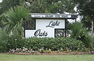
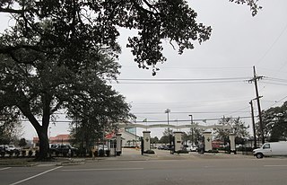
Lake Terrace/Lake Oaks is a neighborhood of the city of New Orleans, Louisiana. A sub-district of the city's Gentilly District, its boundaries as defined by the City Planning Commission are: Lake Pontchartrain to the north; the Industrial Canal to the east; Leon C. Simon Drive, Elysian Fields Avenue, New York Street, the London Avenue Canal, and Allen Toussaint Boulevard to the south; and Bayou St. John to the west. The neighborhood comprises the Lake Terrace and Lake Oaks subdivisions, the principal campus of the University of New Orleans, and the University of New Orleans Research & Technology Park — all built on land reclaimed from Lake Pontchartrain.
St. Anthony is a neighborhood of the city of New Orleans. A subdistrict of the Gentilly District Area, its boundaries as defined by the City Planning Commission are: New York Street to the north, Elysian Fields Avenue to the east, Mirabeau Avenue to the south and the London Avenue Canal to the west.
Desire Area is a neighborhood of the city of New Orleans. A subdistrict of the Bywater District Area, its boundaries as defined by the City Planning Commission are: Gentilly Boulevard to the north; the Industrial Canal to the east; Florida Boulevard, Alvar Street, Higgins Boulevard, Piety Street, Pleasure Street, Oliver White Avenue, and Desire Street to the south; and People's Avenue to the west. It is part of the Upper 9th Ward.
Florida Area is a neighborhood of the city of New Orleans. A subdistrict of the Bywater District Area, its boundaries as defined by the City Planning Commission are: Florida Boulevard, Gallier, Law, Congress and North Dorgenois Streets to the north; Mazant Street to the east; North Galvez Street to the south; and Montegut Street, Law Street, and Almonaster Avenue to the west.
St. Claude is a neighborhood of the city of New Orleans. A subdistrict of the Bywater District Area, its boundaries as defined by the City Planning Commission are: Law, Montegut and North Galvez Streets to the north, Lesseps Street to the east, Burgundy Street, Clouet Street and St. Claude Avenue to the south and Franklin Avenue to the west.

St. Roch is a neighborhood of the U.S. city of New Orleans. A subdistrict of the Bywater District Area, its boundaries as defined by the City Planning Commission are: Lafreniere Street, Paris Avenue, I-610, Benefit Street, and Dahlia Walk to the north; People's and Almonaster Avenues to the east; St. Claude Avenue to the south; Elysian Fields Avenue, Hope, Frenchmen, Duels, St. Anthony, Industry, Allen, & Agriculture Streets, A.P. Tureaud Avenue, Abundance, Republic, Treasure, & Dugue Streets, and Florida & St. Bernard Avenues to the west.

Holy Cross is a neighborhood of the city of New Orleans. A subdistrict of the Lower Ninth Ward District Area, its boundaries as defined by the City Planning Commission are: St. Claude Avenue to the north, St. Bernard Parish to the east, the Mississippi River to the south and the Industrial Canal to the west.

