Kamrup district ; also Kamrup rural district is an administrative district in the state of Assam in India formed by bifurcating old Kamrup district into two in the year 2003; other being Kamrup Metropolitan district, named after region it constitute. The district, along with Nalbari and Barpeta together form the Kamrup region, has Kamrupi culture and language.

Nalbari is a town and a municipal board in Nalbari district in the Indian state of Assam. Nalbari town is also the headquarters of Nalbari District. The town is one of many towns covered under proposed 'State Capital Region'.

Rangiya or Rangia is a town and a municipal board in Kamrup rural district in the Indian state of Assam. It is the regional divisional headquarters of the North East Frontier Railway. It's situated 52 kilometres away from the state headquarters Dispur Guwahati and 39 kilometres from Jalukbari.
Jhalda is a city and a municipality in Purulia district in the Indian state of West Bengal. It is the headquarters of the Jhalda subdivision.

Pirganj is an Upazila of Rangpur District in the division of Rangpur, Bangladesh. Pirganj Upazila area 409.37 km2, located in between 25°18' and 25°31' north latitudes and in between 89°08' and 89°25' east longitudes. It is bounded by mithapukur upazila on the north, palashbari, ghoraghat and nawabganj sadar (dinajpur) upazilas on the south, sadullapur upazila on the east, Mithapukur, Nawabganj Sadar (Dinajpur) and Ghoraghat upazilas on the west.

Stakna Monastery or Stakna Gompa is a Buddhist monastery of the Drugpa sect in Stakna, Leh district, Ladakh, northern India, 21 or 25 kilometres from Leh on the left bank of the Indus River.

Lower Assam is a region situated in Western Brahmaputra Valley encompassing Kamrup and Goalpara regions.
Kamrup Metropolitan is one of the 33 districts in Assam state in north-eastern India. It was carved out of the erstwhile undivided Kamrup district in 2003 and covers an area equivalent to the area under the jurisdiction of the Guwahati Metropolitan Development Authority area. Dispur Legislative Assembly Constituency in Kamrup Metro district with 3.53 lakh voters is the largest constituency in Assam.
Baihata Chariali is a town in Kamrup Rural district of Assam, India; situated at norther site of the river Brahmaputra.

Dimu is a village in Abezhdan Rural District, Abezhdan District, Andika County, Khuzestan Province, Iran. At the 2006 census, its population was 129, in 23 families.
Kaniha is a village in Kamrup district surrounded by Kamalpur town. It is 31 km from Guwahati.
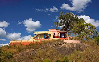
Kamalpur is a town in Kamrup district, Assam. It is 25 km from Jalukbari, Guwahati and surrounded by Rangia town, Baihata Chariali and Kaniha, Dimu Dobak villages. It is also a constituency of the Assam Legislative Assembly.
Nagarbera is a village in Kamrup district. It is on south bank of river Brahmaputra and is 90.6 km from Guwahati city.
Boko is a town located in Assam, in the Kamrup district in the Indian state of Assam. The town is composed of 139 villages. It is approxiamtely 55 kilometers west of Guwahati.
Purna Daichapra is a village of Nalbari district in Western Assam. This village is situated in the border of Nalbari and Kamrup District.
Dimu is a village in Birun Bashm Rural District, Kelardasht District, Chalus County, Mazandaran Province, Iran. At the 2006 census, its population was 91, in 29 families.

Dimu is a Syrian village located in the Jubb Ramlah Subdistrict of the Masyaf District in Hama Governorate, 43 kilometers west of Hama. According to the Syria Central Bureau of Statistics (CBS), Dimu had a population of 1,102 in the 2004 census. Its inhabitants are predominantly Sunni Muslims.
Dimus Chisala is a Zambian boxer. He competed at the 1984 Summer Olympics and the 1988 Summer Olympics.


