Related Research Articles

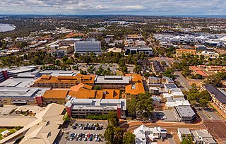
The City of Nedlands is a local government area in the inner western suburbs of the Western Australian capital city of Perth, about 7 kilometres (4 mi) west of Perth's central business district. The city is situated within the western suburbs of the metropolitan area—known colloquially as the “golden triangle” for the concentration of wealth and high housing values.
The Peel region is one of the nine regions of Western Australia. It is located on the west coast of Western Australia, about 75 km (47 mi) south of the state capital, Perth. It consists of the City of Mandurah, and the Shires of Boddington, Murray, Serpentine-Jarrahdale and Waroona.
The Kwinana Freeway is a 72-kilometre (45 mi) freeway in and beyond the southern suburbs of Perth, Western Australia, linking central Perth with Mandurah to the south. It is the central section of State Route 2, which continues north as Mitchell Freeway to Clarkson, and south as Forrest Highway towards Bunbury. A 4-kilometre (2.5 mi) section between Canning and Leach highways is also part of National Route 1. Along its route are interchanges with several major roads, including Roe Highway and Mandjoogoordap Drive. The northern terminus of the Kwinana Freeway is at the Narrows Bridge, which crosses the Swan River, and the southern terminus is at Pinjarra Road, east of Mandurah.

Joondalup is a suburb of Perth, Western Australia, approximately 26 kilometres (16 mi) north of Perth's central business district. It contains the central business district of the regional City of Joondalup and acts as the primary urban centre of Perth's outer northern suburbs.

Yanchep is an outer coastal suburb of Perth, Western Australia, 56 kilometres (35 mi) north of the Perth CBD. It is a part of the City of Wanneroo local government area. Originally a small crayfishing settlement, it was developed by entrepreneur Alan Bond in the 1970s for the 1977 America's Cup. The area covers the urban centre of Yanchep as well as Yanchep National Park in its entirety.

Butler is an outer suburb of Perth, Western Australia, 41 kilometres north of Perth's central business district. It is part of the City of Wanneroo local government area. It forms the majority of the Brighton Estate, a large commercial and residential development by Satterley.
Tonkin Highway is an 81-kilometre-long (50 mi) north–south highway and partial freeway in Perth, Western Australia, linking Perth Airport and Kewdale with the city's north-eastern and south-eastern suburbs. As of April 2020, the northern terminus is at the interchange with Brand Highway and Great Northern Highway in Muchea, and the southern terminus is at Thomas Road in Oakford. It forms the entire length of State Route 4, and connects to several major roads. Besides Brand Highway and Great Northern Highway, it also connects to Reid Highway, Great Eastern Highway, Leach Highway, Roe Highway, and Albany Highway.
The South East Queensland Regional Plan 2009-2031 is a statutory plan designed to guide regional growth and development in South East Queensland, Australia. It was established under the Integrated Planning Act 1997, which has now been replaced by The Sustainable Planning Act 2009.
In January 2004, Deputy Prime Minister John Prescott announced the United Kingdom government's Expansion plans for Milton Keynes. However, the change of government in 2010 and the abolition of the Regional Spatial Strategy in 2012/13 saw these plans revoked and a planned expansion of up to 44,000 dwellings reduced to 28,000. The Milton Keynes Core Strategy was published in July 2013 and regards the figure of 28,000 new homes to be the minimum figure.

The Western Australian Planning Commission (WAPC) is an independent statutory authority of the Government of Western Australia that exists to coordinate strategic and statutory planning for future urban, rural, and regional land use. The WAPC fulfils various statutory responsibilities first established in 1955. The authority is responsible for expenditure arising from the Metropolitan Region Improvement Tax.

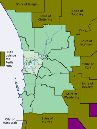
The Metropolitan Region Scheme (MRS) provides the legal basis for land use planning within the Perth metropolitan region. It classifies land into broad zones and reservations and is administered by the Western Australian Planning Commission. It is one of three regional schemes in Western Australia. The MRS is updated via an ongoing process of amendments. Amendments to the MRS are typically informed by a series of strategic plans prepared by the Department of Planning, Lands and Heritage. Detailed land use planning within the area of the MRS is undertaken by local governments and other statutory authorities which prepare one or more local planning schemes within their administrative boundaries. Local plannings schemes must be consistent with the MRS and require the approval of the WAPC. The acquisition of land reserved under the MRS is funded by a hypothecated land tax called the Metropolitan Region Improvement Tax.

The Perth metropolitan region or the Perth metropolitan area is the administrative area and geographical extent of the Western Australian capital city of Perth and its conurbation.
The Sustainable Communities and Climate Protection Act of 2008, also known as Senate Bill 375 or SB 375, is a State of California law targeting greenhouse gas emissions from passenger vehicles. The Global Warming Solutions Act of 2006 sets goals for the reduction of statewide greenhouse gas emissions. Passenger vehicles are the single largest source of greenhouse gas emissions statewide, accounting for 30% of total emissions. SB 375 therefore provides key support to achieve the goals of AB 32.

Urban planning in Australia has a significant role to play in ensuring the future sustainability of Australian cities. Australia is one of the most highly urbanised societies in the world. Continued population growth in Australian cities is placing increasing pressure on infrastructure, such as public transport and roadways, energy, air and water systems within the urban environment.
The Growth Plan for the Greater Golden Horseshoe, 2006 is a regional growth management policy for the Greater Golden Horseshoe (GGH) area of southern Ontario, Canada. Introduced under the Places to Grow Act in 2005, the Plan was approved by the Lieutenant Governor in Council and enacted on June 16, 2006. Administered by the Ontario Ministry of Infrastructure (MOI), the plan identifies density and intensification targets, urban growth centres, strategic employment areas, and settlement area restrictions designed to mitigate negative environmental, economic, and human health impacts associated with sprawling, uncoordinated growth in the region.
Since the early 2000s, a number of proposals have been made by politicians and interest groups in Cork City, Ireland to introduce a light rail system in the city. As of early 2019 it was in a period of public consultation. The proposal, which has "no definitive timeline", has been compared to the Luas light rail system in Dublin.
Bush Forever is a Western Australian government initiative and plan, aimed at preserving a "comprehensive, adequate and representative" 10 percent of each vegetation complex on the Swan Coastal Plain within the Perth metropolitan region. Introduced in 2000, the plan was to achieve this through a network of reserves by 2010.
The 1970 Corridor Plan for Perth provided a strategic framework for planning the growth of the Perth metropolitan area, in Western Australia. The plan superseded the 1955 Plan for the Metropolitan Region and established the principles on which the Metropolitan Regional Planning Authority would consider amendments to the Metropolitan Region Scheme. In contrast to the earlier plan, the Corridor Plan was not a detailed spatial plan of the entire metropolitan area. Instead it was intended to provide a policy framework for the detailed structure planning of each of the four proposed corridors. Initially it was controversial; the government of the day instigated both an independent review and an Honorary Royal Commission into the plan before adopting a modified version. A second review of the plan was completed in 1987, followed by the preparation and adoption of the 1990 Metroplan.
References
- ↑ "Perth and Peel @ 3.5 Million". Department of Planning, Lands and Heritage . 24 September 2020. Archived from the original on 2020-02-29. Retrieved 28 October 2020.
- ↑ Young, Emma (26 July 2018). "Plan revealed to curb Perth and Peel urban sprawl once and for all". WA Today . Retrieved 29 October 2020.
- ↑ Beyer, Mark (19 May 2020). "Urban infill key for 2050 vision for Perth". Business News. Retrieved 20 October 2020.
- ↑ Bunker, Raymond and Troy, Laurence, The changing political economy of the compact city and higher density urban renewal in Perth (20 April 2020), University of New South Wales