Related Research Articles

James Ross Island is a large island off the southeast side and near the northeastern extremity of the Antarctic Peninsula, from which it is separated by Prince Gustav Channel. Rising to 1,630 metres (5,350 ft), it is irregularly shaped and extends 40 nautical miles in a north–south direction.
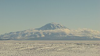
Mount Discovery is a conspicuous, isolated volcanic cone, 2,680 metres (8,790 ft) high, lying at the head of McMurdo Sound and east of Koettlitz Glacier, overlooking the northwest portion of the Ross Ice Shelf. It forms the center of a three-armed mass of which Brown Peninsula is one extension to the north; Minna Bluff is a second to the east; the third is Mount Morning to the west. Mount Discovery was discovered by the British National Antarctic Expedition (1901–04) and named for their expedition ship Discovery.
The Trojan Range is a mountain range rising to 2,760 metres (9,055 ft), extending northward from Mount Francais along the east side of Iliad Glacier, Anvers Island, in the Palmer Archipelago of the British Antarctic Territory. It was surveyed by the Falkland Islands Dependencies Survey (FIDS) in 1955 and named by the UK Antarctic Place-Names Committee (UK-APC) for the Trojans, one of the opposing sides in the Trojan War in Homer's Iliad.

Aagaard Glacier, also known as Glaciar Alderete, is an 8-mile (13 km) long Antarctic glacier which lies close to the east of Gould Glacier and flows in a southerly direction into Mill Inlet, on the east coast of Graham Land. It was charted by the Falkland Islands Dependencies Survey (FIDS) and photographed from the air by the Ronne Antarctic Research Expedition during December 1947; it was named by the FIDS for Bjarne Aagaard, a Norwegian authority on Antarctic whaling and exploration.

Larsen Harbour is a narrow 2.6 miles (4.2 km) long inlet of indenting volcanic rocks and sheeted dykes known as the Larsen Harbour Formation. It is a branch of Drygalski Fjord, entered 2.5 miles (4 km) west-northwest of Nattriss Head, at the southeast end of South Georgia Island. It was charted by the Second German Antarctic Expedition, 1911–12, under Filchner, who named it for Captain Carl Anton Larsen a Norwegian explorer, who made significant contributions to the exploration of Antarctica. The most significant of these was the first discovery of fossils on the continent, for which he received the Back Grant from the Royal Geographical Society. Larsen is also considered the founder of the Antarctic whaling industry and the settlement and whaling station of Grytviken, South Georgia.
Hackapike Bay is an anchorage 4 miles (6 km) northwest of Ryswyck Point, entered west of False Island along the northeast coast of Anvers Island, in the Palmer Archipelago, Antarctica. It was charted and named by the British Graham Land Expedition, 1934–37, under John Rymill.
William Glacier is a glacier flowing south from the interior highlands of Anvers Island to the head of Börgen Bay on the southeast coast of the island, in the Palmer Archipelago. Discovered by the Belgian Antarctic Expedition, 1897–99, under Gerlache, and charted by them simply as a "grand glacier." The name William Glacier first appears on a chart based upon a 1927 survey by DI personnel on the Discovery. Gateway Ridge separates William Glacier from Hooper Glacier.
Billie Peak is a peak, 725 metres (2,380 ft) high, which rises 1.5 nautical miles (3 km) east-northeast of Bay Point on the southeast coast of Anvers Island, in the Palmer Archipelago. It was discovered by the Belgian Antarctic Expedition, 1897–99, under Gerlache. The name appears on a chart based on a 1927 Discovery Investigations survey, but may reflect an earlier naming.
Börgen Bay is a bay 4 nautical miles (7 km) wide, indenting the southeast coast of Anvers Island in the Palmer Archipelago of Antarctica. Canty Point marks the west side of the entrance to Börgen Bay, while Bay Point marks the east entrance. Billie Peak stands 1.5 nautical miles (3 km) east-northeast of Bay Point.
The Briggs Peninsula is a small peninsula forming the west side of Inverleith Harbour on the northeast coast of Anvers Island, in the Palmer Archipelago. The northeast point of the peninsula was charted in 1927 by DI personnel on the RSS Discovery, who named it Briggs Point for Able Seaman A.C. Briggs, a member of the survey party. As air photos show no distinct point in this location, the name was applied to the entire peninsula by the UK Antarctic Place-Names Committee in 1959.
Channel Glacier is a through glacier, 1.5 nautical miles (3 km), extending in an east-west direction across Wiencke Island, between Nipple Peak and Wall Range, in the Palmer Archipelago. It was discovered by the Belgian Antarctic Expedition under Gerlache 1897–99. The name appears on a chart based on a 1927 survey by DI personnel on the Discovery.
Janssen Peak is a conspicuous peak, 1,085 metres (3,560 ft) high, forming the southwestern end of the Sierra DuFief in the southwestern part of Wiencke Island, in the Palmer Archipelago, Antarctica. It was discovered by the Belgian Antarctic Expedition, 1897–99, under Gerlache, and charted by the French Antarctic Expedition, 1903–05, under Jean-Baptiste Charcot, who named it for Jules Janssen, a noted French astronomer.
Krebs Glacier is a glacier flowing west into the head of Charlotte Bay on the west coast of Graham Land, Antarctica. It was charted by the Belgian Antarctic Expedition under Gerlache, 1897–99, and was named by the UK Antarctic Place-Names Committee in 1960 for Arthur Constantin Krebs, who, with Charles Renard, constructed and flew the first dirigible airship capable of steady flight under control, in 1884.
False Island is the largest of three islands lying at the east side of Hackapike Bay, off the northeast coast of Anvers Island, in the Palmer Archipelago. Two islands were charted in this approximate position by the French Antarctic Expedition, 1903–05, under Jean-Baptiste Charcot. False Island was named by Discovery Investigations personnel on the Discovery in 1927.
Flag Point is a point which lies 0.3 nautical miles (0.6 km) east-southeast of Damoy Point and forms the north side of the entrance to Port Lockroy, Wiencke Island, in the Palmer Archipelago. It was discovered by the French Antarctic Expedition, 1903–05, under Jean-Baptiste Charcot. It was named by the Falkland Islands Dependencies Survey (FIDS) in 1944; when the FIDS base at Port Lockroy was established in 1944, a metal Union Flag was erected on this point.

Fournier Bay is a bay 8 nautical miles (15 km) long and 3 nautical miles (6 km) wide, indenting the northeast coast of Anvers Island immediately west of Briggs Peninsula and south of Dralfa Point, in the Palmer Archipelago, Antarctica. Its head is fed by Rhesus, Thamyris, Kleptuza and Altimir Glaciers.
Lion Sound is a small passage between Lion Island and the southeast coast of Anvers Island, in the Palmer Archipelago, Antarctica. It was discovered by the Belgian Antarctic Expedition, 1897–99, under Gerlache. The name appears on a map based on a 1927 survey by Discovery Investigations personnel on the Discovery, the sound being named for its association with Lion Island.

Theta Islands are several small islands and rocks which lie close west of Kappa Island at the west extremity of the Melchior Islands, Palmer Archipelago. The islands were roughly charted by Discovery Investigations personnel in 1927. The name, derived from the eighth letter of the Greek alphabet, appears to have been first used on a 1946 Argentine government chart following surveys of the Melchior Islands by Argentine expeditions in 1942 and 1943.
Tombstone Hill is a hill which rises to 50 m close east-northeast of Damoy Point, Wiencke Island, in the Palmer Archipelago. It was discovered and first mapped by the French Antarctic Expedition, 1903–05, under Charcot. The name given by the Falkland Islands Dependencies Survey (FIDS) in 1944 is descriptive of some rocks on the top of the hill.
Lefèvre-Utile Point is a point 1 nautical mile (2 km) west of Curie Point along the north side of Doumer Island, in the Palmer Archipelago, Antarctica. It was discovered and named by the French Antarctic Expedition, 1903–05, under Jean-Baptiste Charcot.
References
- ↑ "Estrecho Pinochet". SCAR Gazetter. Retrieved 31 January 2021.
- ↑ "Discovery Sound". Geographic Names Information System . United States Geological Survey, United States Department of the Interior . Retrieved 2012-01-21.
![]() This article incorporates public domain material from "Discovery Sound". Geographic Names Information System . United States Geological Survey.
This article incorporates public domain material from "Discovery Sound". Geographic Names Information System . United States Geological Survey.
| | This Palmer Archipelago location article is a stub. You can help Wikipedia by expanding it. |