
Greater Reykjavík is a region in southwestern Iceland that comprises the national capital Reykjavík and six municipalities around it. Each municipality has its own elected council. Municipal governments cooperate extensively in various fields: for example waste policy, shared public transport and a joint fire brigade.

Santa María de Pantasma is a municipality in the Jinotega department of Nicaragua.
Eneas Lakes Provincial Park is a provincial park in British Columbia, Canada, located west of the town of Peachland, to the south of Peachland Creek. The park is approximately 1036 ha. in size and was established in 1968. The Eneas Lakes lie at the head of Finlay Creek.
Puntchesakut Lake Provincial Park is a provincial park in British Columbia, Canada. It is approximately 16.7m deep and has trout as the main fish source.
The Turnabout River is located on Ellesmere Island, Nunavut, Canada. It drains both Turnabout Lake and Turnabout Glacier into Lake Hazen.
The Red Bluff First Nation is a Dakelh First Nations government located in the northern Fraser Canyon region of the Canadian province of British Columbia. It is a member of the Carrier-Chilcotin Tribal Council, which includes both Tsilhqot'in and Carrier (Dakelh) communities.
The Lake Laurentian Conservation Area is a 2,400 acres (970 ha) conservation area in Greater Sudbury, Ontario. Extending from the southeastern shore of Lake Ramsey to the Southeast Bypass, the park incorporates a large green space, several lakes, a self-guided nature trail, wetland areas, hiking trails, bird watching areas, and snowshoeing and cross-country ski trails in winter.
Dissin is a town and seat of Dissin Department in the province of Ioba in Burkina Faso, near the northwest corner of Ghana.
Beverly is an unincorporated community in Northampton County, Virginia, United States.
The Cascade Recreation Area was a Provincial Recreation Area in the Hozameen Range of the Cascade Mountains of British Columbia, Canada, located north of and was added to E.C. Manning Provincial Parkin 2010. It is roughly 11,858 ha. and was created on March 14, 1987. The recreation area has limited road access and is used by hikers, horse riders, mountain bikers and, in winter, snowmobilers. The nearest towns are Hope and Princeton.

Curlew is an unincorporated community in Imperial County, California. It is located on a former branch of the Southern Pacific Railroad 8.5 miles (14 km) north of Holtville, at an elevation of 89 feet below sea level.
Old Harbour is a town in southern Jamaica.
The Scowlitz First Nation or Scowlitz Indian Band is the band government of Skaulits subgroup of the Sto:lo people located on Harrison Bay in the Upper Fraser Valley region between Chehalis (E) and Lake Errock, British Columbia, Canada (W). They are a member government of the Stó:lō Tribal Council.
Summerford is an unincorporated community in Somerford Township, Madison County, Ohio, United States. It is located at 39°56′00″N83°29′30″W, at the intersection of U.S. Route 40 and State Route 56.
Oulad Abbou is a town in Berrechid Province, Casablanca-Settat, Morocco. According to the 2014 Moroccan census it recorded a population of 11,299, up from 10,748 in the 2004 census.
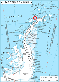
Sigmen Glacier is a 2.2 km long and 2 km wide glacier draining the northwest slopes of Brugmann Mountains on Liège Island in the Palmer Archipelago, Antarctica. It is situated northeast of Zbelsurd Glacier and southwest of Shterna Glacier, draining the west-southwest slopes of Vazharov Peak and the northwest slopes of Mount Kozyak, and flows northwestwards to enter Palakariya Cove.
Saqqarlersuup Sullua is a strait in the Upernavik Archipelago in the Qaasuitsup municipality in northwestern Greenland.

Orizari Glacier is the 3 nautical miles long and 0.5 nautical miles wide glacier in Veregava Ridge on the east side of Sentinel Range in Ellsworth Mountains, Antarctica. It is draining the north slopes of Mount Waldron, and flowing north-northwestwards to join Dater Glacier west of Sipey Peak.

Robinson Pass is the ice-covered saddle of elevation 1850 m between Sostra Heights on the east and the side ridge on the west that trends east-northeast from Mount Dalrymple on the main crest of northern Sentinel Range in Ellsworth Mountains, Antarctica. It is part of the glacial divide between Sabazios Glacier to the north and Embree Glacier to the south.
Red Hill is an unincorporated community in Lawrence County, Indiana, in the United States.


