A super-Poulet number is a Poulet number, or pseudoprime to base 2, whose every divisor d divides

Bosaso is a Administrative divisions of Somalia in the northeastern Bari region of Somalia. Its capital of Bari region. It is also the commercial capital of Puntland state of Somalia and one of Somalia's commercial capitals..

Dessalines is an arrondissement in the Artibonite department of Haiti.
Bantumilli is a village in the Krishna district of the Indian state of Andhra Pradesh. It is the mandal headquarters of Bantumilli mandal of Machilipatnam revenue division. It is well connected by road. It is located at 28 km from Machilipatnam, 50 km from Bhimavaram and 34 km from Gudivada.

Ukhiya is an upazila of Cox's Bazar District in the Division of Chittagong, Bangladesh.
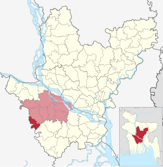
Alfadanga is an upazila of Faridpur District in the Division of Dhaka, Bangladesh.

Yeleswaram or Elesvaram is a town in the Kakinada district in the state of Andhra Pradesh in India.

Thma Koul is a district (srok) of Battambang Province, in north-western Cambodia.
San Pedro de la Cueva is a town in San Pedro de la Cueva Municipality, in the Mexican state of Sonora. It is located in the center of the state at an elevation of 500 meters.

Loropeni is a department or commune of Poni Province in southern Burkina Faso. Its capital lies at the town of Loropeni.
Micocoulier Ecological Reserve is an ecological reserve in Quebec, Canada. It was established on January 7, 1981.

Coronango is a town and municipality in the Mexican state of Puebla in south-eastern Mexico.

Toros is a village in Lukovit Municipality, Lovech Province, northern Bulgaria.
Rincón is a corregimiento in Gualaca District, Chiriquí Province, Panama. It has a land area of 66.3 square kilometres (25.6 sq mi) and had a population of 1,547 as of 2010, giving it a population density of 23.3 inhabitants per square kilometre (60/sq mi). Its population as of 1990 was 1,200; its population as of 2000 was 1,364.
Juan Díaz is a corregimiento in Antón District, Coclé Province, Panama. It has a land area of 85.6 square kilometres (33.1 sq mi) and had a population of 2,634 as of 2010, giving it a population density of 30.8 inhabitants per square kilometre (80/sq mi). Its population as of 1990 was 1,694; its population as of 2000 was 2,037.
San Juan de Dios is a corregimiento in Antón District, Coclé Province, Panama. It has a land area of 55.7 square kilometres (21.5 sq mi) and had a population of 4,797 it 2010, giving it a population density of 86.1 per square kilometre (223/sq mi). The population in 1990 was 6,199 and in 2000 was 4,214.
Playa Chiquita is a corregimiento in Santa Isabel District, Colón Province, Panama. As of 2010, it had a population of 169. By 1990, the population was 184 and as of 2000, the population was 187.
Cerro de Plata is a corregimiento in Cañazas District, Veraguas Province, Panama with a population of 1,594 as of 2010. Its population as of 1990 was 3,563; its population as of 2000 was 1,595.
Las Cruces is a corregimiento in Cañazas District, Veraguas Province, Panama with a population of 1,364 as of 2010. It was created by Law 37 of June 24, 2008.
The Frontier Pathways is a 103-mile (166 km) National Scenic Byway and Colorado Scenic and Historic Byway located in Custer and Pueblo counties, Colorado, US.

