The Arctic Archipelago, also known as the Canadian Arctic Archipelago, is a group of islands north of the Canadian mainland.

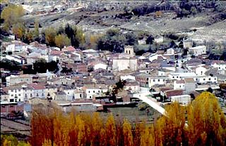
Caleruega is a small town and municipality in the autonomous community of Castile-Leon, Spain. It is part of the Province of Burgos. The town is a few miles south of the Monastery of Santo Domingo de Silos.

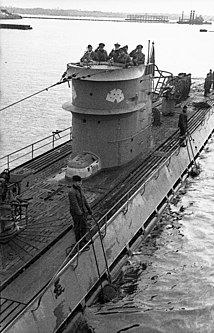
German submarine U-107 was a Type IXB U-boat of Nazi Germany's Kriegsmarine that operated during World War II. Between January 1941 and August 1944, she sailed on 16 active patrols at a time when a U-boat averaged a lifespan of seven to ten patrols. During that time, U-107 sank 39 Allied ships, in addition to damaging another four ships. The U-boat was launched on 2 July 1940, based at the U-boat port of Lorient, with a crew of 53 under the initial command of Günther Hessler. She was later commanded, in order, by Harald Gelhaus, Valker Simmermacher and her final commander, Karl Heinz Fritz.

Petare is a city in Miranda, Venezuela, and is part of the urban area of Caracas. It is located in the Sucre Municipality, one of the five divisions of Caracas. The city was founded in 1621 under the name of San Jose de Guanarito. It grew to become a part of the greater Caracas area as the latter expanded in area and population.
Arauzo de Salce is a municipality and town located in the province of Burgos, Castile and León, Spain. According to the 2005 census (INE), the municipality has a population of 93 inhabitants.

Adrada de Haza is a municipality and town located in the province of Burgos, Castile and León, Spain. According to the 2004 census (INE), the municipality has a population of 260 inhabitants.

Buniel is a municipality and town located in the province of Burgos, Castilla y León, Spain. According to the 2004 census (INE), the municipality has a population of 231 inhabitants.

Cayuela is a municipality located in the province of Burgos, Castile and León, Spain. According to the 2004 census (INE), the municipality has a population of 130 inhabitants.
La Sequera de Haza is a municipality located in the province of Burgos, Castile and León, Spain. According to the 2004 census (INE), the municipality has a population of 53 inhabitants.
Sotillo de la Ribera is a municipality and town located in the province of Burgos, Castile and León, Spain. According to the 2004 census (INE), the municipality has a population of 603 inhabitants.

Terradillos de Esgueva is a municipality and town located in the province of Burgos, Castile and León, Spain. According to the 2004 census (INE), the municipality has a population of 127 inhabitants.

Ansó is a town and municipality located in the province of Huesca, Aragon, Spain. According to the 2004 census (INE), the municipality had a population of 523 inhabitants. The municipality includes the towns of Ansó and Fago.
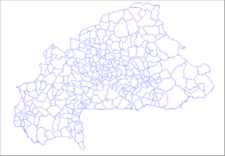
Goumsin is a town in the Kayao Department of Bazèga Province in central Burkina Faso. The town has a population of 2,247.
Siorarsuk Peninsula is a finger-shaped peninsula in northern Baffin Island in the Qikiqtaaluk Region of Nunavut, Canada. It juts into the Foxe Basin north of the Melville Peninsula. Jens Munk Island is 2.5 kilometres (1.6 mi) southeast of it, separated by the South Passage.

Gougoudjé is a town and sub-prefecture in the Télimélé Prefecture in the Kindia Region of western-central Guinea.

Vita is a village in the province of Ávila and autonomous community of Castile and León, Spain. The municipality covers an area of 16.75 square kilometres (6.47 sq mi) and as of 2011 had a population of 95 people.

Haza is a municipality located in the province of Burgos, Castile and León, Spain.
German submarine U-3523 was a Type XXI U-boat of Nazi Germany's Kriegsmarine, built for service in World War II. She was ordered on 6 November 1943, and was laid down on 7 October 1944 at F Schichau GmbH, Danzig, as yard number 1668. She was launched on 14 December 1944, and commissioned under the command of Oberleutnant zur See Willi Müller, on 23 January 1945.

German submarine U-2338 was a Type XXIII U-boat of Nazi Germany's Kriegsmarine during World War II. She was ordered on 20 September 1943, and was laid down on 10 August 1944 at Deutsche Werft AG, Hamburg, as yard number 492. She was launched on 18 September 1944 and commissioned under the command of Oberleutnant zur See Hans-Dietrich Kaiser on 9 October 1944.


