Cummins Lakes Provincial Park is a provincial park in British Columbia, Canada at the head of the Cummins River, northeast of Kinbasket Lake.

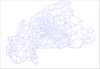
Oury is a department or commune of Balé Province in southern Burkina Faso. Its capital lies at the town of Oury. According to the 1996 census the department has a total population of 24,914.

Stanisławka is a village in the administrative district of Gmina Szubin, within Nakło County, Kuyavian-Pomeranian Voivodeship, in north-central Poland. It lies approximately 5 kilometres (3 mi) north-east of Szubin, 17 km (11 mi) south-east of Nakło nad Notecią, and 17 km (11 mi) south-west of Bydgoszcz.
Cerca-la-Source is an arrondissement (district) in the Centre department of Haiti. As of 2015, the population was 119,756 inhabitants. Postal codes in the Cerca-la-Source Arrondissement start with the number 54.

Manie is a village in the administrative district of Gmina Międzyrzec Podlaski, within Biała Podlaska County, Lublin Voivodeship, in eastern Poland. It lies approximately 8 kilometres (5 mi) north of Międzyrzec Podlaski, 23 km (14 mi) west of Biała Podlaska, and 91 km (57 mi) north of the regional capital Lublin.

Kajetanówka is a village in the administrative district of Gmina Dubienka, within Chełm County, Lublin Voivodeship, in eastern Poland, close to the border with Ukraine. It lies approximately 7 kilometres (4 mi) west of Dubienka, 24 km (15 mi) south-east of Chełm, and 88 km (55 mi) east of the regional capital Lublin.

Kolnica, is a village in the administrative district of Gmina Augustów, within Augustów County, Podlaskie Voivodeship, in north-eastern Poland. It lies approximately 10 kilometres (6 mi) south-east of Augustów and 75 km (47 mi) north of the regional capital Białystok.

Niecki is a village in the administrative district of Gmina Turośń Kościelna, within Białystok County, Podlaskie Voivodeship, in north-eastern Poland. It lies approximately 4 kilometres (2 mi) north of Turośń Kościelna and 11 km (7 mi) south-west of the regional capital Białystok.

Budzyń is a village in the administrative district of Gmina Liszki, within Kraków County, Lesser Poland Voivodeship, in southern Poland. It lies approximately 3 kilometres (2 mi) north-east of Liszki and 12 km (7 mi) west of the regional capital Kraków.

Gościejewo is a village in the administrative district of Gmina Karniewo, within Maków County, Masovian Voivodeship, in east-central Poland. It lies approximately 8 kilometres (5 mi) south-east of Karniewo, 10 km (6 mi) south of Maków Mazowiecki, and 63 km (39 mi) north of Warsaw.

Warszówka is a village in the administrative district of Gmina Blizanów, within Kalisz County, Greater Poland Voivodeship, in west-central Poland. It lies approximately 14 kilometres (9 mi) south of Blizanów, 4 km (2 mi) north-west of Kalisz, and 104 km (65 mi) south-east of the regional capital Poznań.

Chrustowo is a village in the administrative district of Gmina Ujście, within Piła County, Greater Poland Voivodeship, in west-central Poland. It lies approximately 4 kilometres (2 mi) south-east of Ujście, 12 km (7 mi) south of Piła, and 73 km (45 mi) north of the regional capital Poznań.

Jakubowo is a village in the administrative district of Gmina Wągrowiec, within Wągrowiec County, Greater Poland Voivodeship, in west-central Poland. It lies approximately 11 kilometres (7 mi) west of Wągrowiec and 44 km (27 mi) north of the regional capital Poznań.

Struga is a settlement in the administrative district of Gmina Czersk, within Chojnice County, Pomeranian Voivodeship, in northern Poland. It lies approximately 6 kilometres (4 mi) east of Czersk, 35 km (22 mi) east of Chojnice, and 76 km (47 mi) south-west of the regional capital Gdańsk.

Nowy Żelibórz is a village in the administrative district of Gmina Polanów, within Koszalin County, West Pomeranian Voivodeship, in north-western Poland. It lies approximately 8 kilometres (5 mi) south-east of Polanów, 42 km (26 mi) east of Koszalin, and 162 km (101 mi) north-east of the regional capital Szczecin.
Jaramillo is a corregimiento in Boquete District, Chiriquí Province, Panama. It has a land area of 77.5 square kilometres (29.9 sq mi) and had a population of 2,655 as of 2010, giving it a population density of 34.3 inhabitants per square kilometre (89/sq mi). It was created by Law 58 of July 29, 1998, owing to the Declaration of Unconstitutionality of Law 1 of 1982. Its population as of 2000 was 2,047.
Chupampa is a corregimiento in Santa María District, Herrera Province, Panama with a population of 1,231 as of 2010. Its population as of 1990 was 2,448; its population as of 2000 was 1,237.
El Hato is a corregimiento in Guararé District, Los Santos Province, Panama with a population of 374 as of 2010. It was created by Law 58 of July 29, 1998, owing to the Declaration of Unconstitutionality of Law 1 of 1982. Its population as of 2000 was 416.
Perales is a corregimiento in Guararé District, Los Santos Province, Panama with a population of 421 as of 2010. It was created by Law 58 of July 29, 1998, owing to the Declaration of Unconstitutionality of Law 1 of 1982. Its population as of 2000 was 416.
El Alto is a corregimiento in Santa Fé District, Veraguas Province, Panama with a population of 1,318 as of 2010. Its population as of 1990 was 2,242; its population as of 2000 was 2,060.


