Colbitz is a municipality in the Börde district in Saxony-Anhalt, Germany.
Kabelsketal is a municipality in the Saalekreis district, in Saxony-Anhalt, Germany. It is situated east of Halle (Saale). It was formed in 2004 out of the villages of Dieskau, Dölbau, Gröbers und Großkugel.
Kelbra is a town the Mansfeld-Südharz district, in Saxony-Anhalt, Germany. It is situated north of the Kyffhäuser mountains, approx. 20 km west of Sangerhausen, and 20 km east of Nordhausen. Kelbra is part of the Verbandsgemeinde Goldene Aue.
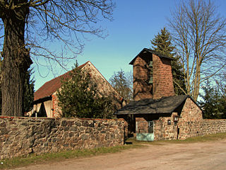
Schönburg is a municipality in the Burgenlandkreis district, in Saxony-Anhalt, Germany. It is situated 5 km east of Naumburg, on the river Saale. It is part of the Verbandsgemeinde Wethautal.

Ummendorf is a municipality in the Börde district in Saxony-Anhalt, Germany.

Ausleben is a municipality in the Börde district in Saxony-Anhalt, Germany.

Eilsleben is a municipality in the Börde district in Saxony-Anhalt, Germany. In January 2010 it absorbed the former municipality Wormsdorf and in September 2010 the former municipalities Drackenstedt, Druxberge and Ovelgünne.

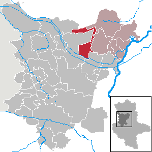
Harbke is a municipality in the Börde district in Saxony-Anhalt, Germany.

Rogätz is a municipality in the Börde district in Saxony-Anhalt, Germany. It is located on the right bank of the river Elbe, and is linked to Schartau by the Rogätz Ferry.
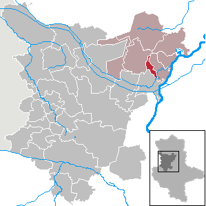
Zielitz is a municipality in the Börde district in Saxony-Anhalt, Germany.

Berga is a municipality in the Mansfeld-Südharz district, Saxony-Anhalt, Germany.
Blankenheim is a municipality in the Mansfeld-Südharz district, Saxony-Anhalt, Germany.
Bornstedt is a municipality in the Mansfeld-Südharz district, Saxony-Anhalt, Germany.

Wallhausen is a municipality in the Mansfeld-Südharz district of Saxony-Anhalt, Germany. It is located on the Helme river north of the Kyffhäuser mountain range and the border with Thuringia. Wallhausen is part of the Verbandsgemeinde Goldene Aue. The municipality consists of the 4 villages Wallhausen, Hohlstedt, Martinsrieth and Riethnordhausen. The former municipalities Martinsrieth and Riethnordhausen were absorbed into Wallhausen in July 2009.

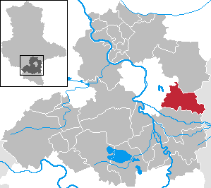
Teutschenthal is a municipality in the Saalekreis district, Saxony-Anhalt, Germany. In January 2005 it absorbed the former municipalities Holleben and Zscherben, in January 2010 Dornstedt, Langenbogen and Steuden and in September 2010 Angersdorf.

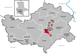
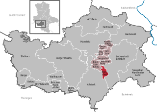
Brücken-Hackpfüffel is a municipality in the Mansfeld-Südharz district, Saxony-Anhalt, Germany. It was formed on 1 January 2009 by the merger of the former municipalities Brücken and Hackpfüffel.

Muldestausee is a municipality in the district of Anhalt-Bitterfeld, in Saxony-Anhalt, Germany. It was formed on 1 January 2010 by the merger of the former municipalities Burgkemnitz, Friedersdorf, Gossa, Gröbern, Krina, Mühlbeck, Muldenstein, Plodda, Pouch, Rösa, Schlaitz and Schwemsal.
Westheide is a municipality in the Börde district in Saxony-Anhalt, Germany. It was formed on 1 January 2010 by the merger of the former municipalities Born, Hillersleben and Neuenhofe.

Molauer Land is a municipality in the Burgenlandkreis district, in Saxony-Anhalt, Germany. It was formed on 1 January 2010 by the merger of the former municipalities Abtlöbnitz, Casekirchen, Leislau and Molau.

Gutenborn is a municipality in the Burgenlandkreis district, in Saxony-Anhalt, Germany. It was formed on 1 January 2010 by the merger of the former municipalities Bergisdorf, Droßdorf, Heuckewalde and Schellbach.


