| Dog Salmon River | |
|---|---|
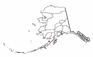
 Location of the mouth of the Dog Salmon River in Alaska | |
| Location | |
| Country | United States |
| State | Alaska |
| Borough | Lake and Peninsula |
| Physical characteristics | |
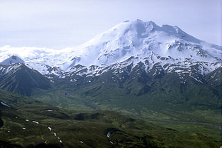
| Source | Mount Kialagvik |
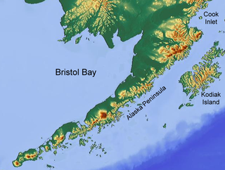
| - location | Alaska Peninsula |
| - coordinates | 57°09′31″N156°44′50″W / 57.15861°N 156.74722°W [1] |
| - elevation | 981 ft (299 m) [2] |
| River mouth | Ugashik River |
| - location | 4 miles (6.4 km) southwest of Ugashik |
| - coordinates | 57°28′51″N157°29′02″W / 57.48083°N 157.48389°W Coordinates: 57°28′51″N157°29′02″W / 57.48083°N 157.48389°W [1] |
| - elevation | 0 ft (0 m) [1] |
| Length | 70 mi (110 km) [1] |
The Dog Salmon River is a 70-mile (110 km) tributary of the Ugashik River in the U.S. state of Alaska. [1] Beginning on the flanks of Mount Kialagvik, it flows northwest through the Alaska Peninsula National Wildlife Refuge to meet the larger river 4 miles (6 km) southwest of Ugashik, at the head of Ugashik Bay, an arm of Bristol Bay. [3]
The Ugashik River is a stream, 43 miles (69 km) long, on the Alaska Peninsula of the U.S. state of Alaska. It flows from headwaters near Lower Ugashik Lake and empties into Ugashik Bay, an estuary of the Bering Sea's Bristol Bay.

In the United States, a state is a constituent political entity, of which there are currently 50. Bound together in a political union, each state holds governmental jurisdiction over a separate and defined geographic territory and shares its sovereignty with the federal government. Due to this shared sovereignty, Americans are citizens both of the federal republic and of the state in which they reside. State citizenship and residency are flexible, and no government approval is required to move between states, except for persons restricted by certain types of court orders. Four states use the term commonwealth rather than state in their full official names.

Alaska is a U.S. state in the northwest extremity of North America, just across the Bering Strait from Asia. The Canadian province of British Columbia and territory of Yukon border the state to the east and southeast, its most extreme western part is Attu Island, and it has a maritime border with Russia to the west across the Bering Strait. To the north are the Chukchi and Beaufort seas—southern parts of the Arctic Ocean. The Pacific Ocean lies to the south and southwest. It is the largest U.S. state by area and the seventh largest subnational division in the world. In addition, it is the 3rd least populous and the most sparsely populated of the 50 United States; nevertheless, it is by far the most populous territory located mostly north of the 60th parallel in North America: its population—estimated at 738,432 by the United States Census Bureau in 2015— is more than quadruple the combined populations of Northern Canada and Greenland. Approximately half of Alaska's residents live within the Anchorage metropolitan area. Alaska's economy is dominated by the fishing, natural gas, and oil industries, resources which it has in abundance. Military bases and tourism are also a significant part of the economy.
It descends to the upper reaches of the bay from an elevation of 981 feet (299 m) [2] in a valley of the Aleutian Range between Mount Chiginagak and Mount Kialagvik. [3] Among its feeder streams are Figure Eight, Goblet, and Wandering creeks. [3]
The Aleutian Range is a major mountain range located in southwest Alaska. It extends from Chakachamna Lake to Unimak Island, which is at the tip of the Alaska Peninsula. It includes all of the mountains of the Peninsula. The Aleutian Range is special because of its large number of active volcanoes, which are also part of the larger Aleutian Arc. The mainland part of the range is about 600 miles (1000 km) long. The Aleutian Islands are (geologically) a partially submerged western extension of the range that stretches for another 1,600 km (1000 mi). However the official designation "Aleutian Range" includes only the mainland peaks and the peaks on Unimak Island. The range is almost entirely roadless wilderness. Katmai National Park and Preserve, a large national park within the range, must be reached by boat or plane.
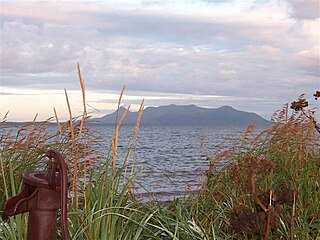
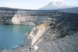
Chiginagak Volcano is a stratovolcano on the Alaska Peninsula, located about 15 km NW of Chiginagak Bay.
It is shallow with many oxbow turns and is not navigable. The streambed is a mix of gravel and mud, with its milky glacier headwaters growing increasingly muddy as it progresses.
There are many rivers in Alaska bearing the name Dog Salmon River and this river should not be confused with those located on the Yukon-Kuskokwim Delta or eastern Norton Sound.

Norton Sound is an inlet of the Bering Sea on the western coast of the U.S. state of Alaska, south of the Seward Peninsula. It is about 240 km (150 mi) long and 200 km (125 mi) wide. The Yukon River delta forms a portion of the south shore and water from the Yukon influences this body of water. It is ice-free from June to October.
As its name suggests, the river primarily hosts large numbers of Chum Salmon along with smaller numbers of Pink Salmon and Dolly Varden char.

The Dolly Varden trout is a species of salmonid native to cold-water tributaries of the Pacific Ocean in Asia and North America. It is in the genus Salvelinus of true chars, which includes 51 recognized species, the most prominent being the brook, lake and bull trout, as well as Arctic char. Although many populations are semi-anadromous, fluvial and lacustrine populations occur throughout its range. It is considered by taxonomists as part of the Salvelinus alpinus or Arctic char complex, as many populations of bull trout, Dolly Varden trout and Arctic char overlap.