Ugashik, Alaska

Last updated

Ugashik, Alaska
Ugaasaq
AKMap-doton-Ugashik.PNG
Location of Ugashik, Alaska
Coordinates: 57°32′3″N157°16′8″W / 57.53417°N 157.26889°W / 57.53417; -157.26889
CountryUnited States
State Alaska
Borough Lake and Peninsula
Government
  Borough mayor Glen Alsworth, Sr. [1]
   State senator Lyman Hoffman (D)
   State rep. Bryce Edgmon (I)
Area
[2]
  Total267.69 sq mi (693.31 km2)
  Land253.62 sq mi (656.87 km2)
  Water14.07 sq mi (36.44 km2)
Elevation
30 ft (9 m)
Population
 (2020)
  Total4
  Density0.02/sq mi (0.01/km2)
Time zone UTC-9 (Alaska (AKST))
  Summer (DST) UTC-8 (AKDT)
ZIP code
99649 [3]
Area code 907
FIPS code 02-80100
GNIS feature ID1411486

Ugashik (Ugaasaq [4] in Sugpiaq) is a census-designated place (CDP) in Lake and Peninsula Borough, Alaska, United States. The population was 4 at the 2020 census, [5] down from 12 in 2010. [6]

Contents

Geography

Ugashik is located on the Alaska Peninsula at 57°32′3″N157°16′8″W / 57.53417°N 157.26889°W / 57.53417; -157.26889 (57.534143, -157.268870). [7] The community sits on the east bank of the Ugashik River, 10 miles (16 km) upriver (east) from its mouth in Ugashik Bay, an arm of Bristol Bay of the Bering Sea, and 25 miles (40 km) downriver (west) from the mouth of Lower Ugashik Lake. The CDP extends east as far as the west shores of Lower and Upper Ugashik Lakes.

According to the United States Census Bureau, the CDP has a total area of 266.6 square miles (690.4 km2), of which 247.5 square miles (641.1 km2) are land and 19.0 square miles (49.3 km2), or 7.15%, are water. [6]

The village of Ugashik is located some 6 miles (10 km) by air and 20 miles (32 km) by river east of the village of Pilot Point. The proximity to the salmon-rich waters of Ugashik Bay and available fresh water supply made it suitable as a location for a salmon cannery, Alaska Packers which operated until 1957. A family-owned company, Briggs Way Cannery, opened in 1962, and runs to this day. It is currently known as Ugashik Wild Salmon Co. and is continued on by the second generation of family and fishermen.

Demographics

Historical population
CensusPop.Note
1880 177
1890 154−13.0%
1900 348126.0%
1930 84
1940 55−34.5%
1950 48−12.7%
1960 36−25.0%
1980 13
1990 7−46.2%
2000 1157.1%
2010 129.1%
2020 4−66.7%
U.S. Decennial Census [8]

Ugashik first appeared on the 1880 U.S. Census as the unincorporated Aleut village of "Oogashik." [9] Of 177 residents, 176 were Aleut and 1 was Creole (Mixed Russian and Native). [10] It returned in 1890 under the present spelling of Ugashik and also included 2 native settlements and Bering Sea Packing Company. Of 154 residents, 123 were Natives, 20 were White and 11 were Asian. [11] It returned again in 1900 with 348 residents, though the racial breakdown was not ascertained. This was its highest ever population and was the 20th largest community in Alaska. It did not report again until 1930. It continued to report in every successive census except 1970. It was designated an Alaskan Native Village Statistical Area (ANVSA) in 1980. In 2000, it was made a census-designated place (CDP).

As of the census [12] of 2008, there were 12 people, 7 households, and 2 families residing in the CDP. The population density was 0.0 inhabitants per square mile (0/km2). There were 35 housing units at an average density of 0.1 per square mile (0.039/km2). The racial makeup of the CDP was 18.18% White, 0% Native American, and 79.8 from two or more races, Alaska Native being one of them.

There were 7 households, out of which none had children under the age of 18 living with them, 28.5% were married couples living together, and 71.4% were non-families. 42.9% of all households were made up of individuals, and one had someone living alone who was 65 years of age or older. The average household size was 1.57 and the average family size was 2.00.

In the CDP, the population was spread out, with 0% from 18 to 24, 18.2% from 25 to 44, 72.7% from 45 to 72, . The median age was 50 years. For every 100 females, there were 120.0 males. For every 100 females age 18 and over, there were 120.0 males.

The median income for a household in the CDP was $28,750, and the median income for a family was $35,417. Males had a median income of $0 versus $0 for females. The per capita income for the CDP was $12,530. There were no families and 10.0% of the population living below the poverty line, including no under eighteens and none of those over 64.

Related Research Articles

<span class="mw-page-title-main">Aleutians East Borough, Alaska</span> Borough in Alaska, United States

Aleutians East Borough is a 2nd class borough in the U.S. state of Alaska. As of the 2020 census the borough's population was 3,420. The borough seat is Sand Point.

<span class="mw-page-title-main">Yakutat, Alaska</span> Consolidated city-borough in Alaska, United States

The City and Borough of Yakutat is a borough in the state of Alaska. Yakutat was also the name of a former city within the borough. The name in Tlingit is Yaakwdáat. It is derived from an Eyak name, diyaʼqudaʼt, and was influenced by the Tlingit word yaakw.

<span class="mw-page-title-main">False Pass, Alaska</span> City in Alaska, United States

False Pass is a city on Unimak Island, in the Aleutians East Borough of southwestern Alaska, United States. Although the population was marked 397 including seasonal fish processing plant workers at the 2020 census, approximately 35 residents call it home year-round.

Nelson Lagoon is a census-designated place (CDP) in Aleutians East Borough, Alaska, United States. At the 2020 census the population was 41, down from 52 in 2010 and 83 in 2000.

<span class="mw-page-title-main">Nikolski, Alaska</span> CDP in Alaska, United States

Nikolski is a census-designated place (CDP) on Umnak Island in Aleutians West Census Area, Alaska, United States. The population was 39 at the 2020 census, up from 18 in 2010. Nikolski is on Nikolski Bay, off the southwest end of the island. It is 116 air miles west of Unalaska, and 900 air miles from Anchorage. Residents are known as Unangan, and Aleut is spoken in most of the remaining homes.

<span class="mw-page-title-main">King Salmon, Alaska</span> Census-designated place in Alaska

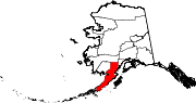
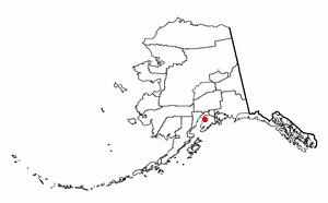
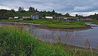
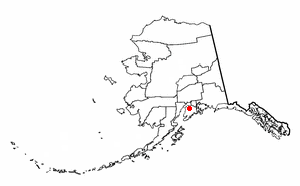
King Salmon is a census-designated place (CDP) in Bristol Bay Borough in the U.S. state of Alaska. It is 284 miles (457 km) southwest of Anchorage. As of the 2020 census the population was 307, down from 374 in 2010. It is home to Katmai National Park and Preserve. King Salmon is the borough seat of neighboring Lake and Peninsula Borough, but does not serve that purpose in its own borough, whose borough seat is in Naknek.

<span class="mw-page-title-main">Excursion Inlet, Alaska</span> Census-designated place in Alaska, United States

Excursion Inlet is a census-designated place (CDP) in Haines Borough in the U.S. state of Alaska. The population was 40 at the 2020 census, up from 12 in 2010.

<span class="mw-page-title-main">Beluga, Alaska</span> Census-designated place in Alaska, United States

Beluga is a census-designated place (CDP) in Kenai Peninsula Borough, Alaska, United States. The population was 20 at the 2010 census, down from 32 in 2000.

<span class="mw-page-title-main">Crown Point, Alaska</span> Census-designated place in Alaska, United States

Crown Point is a census-designated place (CDP) in Kenai Peninsula Borough, Alaska, United States. The population was 74 at the 2010 census. Land access to this area is by either the Alaska Railroad or the Seward Highway.

<span class="mw-page-title-main">Funny River, Alaska</span> Census-designated place in Alaska, United States

Funny River is a census-designated place (CDP) in Kenai Peninsula Borough, Alaska, United States. At the 2010 census the population was 877, up from 636 in 2000.

<span class="mw-page-title-main">Nanwalek, Alaska</span> Census-designated place in Alaska, United States

Nanwalek, formerly Alexandrovsk and later English Bay, is a census-designated place (CDP) in the Kenai Peninsula Borough, Alaska, United States, that contains a traditional Alutiiq village. The population was 254 at the 2010 census, up from 177 in 2000. There is one school located in the community, attended by 76 students.

<span class="mw-page-title-main">Nikiski, Alaska</span> Census-designated place in Alaska, United States

Nikiski is a census-designated place (CDP) in Kenai Peninsula Borough, Alaska, United States. The population was 4,456 at the 2020 census, down from 4,493 in 2010.

<span class="mw-page-title-main">Ninilchik, Alaska</span> Census-designated place in Alaska, United States

Ninilchik is a census-designated place (CDP) in Kenai Peninsula Borough, Alaska, United States. At the 2010 census the population was 883, up from 772 in 2000.

<span class="mw-page-title-main">Sterling, Alaska</span> Census-designated place in Alaska, United States

Sterling is a census-designated place (CDP) in Kenai Peninsula Borough, Alaska, United States. At the 2020 census the population was 5,918, up from 5,617 in 2010. Sterling is the tenth-most populated CDP in Alaska.

<span class="mw-page-title-main">Chignik Lagoon, Alaska</span> Census-designated place in Alaska, United States

Chignik Lagoon is a census-designated place (CDP) in Lake and Peninsula Borough, Alaska, United States. At the 2020 census, the population was 72.

<span class="mw-page-title-main">Egegik, Alaska</span> City in Alaska, United States

Egegik is a city in Lake and Peninsula Borough, Alaska, United States. As of the 2020 census, the population of the city is 39, down from 109 in 2010. It has been home to cannery operations. If the city's population somehow exploded in the decades to come, it will potentially become the new borough seat of Lake and Peninsula Borough replacing King Salmon.

<span class="mw-page-title-main">Igiugig, Alaska</span> Census-designated place in Alaska, United States

Igiugig is a census-designated place (CDP) in Lake and Peninsula Borough, Alaska, United States. The population was 68 at the 2020 census, up from 54 in 2010. The village is at the source of the Kvichak River, at the outlet of Lake Iliamna.

Kokhanok is a census-designated place (CDP) in Lake and Peninsula Borough, Alaska, United States. At the 2020 census the population was 152, down from 170 in 2000.

<span class="mw-page-title-main">Pedro Bay, Alaska</span> Census-designated place in Alaska, United States

Pedro Bay is a census-designated place (CDP) in Lake and Peninsula Borough, Alaska, United States. The population was 43 as of the 2020 census, slightly up from 42 in 2010.

<span class="mw-page-title-main">Pilot Point, Alaska</span> City in Alaska, United States

Pilot Point is a city in Lake and Peninsula Borough, Alaska, United States, on the Alaska Peninsula. As of the 2020 census, the population of the city was 70, up from 68 in 2010.

References

  1. 2015 Alaska Municipal Officials Directory. Juneau: Alaska Municipal League. 2015. p. 12.
  2. "2020 U.S. Gazetteer Files". United States Census Bureau. Retrieved October 29, 2021.
  3. "Ugashik AK ZIP Code". zipdatamaps.com. 2023. Retrieved June 16, 2023.
  4. ANLC : Alaska Native Place Names
  5. "2020 Census Data - Cities and Census Designated Places" (Web). State of Alaska, Department of Labor and Workforce Development. Retrieved December 5, 2021.
  6. 1 2 "Geographic Identifiers: 2010 Census Summary File 1 (G001), Ugashik CDP, Alaska". American FactFinder. U.S. Census Bureau. Archived from the original on February 13, 2020. Retrieved August 15, 2019.
  7. "US Gazetteer files: 2010, 2000, and 1990". United States Census Bureau. February 12, 2011. Retrieved April 23, 2011.
  8. "U.S. Decennial Census". Census.gov. Retrieved June 6, 2013.
  9. "Geological Survey Professional Paper". 1949.
  10. "Statistics of the Population of Alaska" (PDF). United States Census Bureau. 1880.
  11. "Report on Population and Resources of Alaska at the Eleventh Census: 1890" (PDF). United States Census Bureau. Government Printing Office.
  12. "U.S. Census website". United States Census Bureau . Retrieved January 31, 2008.