Port Heiden, Alaska Masrriq | |
---|---|
Coordinates: 56°56′56″N158°39′21″W / 56.94889°N 158.65583°W | |
Country | United States |
State | Alaska |
Borough | Lake and Peninsula |
Incorporated | November 20, 1972 [1] |
Government | |
• Mayor | James Christensen |
• State senator | Lyman Hoffman (D) |
• State rep. | Bryce Edgmon (I) |
Area | |
• Total | 47.37 sq mi (122.69 km2) |
• Land | 46.77 sq mi (121.12 km2) |
• Water | 0.60 sq mi (1.57 km2) |
Elevation | 95 ft (29 m) |
Population (2020) | |
• Total | 100 |
• Density | 2.14/sq mi (0.83/km2) |
Time zone | UTC-9 (Alaska (AKST)) |
• Summer (DST) | UTC-8 (AKDT) |
ZIP code | 99549 |
Area code | 907 |
FIPS code | 02-63390 |
GNIS feature ID | 1669438 |
Port Heiden (Alutiiq: Masrriq) is a city in Lake and Peninsula Borough, Alaska, United States. As of the 2020 census, the population of the city is 100, slightly down from 102 in 2010. [3]
Port Heiden is located at 56°56′56″N158°39′21″W / 56.94889°N 158.65583°W (56.948949, -158.655745). [4]
According to the United States Census Bureau, the city has a total area of 51.4 square miles (133 km2), of which, 50.7 square miles (131 km2) of it is land and 0.7 square miles (1.8 km2) of it (1.28%) is water.
Port Heiden has a subarctic climate (Köppen Dfc).
Climate data for Port Heiden (1961–1990 normals, extremes 1942–1988) | |||||||||||||
---|---|---|---|---|---|---|---|---|---|---|---|---|---|
Month | Jan | Feb | Mar | Apr | May | Jun | Jul | Aug | Sep | Oct | Nov | Dec | Year |
Record high °F (°C) | 57 (14) | 55 (13) | 54 (12) | 62 (17) | 75 (24) | 81 (27) | 87 (31) | 82 (28) | 73 (23) | 64 (18) | 55 (13) | 59 (15) | 87 (31) |
Mean maximum °F (°C) | 42.4 (5.8) | 43.0 (6.1) | 45.8 (7.7) | 49.3 (9.6) | 58.4 (14.7) | 64.6 (18.1) | 70.7 (21.5) | 70.4 (21.3) | 63.1 (17.3) | 55.0 (12.8) | 47.0 (8.3) | 44.1 (6.7) | 75.6 (24.2) |
Mean daily maximum °F (°C) | 28.1 (−2.2) | 27.5 (−2.5) | 32.8 (0.4) | 37.8 (3.2) | 46.1 (7.8) | 52.7 (11.5) | 57.3 (14.1) | 58.0 (14.4) | 53.5 (11.9) | 42.9 (6.1) | 35.6 (2.0) | 30.7 (−0.7) | 41.9 (5.5) |
Daily mean °F (°C) | 22.2 (−5.4) | 21.4 (−5.9) | 26.8 (−2.9) | 32.1 (0.1) | 40.4 (4.7) | 47.0 (8.3) | 51.9 (11.1) | 52.9 (11.6) | 48.2 (9.0) | 37.5 (3.1) | 30.0 (−1.1) | 25.2 (−3.8) | 36.3 (2.4) |
Mean daily minimum °F (°C) | 16.3 (−8.7) | 15.3 (−9.3) | 20.8 (−6.2) | 26.4 (−3.1) | 34.7 (1.5) | 41.3 (5.2) | 46.4 (8.0) | 47.7 (8.7) | 42.7 (5.9) | 32.0 (0.0) | 24.5 (−4.2) | 19.7 (−6.8) | 30.7 (−0.7) |
Mean minimum °F (°C) | −8.2 (−22.3) | −9.1 (−22.8) | −1.8 (−18.8) | 10.0 (−12.2) | 25.2 (−3.8) | 32.7 (0.4) | 39.0 (3.9) | 38.8 (3.8) | 31.2 (−0.4) | 14.9 (−9.5) | 4.7 (−15.2) | −1.9 (−18.8) | −14.6 (−25.9) |
Record low °F (°C) | −25 (−32) | −22 (−30) | −26 (−32) | −6 (−21) | 11 (−12) | 25 (−4) | 32 (0) | 31 (−1) | 24 (−4) | −1 (−18) | −13 (−25) | −22 (−30) | −26 (−32) |
Average precipitation inches (mm) | 0.89 (23) | 0.78 (20) | 1.03 (26) | 0.95 (24) | 1.01 (26) | 1.18 (30) | 1.84 (47) | 2.25 (57) | 2.44 (62) | 2.43 (62) | 1.66 (42) | 1.49 (38) | 17.95 (456) |
Average snowfall inches (cm) | 14.2 (36) | 8.7 (22) | 6.7 (17) | 8.2 (21) | 2.9 (7.4) | 0.1 (0.25) | 0.0 (0.0) | 0.0 (0.0) | 0.0 (0.0) | 4.0 (10) | 7.9 (20) | 10.3 (26) | 63.0 (160) |
Average precipitation days (≥ 0.01 inch) | 5.7 | 7.1 | 7.0 | 6.9 | 8.3 | 9.4 | 10.8 | 13.4 | 13.5 | 14.1 | 8.5 | 9.3 | 114.0 |
Average snowy days (≥ 0.01 inch) | 5.9 | 5.6 | 4.6 | 4.7 | 1.6 | 0.1 | 0.0 | 0.0 | 0.0 | 2.1 | 4.2 | 6.1 | 34.9 |
Source 1: WRCC [5] | |||||||||||||
Source 2: XMACIS (snowfall) [6] |
Census | Pop. | Note | %± |
---|---|---|---|
1880 | 40 | — | |
1890 | 74 | 85.0% | |
1920 | 30 | — | |
1930 | 51 | 70.0% | |
1960 | 74 | — | |
1970 | 66 | −10.8% | |
1980 | 92 | 39.4% | |
1990 | 119 | 29.3% | |
2000 | 119 | 0.0% | |
2010 | 102 | −14.3% | |
2020 | 100 | −2.0% | |
U.S. Decennial Census [7] |
Port Heiden first appeared on the 1880 U.S. Census as the unincorporated Aleut village of "Mashikh." [8] Some maps erroneously placed it at the latter settlement of Port Moller instead of at Port Heiden. In 1890, it returned as "Meshik." It next reported in 1920 as Port Heiden, and again in 1930. It did not appear again until 1960, but has appeared in every subsequent census. It was formally incorporated in 1972.
As of the census [9] of 2000, there were 119 people, 41 households, and 23 families residing in the city. The population density was 2.3 inhabitants per square mile (0.89/km2). There were 56 housing units at an average density of 1.1 units per square mile (0.42 units/km2). The racial makeup of the city was 19.33% White, 65.55% Native American, 2.52% from other races, and 12.61% from two or more races. 2.52% of the population were Hispanic or Latino of any race.
There were 41 households, out of which 39.0% had children under the age of 18 living with them, 46.3% were married couples living together, 2.4% had a female householder with no husband present, and 41.5% were non-families. 39.0% of all households were made up of individuals, and 7.3% had someone living alone who was 65 years of age or older. The average household size was 2.90 and the average family size was 3.79.
In the city, the age distribution of the population shows 39.5% under the age of 18, 5.0% from 18 to 24, 26.9% from 25 to 44, 22.7% from 45 to 64, and 5.9% who were 65 years of age or older. The median age was 33 years. For every 100 females, there were 105.2 males. For every 100 females age 18 and over, there were 125.0 males.
The median income for a household in the city was $31,875, and the median income for a family was $70,000. Males had a median income of $53,750 versus $21,667 for females. The per capita income for the city was $20,532. There were no families and 5.6% of the population living below the poverty line, including no under eighteens and 25.0% of those over 64.
Clark's Point is a city in Dillingham Census Area, Alaska, United States. The population was 62 at the 2010 census.
Port Lions is a city located on Kodiak Island in the Kodiak Island Borough of the U.S. state of Alaska. As of the 2010 census, the population of the city was 194, down from 256 in 2000.
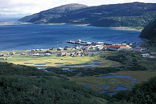
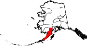
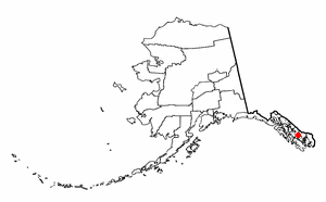
Chignik is a city in Lake and Peninsula Borough, Alaska, United States. It is two hundred and fifty miles southwest of Kodiak. At the 2020 census the population was 97, up from 91 in 2010.
Chignik Lagoon is a census-designated place (CDP) in Lake and Peninsula Borough, Alaska, United States. At the 2020 census, the population was 72.
Chignik Lake is a census-designated place (CDP) in Lake and Peninsula Borough, Alaska, United States. It is 475 miles (764 km) southwest of Anchorage. At the 2020 census, the population was 61.
Newhalen is a city in Lake and Peninsula Borough, Alaska, United States. At the 2020 census, the population was 168.
Chase is a census-designated place (CDP) in Matanuska-Susitna Borough, Alaska, United States. Located 9.2 miles north from Talkeetna, it is part of the Anchorage, Alaska Metropolitan Statistical Area. The population was 19 at the 2020 census, down from 34 in 2010.
Port Protection is a census-designated place (CDP) in Prince of Wales-Hyder Census Area, Alaska, United States. The population was 36 at the 2020 census, down from 48 in 2010 census.
Whale Pass is a second class city in Prince of Wales-Hyder Census Area, Alaska, United States. The population was 31 at the 2010 census, down from 58 in 2000.
Port Alexander is a city at the southeastern corner of Baranof Island in Prince of Wales-Hyder Census Area, Alaska, United States. At the 2010 census the population was 52, down from 81 in 2000.
Huslia is a city in Yukon-Koyukuk Census Area, Alaska, United States. Rarely known as Hussliakatna, it is inhabited by Koyukuk-hotana Athabascans. The population was 293 at the 2000 census and 275 as of the 2010 census.
Nulato is a city in Yukon-Koyukuk Census Area, Alaska, United States. At the 2020 census, the population was 239.
Divernon is a village in Sangamon County, Illinois, United States. The population was 1,172 at the 2010 census, and 1,119 at a 2018 estimate. It is part of the Springfield, Illinois Metropolitan Statistical Area.
Secretary is a town in Dorchester County, Maryland, United States. The population was 535 at the 2010 census.
Old Orchard is a census-designated place (CDP) in Palmer Township in Northampton County, Pennsylvania, United States. As of the 2010 census, Old Orchard had a total population of 2,434. Old Orchard is part of the Lehigh Valley, which had a population of 861,899 and was the 68th-most populous metropolitan area in the U.S. as of the 2020 census.
Callimont is a borough in Somerset County, Pennsylvania, United States. The population was 53 at the 2020 census. It is part of the Johnstown, Pennsylvania, Metropolitan Statistical Area.
Homeland Park is a census-designated place (CDP) in Anderson County, South Carolina. The population was 6,445 at the 2020 census.
Chaseburg is a village in Vernon County, Wisconsin, United States. The population was 284 at the 2010 census.
Lebo is a city in Coffey County, Kansas, United States. As of the 2020 census, the population of the city was 885.
Thoms Place is a former census-designated place (CDP) on Wrangell Island in the city of Wrangell, Alaska, United States.The population was 22 at the 2000 census, at which time it was an unincorporated part of the former Wrangell-Petersburg Census Area, Alaska. It is now included in the City and Borough of Wrangell, which became a borough on June 1, 2008.