Sidol is a small settlement in the Tuhinj Valley in the Municipality of Kamnik in the Upper Carniola region of Slovenia. It lies in a small enclosed valley in the hills above Šmartno v Tuhinju.

Planina nad Horjulom is a dispersed settlement northwest of Horjul in the Municipality of Dobrova–Polhov Gradec in the Upper Carniola region of Slovenia. It includes the hamlets of Kolobocija, Lom, Pustota, and Zameja, as well as part of the hamlet of Suhi Dol.

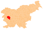
Čekovnik is a dispersed settlement in the hills west of Idrija in the traditional Inner Carniola region of Slovenia.
Lome is a dispersed settlement in the hills southeast of Črni Vrh in the Municipality of Idrija in the traditional Inner Carniola region of Slovenia.

Srednja Kanomlja is a dispersed settlement in the Kanomljica Valley west of Spodnja Idrija in the Municipality of Idrija, Slovenia. The village formerly included the hamlet of Kanomeljsko Razpotje, now Razpotje.
Zadlog is a settlement northwest of Črni Vrh in the Municipality of Idrija in the traditional Inner Carniola region of Slovenia.

Zavratec is a village in the hills east of Idrija in the traditional Inner Carniola region of Slovenia.

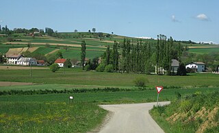
Landol is a village in the Municipality of Postojna in the Inner Carniola region of Slovenia.

Hlevni Vrh is a small dispersed settlement in the hills north of Logatec in the Inner Carniola region of Slovenia. It includes the hamlet of Jezero.
Mizni Dol is a small settlement in the hills west of Vrhnika in the Inner Carniola region of Slovenia.
Zaplana is a small village in the hills west of Vrhnika in the Inner Carniola region of Slovenia.
Sotina is a village in the Municipality of Rogašovci in the Prekmurje region of northeastern Slovenia. The village includes the following hamlets: Bezovkova Graba, Maribor, Bracov Dol, Činčov Breg, Kolarova Graba, Majcov Mlin, Martinova Graba, Patrov Breg, Tomanov Breg, and Turzov Breg.

Podgorje pri Pišecah is a settlement in the hills west of Bizeljsko in the Municipality of Brežice in eastern Slovenia. The area is part of the traditional region of Styria. It is now included with the rest of the municipality in the Lower Sava Statistical Region.

Zamostec is a settlement east of Sodražica in southern Slovenia. The area is part of the traditional region of Lower Carniola and is now included in the Southeast Slovenia Statistical Region. The settlement includes the hamlets of Vranove Njivice, Podgora, Mandrge, Podvas, Grdi Dol, and Bravčji Vrt.
Okrog is a small settlement south of Gabrovka in the Municipality of Litija in central Slovenia. The area is part of the traditional region of Lower Carniola. It is now included with the rest of the municipality in the Central Sava Statistical Region. The settlement is known as Ukrog in the local dialect. It includes the hamlet of Dule.

Mačji Dol is a small settlement northwest of Šentlovrenc in the Municipality of Trebnje in eastern Slovenia. The municipality is part of the historical region of Lower Carniola and is now included in the Southeast Slovenia Statistical Region.

Kitni Vrh is a small settlement just above Gabrovka pri Zagradcu in the Municipality of Ivančna Gorica in central Slovenia. The area is part of the historical region of Lower Carniola. The municipality is now included in the Central Slovenia Statistical Region.
Kamnjek is a former settlement in the Municipality of Kranj in the Upper Carniola region of Slovenia. It now a hamlet of the village of Letenice. It lies west of the village center of Letenice, in a small damp valley on a road leading into the east side of the Udin Woods.
Razpotje south of Srednja Kanomlja in the Municipality of Idrija, Slovenia. It is a popular excursion destination.
Črna is a formerly independent settlement in the eastern part of Dole in central Slovenia. It is part of the traditional region of Inner Carniola and is now included with the rest of the municipality in the Gorizia Statistical Region.