
The Eifel is a low mountain range in western Germany, eastern Belgium and northern Luxembourg. It occupies parts of southwestern North Rhine-Westphalia, northwestern Rhineland-Palatinate and the southern area of the German-speaking Community of Belgium.

Hillesheim is the third largest town in the Vulkaneifel district in Rhineland-Palatinate, Germany. It was the seat of the former Verbandsgemeinde Hillesheim.

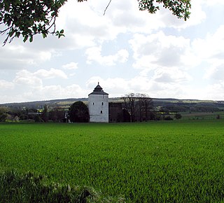
Gerolstein is a town in the Vulkaneifel district of Rhineland-Palatinate, Germany. Gerolstein is a local municipality of the Verbandsgemeinde Gerolstein. It has been approved as a Luftkurort.
Blankenheim is a municipality in the district of Euskirchen in the state of North Rhine-Westphalia, Germany.
Zons, formerly known as Feste Zons(Fortress Zons), today officially called Stadt Zons is an old town in Germany on the west bank of the Lower Rhine between Cologne and Düsseldorf. It has been a part (Stadtteil) of the town of Dormagen since 1975. In 2020 its population was 5,452.
Erp is a village in Erftstadt, North Rhine-Westphalia, Germany. It has about 2650 inhabitants (2006).

Birgel is an Ortsgemeinde – a municipality belonging to a Verbandsgemeinde, a kind of collective municipality – in the Vulkaneifel district in Rhineland-Palatinate, Germany. It belongs to the Verbandsgemeinde of Gerolstein, whose seat is in the municipality of Gerolstein.

Jünkerath is an Ortsgemeinde – a municipality belonging to a Verbandsgemeinde, a kind of collective municipality – in the Vulkaneifel district in Rhineland-Palatinate, Germany. It was th seat of the former Verbandsgemeinde of Obere Kyll.

Lissendorf is an Ortsgemeinde – a municipality belonging to a Verbandsgemeinde, a kind of collective municipality – in the Vulkaneifel district in Rhineland-Palatinate, Germany. It belongs to the Verbandsgemeinde of Gerolstein, whose seat is in the municipality of Gerolstein.
Nohn is an Ortsgemeinde – a municipality belonging to a Verbandsgemeinde, a kind of collective municipality – in the Vulkaneifel district in Rhineland-Palatinate, Germany. It belongs to the Verbandsgemeinde of Gerolstein, whose seat is in the like-named town.

Oberbettingen is an Ortsgemeinde – a municipality belonging to a Verbandsgemeinde, a kind of collective municipality – in the Vulkaneifel district in Rhineland-Palatinate, Germany. It belongs to the Verbandsgemeinde of Gerolstein, whose seat is in the like-named town.

Stadtkyll is an Ortsgemeinde – a municipality belonging to a Verbandsgemeinde, a kind of collective municipality – in the Vulkaneifel district in Rhineland-Palatinate, Germany. It belongs to the Verbandsgemeinde of Gerolstein, whose seat is in the municipality of Gerolstein. Stadtkyll is a state-recognized climatic spa (Luftkurort).
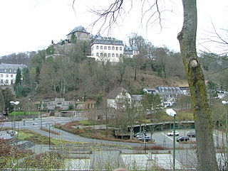
Lissingen Castle is a well-preserved former moated castle dating to the 13th century. It is located on the River Kyll in Gerolstein in the administrative district of Vulkaneifel in Rhineland-Palatinate, Germany. From the outside it appears to be a single unit, but it is a double castle; an estate division in 1559 created the so-called lower castle and upper castle, which continue to have separate owners. Together with Bürresheim and Eltz, it has the distinction among castles in the Eifel of never having been destroyed.
The Wildenburg lies in the North Rhine-Westphalian part of the Eifel Mountains in the national park district of Hellenthal in the German county of Euskirchen.
The fortification on the Stromberg near Ripsdorf in the German state of North Rhine-Westphalia is a circular rampart site, which may have been a Celtic refuge fort.
The Alte Burg near Lommersdorf in the municipality of Blankenheim in the county of Euskirchen in the German state of North Rhine-Westphalia is a levelled mediaeval castle site.

Arloff Castle is on the river Erft in the village of Arloff, part of the borough of Bad Münstereifel in the county of Euskirchen, in the German state of North Rhine-Westphalia.
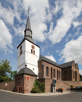
Arloff is a village in the borough of Bad Münstereifel in the district of Euskirchen in the German state of North Rhine-Westphalia.
The Eifel dialects are those dialects spoken in the Eifel mountains of Germany. They divide into two language regions: the dialects spoken in the southern Eifel (Eifelisch) are part of the Moselle Franconian dialect group and closely resemble Luxembourgish. In the northern Eifel, by contrast, the dialects (Eifelplatt) belong to the Ripuarian dialect group and are more like Öcher Platt or Kölsch. In between there is a dialect continuum of typical transitions, whereby more or less every village speaks a little differently from its neighbours.

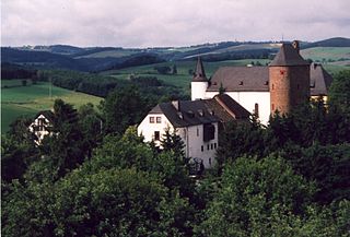
The Kasselburg is a ruined hill castle on a 490-metre-high basalt massif in Pelm near Gerolstein in the county of Vulkaneifel in the German state of Rhineland-Palatinate.


