
The Allegheny River is a 325-mile-long (523 km) tributary of the Ohio River that is located in western Pennsylvania and New York in the United States. It runs from its headwaters just below the middle of Pennsylvania's northern border, northwesterly into New York, then in a zigzag southwesterly across the border and through Western Pennsylvania to join the Monongahela River at the Forks of the Ohio at Point State Park in Downtown Pittsburgh, Pennsylvania.

The Pennsylvania Turnpike, sometimes shortened to Penna Turnpike or PA Turnpike, is a controlled-access toll road which is operated by the Pennsylvania Turnpike Commission (PTC) in Pennsylvania. It runs for 360 miles (580 km) across the southern part of the state, connecting Pittsburgh and Philadelphia, and passes through four tunnels as it crosses the Appalachian Mountains. A component of the Interstate Highway System, it is part of Interstate 76 (I-76) between the Ohio state line and Valley Forge. I-70 runs concurrently with I-76 between New Stanton and Breezewood, Interstate 276 (I-276) between Valley Forge and Bristol Township, and I-95 from Bristol Township to the New Jersey state line.

Armstrong County is a county in the Commonwealth of Pennsylvania. As of the 2020 census, the population was 65,558. The county seat is Kittanning. The county was organized on March 12, 1800, from parts of Allegheny, Westmoreland and Lycoming Counties. It was named in honor of John Armstrong, who represented Pennsylvania in the Continental Congress and served as a major general during the Revolutionary War.

Freeport is a borough in Armstrong County, Pennsylvania, United States. It is situated along the Allegheny River in the southwestern corner of the county. The population was 1,736 at the 2020 census.
Buffalo Township is a township in Butler County, Pennsylvania, United States. The population was 7,896 at the 2020 census.

The Wheeling Suspension Bridge is a suspension bridge spanning the main channel of the Ohio River at Wheeling, West Virginia. It was the largest suspension bridge in the world from 1849 until 1851. Charles Ellet Jr. designed it and supervised construction of what became the first bridge to span a major river west of the Appalachian Mountains. It linked the eastern and western section of the National Road, and became especially strategically important during the American Civil War. Litigation in the United States Supreme Court concerning its obstruction of the new high steamboat smokestacks eventually cleared the way for other bridges, especially needed by expanding railroads. Because this bridge was designed during the horse-and-buggy era, 2-ton weight limits and vehicle separation requirements applied in later years until it was closed to automobile traffic in September 2019.

The Main Line of Public Works was a package of legislation passed by the Commonwealth of Pennsylvania in 1826 to establish a means of transporting freight between Philadelphia and Pittsburgh. It funded the construction of various long-proposed canal and road projects, mostly in southern Pennsylvania, that became a canal system and later added railroads. Built between 1826 and 1834, it established the Pennsylvania Canal System and the Allegheny Portage Railroad.

The Allegheny County Belt System color codes various county roads to form a unique system of routes in Allegheny County, Pennsylvania, and around the city of Pittsburgh.

The Coraopolis Bridge[1] is a girder bridge over the back channel of the Ohio River connecting Grand Avenue on Neville Island to Ferree Street in Coraopolis, Pennsylvania. It opened in 1995 to replace a structure of historic significance. The original Pratt/Bowstring/Pennsylvania[2] through truss spans, designed by Theodore Cooper, were formerly the (third) Sixth Street Bridge, spanning the Allegheny River, in downtown Pittsburgh, and were built in 1892 by the Union Bridge Company. They were floated downstream by the Foundation Company in 1927 rather than being demolished when the bridge was removed to enable construction of the present (fourth) Three Sisters (Pittsburgh) Sixth Street Self-anchored suspension bridge. However, by the late 1980s, the old bridge could no longer support traffic volumes and was replaced by a newer structure.
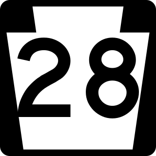
Pennsylvania Route 28 is a major state highway, which runs for 98 miles (158 km) from Anderson Street in Pittsburgh to U.S. Route 219 (US 219) in Brockway in Pennsylvania in the United States.

The Allegheny County Courthouse in Downtown Pittsburgh, is part of a complex designed by H. H. Richardson. The buildings are considered among the finest examples of the Romanesque Revival style for which Richardson is well known.

The Liberty Bridge, which was completed in 1928, connects downtown Pittsburgh, Pennsylvania, to the Liberty Tunnels and the South Hills neighborhoods beyond. It crosses the Monongahela River and intersects Interstate 579 at its northern terminus.

The South Tenth Street Bridge, most often called the Tenth Street Bridge, but officially dubbed the Philip Murray Bridge, is a suspension bridge that spans the Monongahela River in Downtown Pittsburgh, Pennsylvania.
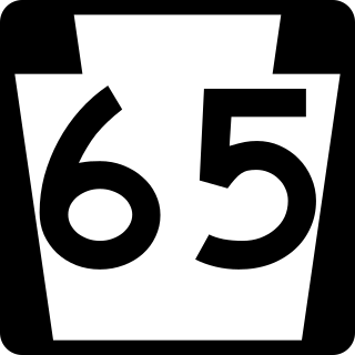
Pennsylvania Route 65 is a major 51-mile-long (82 km) state highway located in western Pennsylvania, United States. The route, traveling north–south from the Interstate 279/U.S. Route 19 Truck concurrency in Pittsburgh north to the PA 108/PA 168 concurrency in New Castle, connects downtown Pittsburgh to the northwestern portion of the Pittsburgh Metropolitan Area. PA 65 is similar in its purpose to PA 18 and PA 51, both of which run parallel to PA 65 at one point or another; however, the three routes pass through different cities for most of their respective alignments.
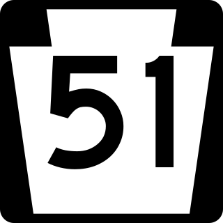
Pennsylvania Route 51 is a major state highway that is located in Western Pennsylvania in the United States. It runs for 89 miles (143 km) from Uniontown to the Ohio state line near Darlington, where it connects with Ohio State Route 14.

The Pittsburgh Light Rail is a 26.2-mile (42.2 km) light rail system in Pittsburgh, Pennsylvania, and surrounding suburbs. It operates as a deep-level subway in Downtown Pittsburgh, but runs mostly at-grade in the suburbs south of the city. The system is largely linear in a north-south direction, with one terminus near Pittsburgh's central business district and two termini in the South Hills. The system is owned and operated by Pittsburgh Regional Transit.

Donald Ronald Lobaugh was a United States Army soldier and a recipient of the United States military's highest decoration—the Medal of Honor—for his actions in World War II.

The Senator Robert D. Fleming Bridge, commonly known as the 62nd Street Bridge, is a truss bridge that carries Pennsylvania Route 8 across the Allegheny River between the Pittsburgh neighborhoods of Morningside and Lawrenceville and Sharpsburg, Pennsylvania.
'Freeport bridge may refer to:

