
China has great physical diversity. The eastern plains and southern coasts of the country consist of fertile lowlands and foothills. They are the location of most of China's agricultural output and human population. The southern areas of the country consist of hilly and mountainous terrain. The west and north of the country are dominated by sunken basins, rolling plateaus, and towering massifs. It contains part of the highest tableland on earth, the Tibetan Plateau, and has much lower agricultural potential and population.

Pingtung County is a county in Southern Taiwan known for its agriculture and tourism. In recent years, it promotes specialties such as tuna and wax apples. Pingtung is where Kenting National Park, the oldest and the largest national park in Taiwan established in 1984, is located. The county seat is Pingtung City.

Lukang is an urban township in northwestern Changhua County, Taiwan. The township is on the west coast of Taiwan, facing the Taiwan Strait. The township's name, which translates to "deer port", came from the port's trade of deerskins during the Dutch period. Lukang was an important sea port in the 18th century and 19th century. It was the most populous city in central Taiwan until the early 20th century. In March 2012, it was named one of the Top 10 Small Tourist Towns by the Tourism Bureau of Taiwan.

Karasumi is a food product made by salting mullet roe and drying it in sunlight. A theory suggests that it got its name from its resemblance to the blocks of sumi (inkstick) imported from China (Kara) for use in Japanese calligraphy. Karasumi is a high priced delicacy and it is eaten while drinking sake. It is a softer analog of Mediterranean Bottarga.
Jiang can be a pinyin transliteration of one of several Chinese surnames:

Lieyu Township is a rural township in Kinmen County, Fujian Province, Republic of China (Taiwan). It mainly consists of Lesser Kinmen, Dadan, and Erdan, three islands of the ROC located to the west of Greater Kinmen and immediately to the east of Xiamen of the People's Republic of China.

Xiaoliuqiu, Little Liuqiu or Lamay Island is an island belonging to Taiwan administered as Liuqiu Township of Pingtung County. It has an area of 6.8 square kilometres (2.6 sq mi) and lies 15 kilometres (8.1 nmi) west of Donggang; it is Taiwan's only large coral island. The eight villages on the island are populated by approximately 13,000 residents with 10 shared surnames.

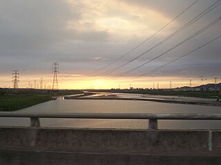
Donggang Township or Tungkang Township is an urban township in west-central Pingtung County, Taiwan. Located on Taiwan's western coastline, along the Taiwan Strait, it has one of Taiwan's largest fishing harbors. Dapeng Bay with its national scenic area is just south of Donggang.
The Dadu River, also known as the Wu or Black River, is a river on Taiwan Island.

National Pingtung University of Science and Technology is a leading public university in Neipu Township, Pingtung County, Taiwan. NPUST occupies the largest unified campus grounds in all of Taiwan. It was established in April 1924 as the Kaohsiung District Pingtung Extension School of Agriculture and over the years it has undergone several restructurings and name changes. The current name of National Pingtung University of Science and Technology was adopted in August 1997. NPUST is the only university in Taiwan to host a Rescue Center for Endangered Wild Animals (PTRC), Shelter for Stray Dogs and Working Dog Training School. In addition to the Neipu Campus, it has land in Kenting National Park and Taitung County.

Beigang or Peikang is an urban township in Yunlin County, Taiwan. It is primarily known for its Chaotian Temple, one of the most famous temples of Mazu on Taiwan. It has a population of 40,327 as of November 2017.

Ruisui Township is a rural township located in southern Hualien County, Taiwan, and has a population of 12,107 inhabitants in 11 villages.

Donggang District is the main urban district of the city of Rizhao, Shandong province, China. It has an area of 1,636.4 km2 (631.8 sq mi) and around 865,000 inhabitants. All the main government agencies of the city, as well as the Port of Rizhao, are located in Donggang.

Donggang is a city in the southeast of Liaoning Province in Northeast China. Situated on the coast of the Yellow Sea at the mouth of the Yalu River, it is located near the maritime border with North Korea. Administratively, it is a county-level city of Dandong, the downtown of which lies 35 kilometres (22 mi) to the northeast.

The Donglong Temple is a temple in Donggang Township, Pingtung County, Taiwan.

The Jinde Bridge is a bridge connecting Donggang Township and Xinyuan Township in Pingtung County, Taiwan.

The Baisha Port is a port in Liuqiu Township, Pingtung County, Taiwan. It is the main port for people to get in and out from Lamay Island.

The An-Nur Tongkang Mosque is a mosque in Donggang Township, Pingtung County, Taiwan. It is the eighth and latest mosque built in Taiwan. It is also the first mosque in Pingtung County.

