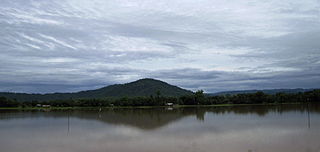
Ri Bhoi is an administrative district in the state of Meghalaya in India. The district headquarters are located at Nongpoh. The district occupies an area of 2378 km² and has a population of 258,840. As of 2011 it is the second least populous district of Meghalaya, after South Garo Hills.

Karbi Anglong district is an administrative unit in the Indian state of Assam. It is an autonomous district administered by the Karbi Anglong Autonomous Council (KAAC) according to the provisions of the Sixth Schedule of the constitution of India. The district headquarters is in Diphu.

Dima Hasao district, is an administrative district in the state of Assam, India. As of 2011, it is the least populous district of Assam.

Nagaon district is an administrative district in the Indian state of Assam. At the time of the 2011 census it was the most populous district in Assam, before Hojai district was split from it in 2016.

Diphu is the headquarter of Karbi Anglong district in the state of Assam in India. This small town is a popular tourist hill station for people of nearby cities.

The Karbis or Mikir are one of the major ethnic community in Northeast India. They are mostly concentrated in the hill districts of Karbi Anglong and West Karbi Anglong of Assam.

Nagaon is a city and a municipal board in Nagaon district in the Indian state of Assam. It is situated 122.6 kilometres (76 mi) east of Guwahati.

Durganagar is a locality in North Dumdum of North 24 Parganas district in the Indian state of West Bengal. It was named after the goddess Durga. It is a part of area covered by Kolkata Metropolitan Development Authority (KMDA). Durganagar is about 6.2 km from Dakshineswar Kali Temple and 1 km west of Netaji Subhash Chandra Bose International Airport, Kolkata.
Bokajan is a town in Karbi Anglong district in the state of Assam, India. Bokajan is best known for its Cement factory. It is 15 km away from Dimapur and partially borders Nagaland.

Bokakhat is a town in Assam and a Municipality Board in Golaghat district in the state of Assam, India. It is about 23 km away from the world heritage site Kaziranga National Park. Bokakhat town is situated almost in the middle of Assam. It is the headquarters of Bokakhat subdivision. The town is base to many nearby tourist places and is well connected to other cities and towns by road. The Kaipho Langso waterfall, an important picnic spot surrounded with magnificent views, lies in Karbi Anglong 13 km away from Bokakhat. Other nearby attractions include the ruins of the ancient Numaligarh and the Deoparbat, the tea gardens of Hatikhuli, Methoni, Diffloo Behora and Borsapori and also the coffee and rubber plantations. The nearest airports are at Jorhat and Guwahati. The nearest railway stations are Badulipar and Furkating.
Hamren is a hillside town and the headquarters of the West Karbi Anglong district in the Indian state of Assam.
Howraghat is a town in the Karbi Anglong district of the Indian state of Assam. It is home to many indigenous communities mainly Karbi, Dimasa Kachari, Tiwa (Lalung) Kachari, Bodo Kachari, etc.

Assam University is a central public university located at Silchar, Assam, India. It was founded in the year 1994 by the provisions of an act enacted by the Parliament of India. Former Air Chief Marshal Arup Raha is the Chancellor, the Governor of Assam is the Chief Rector and the President of India is acting as the Visitor of the university. The university has sixteen schools which offer Humanities, Languages, Environmental Sciences, Information Sciences, Life Sciences, Physical Sciences, Social Sciences, Law, Technology and Management Studies. There are 42 departments under these sixteen schools. The five districts under the jurisdiction of Assam University have 73 undergraduate colleges as of 31 March 2020. Assam University is an institutional signatory to the Global Universities Network for Innovation (GUNI), Barcelona and United Nations Global Compact (UNGC) for its commitment to educational social responsibilities.

The Karbi language is a Tibeto-Burman language spoken by the Karbi people of Northeastern India.

The Tiwa people, are a Tibeto-Burmese ethnic group primarily inhabiting the Northeast Indian states of Assam, Meghalaya, Arunachal Pradesh, Manipur and Nagaland, and some parts of neighbouring Bangladesh and Myanmar.
Karbi Anglong Baptist Convention (KABC) is a Baptist Christian denomination based in Assam, India. It is affiliated with the Council of Baptist Churches in Northeast India and the Asia Pacific Baptist Federation.
Artukekang is a place situated in Dongkamukam town, in West Karbi Anglong district of Assam, India.

The West Karbi Anglong district is an administrative unit in the Indian state of Assam. It is a relatively new district formed out of the existing Karbi Anglong district in 2016. The administrative headquarters of the district is located at Hamren. The district is a part of the Karbi Anglong Autonomous Council and is administered according to the provisions of the Sixth Schedule of the Indian Constitution.

Shikdamakha is a village in the West Karbi Anglong district of Assam state in North East India. It falls under the Amri development block and Vidhan Sabha No.20 Baithalangso ST LAC.
KASA Stadium or Karbi Anglong Sports Association (KASA) Stadium is a multi-purpose stadium at Diphu, Karbi Anglong, Assam, India. It is used mainly for football and athletics. The stadium has capacity of 9000 spectators. The inaugural friendly football match was held here between the reigning champions of Assam State Premier League and home team, Karbi Anglong Morning Star Football Club and the Asaduzzaman FC, Bangladesh.


