Irving Point is a point forming the eastern extremity of Visokoi Island in the South Sandwich Islands. It was discovered and first roughly charted in 1819 by a Russian expedition under Fabian Gottlieb von Bellingshausen. It was named "Penguin Point", because of a penguin rookery there, by Discovery Investigations personnel following their survey in 1930, but that name has been changed because it is already in use for other features. Irving Point was recommended by the UK Antarctic Place-Names Committee in 1953 and is for Lieutenant Commander J. Irving, Royal Navy, who made sketches of the South Sandwich Islands from the Discovery II in 1930.

Morton Strait is the 9 km (4.9 nmi)-long and 6.2 km (3.3 nmi)-wide strait between Snow Island on the southwest and Rugged Island and Livingston Island on the northeast, in the South Shetland Islands, Antarctica. The Aim Rocks and Long Rock lie in the strait.

Duff Point is a point on Archar Peninsula forming the western extremity of Greenwich Island, in the South Shetland Islands, Antarctica. The name Duffs Straits was applied to McFarlane Strait by James Weddell in 1820–23, after Captain Norwich Duff under whom Weddell served in HMS Espoir in 1814. The name Duff Point was given by the UK Antarctic Place-Names Committee in 1961 in order to preserve Weddell's name in the area; this point forms the northeast entrance to McFarlane Strait.

Weeks Stack is a sea stack lying off the north tip of Nelson Island in the northern approach to Fildes Strait, in the South Shetland Islands. Named by the United Kingdom Antarctic Place-Names Committee (UK-APC) in 1961 for Captain Weeks, Master of the British sealing vessel Horatio from London, who visited the South Shetland Islands in 1820-21.
Swell Point is a small, narrow point 2.2 km south of Resolution Point, on the east side and near the southeast extremity of Cook Island in the South Sandwich Islands. Charted and named by DI personnel on the Discovery II in 1930.
Jeffries Point is a point on the south-central side of Cook Island in the South Sandwich Islands. It was charted in 1930 by Discovery Investigations personnel on the Discovery II and named for Miss M.E. Jeffries, an assistant to the staff of the Discovery Committee.
Towle Point is a point 1 nautical mile (1.9 km) north of Post Office Hill that marks the northeast extremity of Ross Island. In association with the names of expeditionary ships grouped on this island, named after USNS Private John R. Towle, a ship that carried cargo to this area in support of United States Antarctic Program (USAP) in at least 18 seasons, 1956-80.
Grindle Rock is a conspicuous rock, 213 metres (700 ft) high, lying 0.7 nautical miles (1.3 km) west of Bristol Island in the South Sandwich Islands. It was discovered by a British expedition under James Cook in 1775. It was recharted in 1930 by Discovery Investigations personnel on the Discovery II and named by them for Sir Gilbert E.A. Grindle, Permanent Under-Secretary of State for the British Colonies.
Eddy Point is a small point located on the south side of Fildes Peninsula, 0.5 nautical miles (1 km) west of Halfthree Point on King George Island, in the South Shetland Islands. It was charted and named by Discovery Investigations personnel on the Discovery II in 1935. The feature is used as a reference point for locating the rocks which lie along the route of boats passing through Fildes Strait.

Einthoven Hill is a hill at the south extremity of Avroleva Heights, 3 nautical miles (6 km) southwest of Mitchell Point on the east side of Brabant Island in the Palmer Archipelago, Antarctica. It was photographed by Hunting Aerosurveys Ltd in 1956–57, and mapped from these photos in 1959. It was named by the UK Antarctic Place-Names Committee for Willem Einthoven, the Dutch inventor of the electrocardiograph.

Fildes Strait is a strait which extends in a general east-west direction between King George Island and Nelson Island, in the South Shetland Islands. This strait has been known to sealers in the area since about 1822, but at that time it appeared on the charts as "Field's Strait". It was probably named for Robert Fildes, a British sealer of that period, whose vessel Robert was wrecked in Clothier Harbour in 1822.
Cape Flannery is a cape which forms the west end of Thule Island in the South Sandwich Islands. It was charted in 1930 by Discovery Investigations personnel on the RSS Discovery II, who named it for Sir Fortescue Flannery, a member of the Discovery Committee.
Flat Top Peninsula is a small, flat-topped peninsula 2 km (1 mi) north of the south-western extremity of King George Island in the South Shetland Islands of Antarctica. The peninsula was named on a chart based upon a survey by Discovery Investigations personnel of the Discovery II during 1935.
Halfthree Point is a point forming the south-eastern end of Fildes Peninsula, King George Island, in the South Shetland Islands of Antarctica. It was charted and named by Discovery Investigations personnel on the Discovery II in 1935. It is part of the Fildes Peninsula Antarctic Specially Protected Area, designated as such because of its paleontological values.
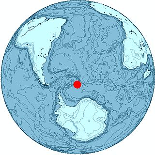
Mikhaylov Point is a small promontory marking the southern extremity of Visokoi Island in the South Sandwich Islands. It was named "Low Point" by Discovery Investigations personnel following their survey of 1930, but the name has been changed to avoid duplication with Low Point on nearby Vindication Island, itself now renamed to Braces Point. The name "Mikhaylov Point" was recommended by the UK Antarctic Place-Names Committee in 1953 and is for Pavel N. Mikhaylov, artist aboard the Vostok during the Russian expedition under Fabian von Bellingshausen, 1819–21. Mikhaylov made an excellent series of sketches of the South Sandwich Islands.
Harmony Point is a point which lies close west of Harmony Cove and forms the western extremity of Nelson Island, in the South Shetland Islands of Antarctica. It was charted in 1935 by Discovery Investigations personnel on the Discovery II, and named from association with Harmony Cove.
Twitcher Rock is a rock in the southern part of Douglas Strait, 55 meters high and 140 to 150 meters in diameter, lying 0.7 nautical miles (1.3 km) east of Hewison Point, the southeast point of Thule Island in the South Sandwich Islands. Discovered by a Russian expedition under Bellingshausen in 1820. Charted in 1930 by DI personnel on the Discovery II. They named it for John Montagu, 4th Earl of Sandwich, who was popularly known by the nickname "Jemmy Twitcher."
Maurice Channel is a strait 1.5 nautical miles (3 km) wide between Bellingshausen Island and Cook Island, in the South Sandwich Islands off Antarctica. In 1820, Fabian Gottlieb von Bellingshausen indirectly indicated the existence of the strait by describing Southern Thule as consisting of one high rock and three small islands. The strait was charted in 1930 by Discovery Investigations personnel on the Discovery II and named for Henry Gascoyne Maurice, a member of the Discovery Committee.
Reef Point is a point bounded by a small reef forming the west end of Cook Island in the South Sandwich Islands. Charted and named in 1930 by DI personnel on the Discovery II.
Mount Larsen is a mountain, 710 metres (2,330 ft) high, situated in the east-central portion of Thule Island in the South Sandwich Islands. It was charted in 1930 by Discovery Investigations personnel on the Discovery II who named it for Captain C.A. Larsen.