
South Georgia and the South Sandwich Islands (SGSSI) is a British Overseas Territory in the southern Atlantic Ocean. It is a remote and inhospitable collection of islands, consisting of South Georgia and a chain of smaller islands known as the South Sandwich Islands. South Georgia is 165 kilometres (103 mi) long and 35 kilometres (22 mi) wide and is by far the largest island in the territory. The South Sandwich Islands lie about 700 kilometres (430 mi) southeast of South Georgia. The territory's total land area is 3,903 km2 (1,507 sq mi). The Falkland Islands are about 1,300 kilometres (810 mi) west from its nearest point.

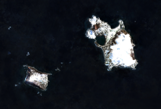
The Shag Rocks are six small islets, as opposed to islands, in the westernmost extreme of South Georgia, 240 km (150 mi) west of the main island of South Georgia and 1,000 km (620 mi) off the Falkland Islands. The Shag Rocks are located at 53°32′51″S42°01′12″W. 16 kilometres (9.9 mi) further southeast is Black Rock, which is located at 53°38′06″S41°46′30″W.
The extreme points of South America are the points that are farther north, south, east or west than any other location on the continent. The continent's southernmost point is often said to be Cape Horn, but Águila Islet of the Diego Ramírez Islands lies further south.
Thule Island, also called Morrell Island, is one of the southernmost of the South Sandwich Islands, part of the grouping known as Southern Thule. It is named, on account of its remote location, after the mythical land of Thule, said by ancient geographers to lie at the extreme end of the Earth. The alternative name Morrell Island is after Benjamin Morrell, an American explorer and whaling captain. It was espied by James Cook and his Resolution crew on 31 January 1775 during his attempt to find Terra Australis.
Vindication Island is a small uninhabited island of the Candlemas Islands in the South Sandwich Islands. It is one of about a dozen islands that make up the South Sandwich island arc, a chain of volcanoes in the Southern Ocean that was discovered in 1775 by James Cook. The volcanism is caused by the subduction of the South American Plate beneath the Sandwich Plate.

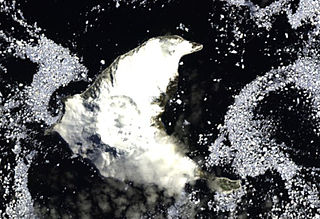
Corbeta Uruguay base was an Argentine military outpost established in November 1976 on Thule Island, Southern Thule, in the South Sandwich Islands. It was vacated and mostly demolished in 1982 following Britain's victory against Argentina in the Falklands War.

Figueroa Point is an ice-free point at the northeast extremity of Greenwich Island in the South Shetland Islands, Antarctica forming the southeast side of the entrance to Galápagos Cove. Dovizio Rock is lying 190 m (210 yd) to the northeast, Ibar Rocks are centred 860 m (940 yd) to the southeast, Bonert Rock62°27′01.8″S59°42′58.3″W is 730 m (800 yd) to the south-southeast and Rosales Rocks62°26′57.5″S59°43′16.4″W are 500 m (550 yd) south by east of Figueroa Point. The area was visited by early 19th century sealers.
Wilson Rock is a rock, 183 m high, lying 1.4 nautical miles (2.6 km) west of Bristol Island in the South Sandwich Islands. Discovered by Captain James Cook in 1775, but more accurately charted by Admiral Thaddeus Bellingshausen in 1819–20. Recharted in 1930 by DI personnel on the Discovery II and named for Sir Samuel H. Wilson, Permanent Under-Secretary of State for the British Colonies.
Beach Point is the northeast tip of Thule Island, in the South Sandwich Islands, made conspicuous by a bare rock ridge and a narrow beach of boulders and pebbles. It was charted and named in 1930 by DI personnel on the Discovery II who made a landing there.
Wasp Point is a projecting point in the middle of the southwest coast of Thule Island, South Sandwich Islands. It was named by United Kingdom Antarctic Place-Names Committee (UK-APC) in 1971 after the American sealing vessel in which Captain Benjamin Morrell of Stonington, CT, visited the island in 1823. Next to Longton Point on Cook Island, it is the southernmost landmass of the South Sandwich Islands and the southernmost landmass worldwide north of the 60th parallel south and therefore the southernmost landmass outside of the Antarctic Treaty System.
Grindle Rock is a conspicuous rock, 213 metres (700 ft) high, lying 0.7 nautical miles (1.3 km) west of Bristol Island in the South Sandwich Islands. It was discovered by a British expedition under James Cook in 1775. It was recharted in 1930 by Discovery Investigations personnel on the Discovery II and named by them for Sir Gilbert E.A. Grindle, Permanent Under-Secretary of State for the British Colonies.
Douglas Strait is a strait 2 nautical miles (4 km) wide between Thule Island and Cook Island, in the South Sandwich Islands. The existence of this strait was first noted by a Russian expedition under Fabian Gottlieb von Bellingshausen in 1820. It was charted in 1930 by Discovery Investigations personnel on the Discovery II and named for Vice-Admiral Sir Percy Douglas, a member of the Discovery Committee.
Freezland Rock is a conspicuous sharp-pointed rock, 305 metres (1,000 ft) high, located 2 nautical miles (4 km) west of Bristol Island in the South Sandwich Islands. This feature was originally named "Freezland Peak" by Captain Cook, after Samuel Freezland, the seaman who first sighted it and so discovered the South Sandwich group in 1775. Cook's chart, showing the feature as an insular rock, was verified in 1930 by Discovery Investigations personnel on the Discovery II and the terminology has been altered accordingly.

Hewison Point is a point which forms the east side of Ferguson Bay and the southeast end of Thule Island, in the South Sandwich Islands. It was first charted by a Russian expedition under Fabian Gottlieb von Bellingshausen in 1819–20. It was recharted in 1930 by Discovery Investigations personnel on the Discovery II who named it for Lieutenant Colonel Hewison of Ferguson Brothers, Port Glasgow, Scotland, builders of the Discovery II.
Herd Point is a point which forms the west side of Ferguson Bay at the south end of Thule Island, in the South Sandwich Islands. It was roughly charted by a Russian expedition under Fabian Gottlieb von Bellingshausen in 1819–20. It was recharted in 1930 by Discovery Investigations personnel on the Discovery II and named for R.D. Herd of Ferguson Brothers, Port Glasgow, Scotland, the builders of the Discovery II.
Maurice Channel is a strait 1.5 nautical miles (3 km) wide between Bellingshausen Island and Cook Island, in the South Sandwich Islands off Antarctica. In 1820, Fabian Gottlieb von Bellingshausen indirectly indicated the existence of the strait by describing Southern Thule as consisting of one high rock and three small islands. The strait was charted in 1930 by Discovery Investigations personnel on the Discovery II and named for Henry Gascoyne Maurice, a member of the Discovery Committee.
Salamander Point is the northern point of Bellingshausen Island, South Sandwich Islands. This feature was named North Point during the survey of the island from RRS Discovery II in 1930, but the name was changed by United Kingdom Antarctic Place-Names Committee (UK-APC) in 1971 to avoid duplication. The new name is in association with nearby Basilisk Peak; Salamander is an animal mythically supposed to live in fire.
Mount Holdgate is a prominent mountain, 960 metres (3,150 ft) high, with steep icefalls and rock buttresses which provides a clear landmark at the southeast end of Cook Island in the South Sandwich Islands. It was named by the UK Antarctic Place-Names Committee for Martin W. Holdgate, organizer and senior scientist of the survey of the South Sandwich Islands from HMS Protector in 1964.
Tomblin Rock is an isolated rock 0.6 nautical miles (1.1 km) east-southeast of Demon Point, Candlemas Island, in the South Sandwich Islands. It is 24 meters high. It is more than 50 meters long north–south, and about 23 meters wide. It has an area of less than 0.1 hectares.

