Down Ampney

Last updated
Down Ampney
Down Ampney (Glos) All Saints Church - geograph.org.uk - 68217.jpg
All Saints Church, Down Ampney
Gloucestershire UK location map.svg
Red pog.svg
Down Ampney
Location within Gloucestershire
Population644 (2011 Census)
District
Shire county
Region
Country England
Sovereign state United Kingdom
Post town Cirencester
Postcode district GL7
Police Gloucestershire
Fire Gloucestershire
Ambulance South Western
UK Parliament
List of places
UK
England
Gloucestershire
51°40′N1°51′W / 51.667°N 1.850°W / 51.667; -1.850

Down Ampney (pronounced Amney) [1] is a medium-sized village located in Cotswold district in Gloucestershire, in England. The population taken at the 2011 census was 644. [2]

Contents

It is off the A417 which runs between Cirencester and Faringdon (in Oxfordshire) on the A420, and about 3 miles (4.8 km) north of Cricklade, which is on the A419 which runs from Cirencester to Swindon, Wiltshire.

History

Down Ampney was notable in medieval times as one of the seats of the powerful Hungerford family, whose principal family seat was at Farleigh Hungerford, Somerset. The Down Ampney estate later passed from the Hungerford family to the Earls of St German (the Eliot Family). [3]

Ralph Vaughan Williams

The Old Vicarage in Down Ampney was the birthplace in 1872 of composer Ralph Vaughan Williams, whose father, the Reverend Arthur Vaughan Williams (1834–1875), was vicar of All Saints. In 1906 the composer wrote a tune for the hymn "Come Down, O Love Divine" which he titled "Down Ampney" in honour of his birthplace. [4] [5]

RAF Down Ampney

During the Second World War, RAF Down Ampney airfield was a base for Dakota aircraft seeing active service in the war. The airfield played an important role in the Battle of Arnhem, 1944. [6] [7]

Governance

Down Ampney has a Parish Council, currently with 7 members. The current Chair is local resident Ray Jenkins.

As of May 2015 the village became part of 'The Ampneys and Hampton Ward' on Cotswold District Council. The current District Councillor is Liberal Democrat Lisa Spivey who was elected in the 2019 United Kingdom local elections.

Ampney Crucis is part of the wider South Cerney electoral division for elections to Gloucestershire County Council, the current County Councillor is Conservative Shaun Parsons who was elected in the 2017 United Kingdom local elections. [8]

All Saints' Church

All Saints' Church is an ancient building that was founded by the Knights Hospitaller [9] in 1265. It lies on the edge of the village; its peripheral location was brought about when the centre of the village shifted north due to the effects of the bubonic plague. [3] [7]

Its prominent spire dates from the 14th century, although much of the church fabric seen today is the product of Victorian restoration work carried out in 1863.

The church contains a number of elaborate monuments to the Hungerford family, [3] including a 1637 Renaissance-style monument to Sir John and Sir Anthony Hungerford. Among the medieval memorials are two recumbent effigy tombs of Sir Nicholas de Valers (d.1300) and Lady Margaret de Valers (d.1320). The wooden fittings in the church, including the pulpit, reredos, and rood screen were designed in 1898 by Charles Ponting. Another screen in the north transept screen dates from 1900 and incorporating painted Jacobean panels displaying the coat of arms of Sir Anthony Hungerford. Today the church is a Grade I listed building. [10] There is also a 20th-century stained-glass window in commemoration of 271 Sqn and the R.A.S.C who flew in the Dakota aircraft from the airfield for the Battle of Arnhem in 1944. The church holds an annual Arnhem Service in memory of the wartime operation. [3] Another stained-glass is dedicated to the memory of Rev, Arthur Vaughan Williams who is buried in the churchyard. [5]

The church featured in the 2017 Channel 4 television programme Penelope Keith's Hidden Villages . [3]

Amenities

In addition to the church and the airfield, the village has a school which is more than 150 years old, a multi-use games area for younger residents, a tennis club, a village hall and a small village shop.[ citation needed ]

The Down Ampney estate, comprising almost all of the farm land in the parish, is now owned by the Co-operative Group. [11]

Related Research Articles

<span class="mw-page-title-main">Cotswolds</span> Protected area mostly in South West England

The Cotswolds is a region of central South West England, along a range of rolling hills that rise from the meadows of the upper River Thames to an escarpment above the Severn Valley and the Vale of Evesham. The area is defined by the bedrock of Jurassic limestone that creates a type of grassland habitat that is quarried for the golden-coloured Cotswold stone. The predominantly rural landscape contains stone-built villages, towns, stately homes and gardens featuring the local stone.
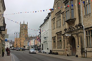
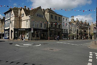
<span class="mw-page-title-main">Cirencester</span> Market town in Gloucestershire, England

Cirencester is a market town in Gloucestershire, England, 80 miles (130 km) west of London. Cirencester lies on the River Churn, a tributary of the River Thames. It is the eighth largest settlement in Gloucestershire and the largest town within the Cotswolds. It is the home of the Royal Agricultural University, the oldest agricultural college in the English-speaking world, founded in 1840. The town had a population of 20,229 in 2021.

<span class="mw-page-title-main">Cotswold District</span> Non-metropolitan district in England

Cotswold is a local government district in Gloucestershire, England. It is named after the wider Cotswolds region and range of hills. The council is based in the district's largest town of Cirencester. The district also includes the towns of Chipping Campden, Fairford, Lechlade, Moreton-in-Marsh, Northleach, Stow-on-the-Wold and Tetbury, along with numerous villages and surrounding rural areas.

<span class="mw-page-title-main">Tetbury</span> Town in Gloucestershire, England

Tetbury is a town and civil parish inside the Cotswold district in Gloucestershire, England. It lies on the site of an ancient hill fort, on which an Anglo-Saxon monastery was founded, probably by Ine of Wessex, in 681. The population of the parish was 5,250 in the 2001 census, increasing to 5,472 at the 2011 census. The population further increased to 6,453 in the 2021 Census.

<span class="mw-page-title-main">Kemble, Gloucestershire</span> Village in the Cotswolds of England

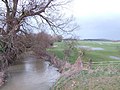
Kemble is a village in the civil parish of Kemble and Ewen, in the Cotswold district of Gloucestershire, England. Historically part of Wiltshire, it lies 4 miles (6.4 km) from Cirencester and is the settlement closest to Thames Head, the source of the River Thames. In 2020 it had an estimated population of 940. At the 2011 census the parish had a population of 1,036.
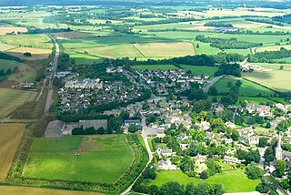
Ampney may refer to:

<span class="mw-page-title-main">Ampney Crucis</span> Human settlement in England

Ampney Crucis is a village and civil parish in the Cotswolds, part of the Cotswold District of Gloucestershire, England.

<span class="mw-page-title-main">Ampney St Mary</span> Human settlement in England

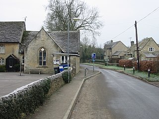
Ampney St Mary is a small village and civil parish in the Cotswolds, part of the Cotswold District of Gloucestershire, England. According to the 2001 census the parish has a population of 54, increasing to 218 at the 2011 census.

<span class="mw-page-title-main">Ampney St Peter</span> Human settlement in England

Ampney St Peter is a small village and civil parish in the Cotswolds, part of the Cotswold of Gloucestershire, England. According to the 2014 mid year estimate, the parish has a population of 75. Locally, the town was known as Easington.

<span class="mw-page-title-main">Barnsley, Gloucestershire</span> Human settlement in England

Barnsley is a village and civil parish in the Cotswold district of Gloucestershire, England, 3.7 miles (6.0 km) northeast of Cirencester. It is 125 kilometres (78 mi) (geodesically) west of London.

<span class="mw-page-title-main">Baunton</span> Human settlement in England

Baunton is a village and civil parish in the Cotswold district of Gloucestershire, England, located about two miles north of Cirencester on the River Churn.

<span class="mw-page-title-main">Coln Rogers</span> Human settlement in England

Coln Rogers is a village and former civil parish, now in the parish of Coln St. Dennis, in the Cotswold district of the county of Gloucestershire, England. In 1931 the parish had a population of 95.

<span class="mw-page-title-main">Oaksey</span> Village in Wiltshire

Oaksey is a village and civil parish in Wiltshire, England, on the county boundary with Gloucestershire. The village is about 5.5 miles (8.9 km) northeast of the market town of Malmesbury and a similar distance south of the Gloucestershire market town of Cirencester.

<span class="mw-page-title-main">Siddington, Gloucestershire</span> Village and parish in Gloucestershire, England

Siddington is a village and civil parish in Gloucestershire, England. It is located immediately south of Cirencester. At the 2011 United Kingdom Census, the parish had a population of 1,249.

Meysey Hampton is a village and civil parish in Gloucestershire, England, approximately 30 miles (48 km) to the south-east of Gloucester. It lies in the south of the Cotswolds, an Area of Outstanding Natural Beauty.

<span class="mw-page-title-main">Church of St. John the Baptist, Cirencester</span> Church

The Church of St. John Baptist, Cirencester is a parish church in the Church of England in Cirencester, Gloucestershire, England. It is a Grade I listed building.

<span class="mw-page-title-main">Coates, Gloucestershire</span> Village and civil parish in Gloucestershire, England

Coates is a village and civil parish situated in Cotswold District, Gloucestershire, England. It is around 3 miles (4.8 km) west of Cirencester and close to Cirencester Park, part of the Bathurst Estate. It is the nearest village to the source of the river Thames at Thames Head, and it is close to the course of the Foss Way or Fosse Way, the ancient Roman road. The nearest railway station is Kemble. The village population taken at the 2021 census was 491.

<span class="mw-page-title-main">RAF Down Ampney</span> Airport in Gloucestershire, England

Royal Air Force Down Ampney or more simply RAF Down Ampney is a former Royal Air Force station located 1.8 miles (2.9 km) north east of Cricklade, Wiltshire and 3 miles (4.8 km) south west of RAF Fairford, Gloucestershire. The airfield operated during the Second World War from February 1944 until February 1947.

<span class="mw-page-title-main">Crudwell</span> Village in England

Crudwell is a village and civil parish in north Wiltshire, England. The nearest towns are Malmesbury, about 4 miles (6.4 km) to the south-west, and Cirencester, Gloucestershire 8 miles (13 km) to the north-east. Also to the north-east is Cotswold Airport. Kemble village, about 4 miles (6.4 km) away, has the nearest railway station, with services to London Paddington and Gloucester.

References

  1. Cummings, Mark (24 February 2011). "I say Over...you say Oooover". BBC. Retrieved 31 March 2020.
  2. "Parish population 2011" . Retrieved 24 March 2015.
  3. 1 2 3 4 5 "Down Ampney Village, History". www.downampneyvillage.co.uk. Retrieved 1 June 2020.
  4. Bradley, Ian (2006). Daily Telegraph Book of Hymns. Bloomsbury Academic. p. 87. ISBN   978-0-8264-8282-2 . Retrieved 1 June 2020.
  5. 1 2 "Down Ampney Village, Ralph Vaughan Williams". www.downampneyvillage.co.uk. Retrieved 1 June 2020.
  6. Cooper, Alan W. (2012). Air Battle for Arnhem. Pen and Sword. ISBN   978-1-4738-1168-3 . Retrieved 1 June 2020.
  7. 1 2 "Down Ampney Village, Church". www.downampneyvillage.co.uk. Retrieved 1 June 2020.
  8. "Cllr Shaun Parsons". Gloucestershire County Council. Retrieved 26 March 2021.
  9. Herde, Peter (2007). "The Dispute between the Hospitallers and the Bishop of Worcester about the Church of Down Ampney. An Unpublished Letter of Justice of Pope John XXI (1276)". In Karl Borchardt, Nikolas Jaspert and Helen J. Nicholson (ed.). The Hospitallers, the Mediterranean and Europe. Festschrift for Anthony Luttrell. Aldershot: Ashgate. ISBN 978-0-7546-6275-4. p. 48.
  10. Historic England. "Church of All Saints, Down Ampney (1089941)". National Heritage List for England . Retrieved 1 June 2020.
  11. Statutory Declaration of D. N. Humphreys

51°40′N1°51′W / 51.667°N 1.850°W / 51.667; -1.850