
The French Air and Space Force (AAE) is the air and space force of the French Armed Forces. It was formed in 1909 as the Service Aéronautique, a service arm of the French Army, and then made an independent military arm in 1934, becoming the French Air Force. On 10 September 2020, it assumed its current name, the French Air and Space Force. The number of aircraft in service with the French Air and Space Force varies depending on the source, however sources from the French Ministry of Defence give a figure of 658 aircraft in 2014. The French Air and Space Force has 232 combat aircraft in service, with the majority being 130 Dassault Mirage 2000 and 102 Dassault Rafale. As of 2021, the French Air and Space Force employs a total of 40,500 regular personnel. The reserve element of the air and space force consisted of 5,187 personnel of the Operational Reserve.

Ouvrage Schoenenbourg is a Maginot Line fortification. It is located on the territory of the communes of Hunspach, Schœnenbourg and Ingolsheim, in the French département of Bas-Rhin, forming part of the Fortified Sector of Haguenau, facing Germany. At the east end of the Alsace portion of the Maginot Line, its neighbour is the gros ouvrage Hochwald. It is the largest such fortification open to the public in Alsace. Officially recorded as an historical monument, it retains all its original structural elements. Schoenenbourg was heavily bombarded during the Battle of France in 1940, receiving more enemy ordnance than any other position in France, with no significant damage. In 1945, retreating German troops used explosives to destroy much of the ouvrage. After the war it was fully repaired and placed back into service as part of a programme to use Maginot fortifications to resist a potential Warsaw Pact advance through Europe. By the 1970s the plan had lost favour and funding, and Schoenenboug was abandoned. In 1987 a local organisation undertook Schoenenbourg's preservation, and today it is open to public visitation.

Ouvrage Hochwald is a gros ouvrage of the Maginot Line, one of the largest fortifications in the Line. Located on the Hochwald ridge in the Fortified Sector of Haguenau in the community of Drachenbronn-Birlenbach in the Bas-Rhin department of northeastern France, it was designed to protect the northern Vosges region of France. Ouvrage Hochwald is sometimes considered as two ouvrages because of its separation of the western and the eastern portions of the ouvrage. Uniquely, the original plans for the position included an elevated battery to the rear with long-range 145 mm or 155 mm gun turrets of a new kind. Hochwald is used by the French Air Force as an armoured air defense coordination center.
The French air defence organisation is integrated in the military Armée de l’Air (ALA), the French Air Force.
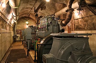
Ouvrage Michelsberg, one of the Maginot Line fortifications, formed part of the Fortified Sector of Boulay as well as the fortified region of Metz. The ouvrage is located in Moselle (département) between the towns of Dalstein and d'Ebersviller, about 23 km from Thionville. It is located between gros ouvrage Mont des Welches and petit ouvrage Hobling, facing Germany. Michelsberg did not see significant action in the Battle of France until June 1940, when it was attacked from the rear by German forces that had bypassed the Maginot Line. It successfully resisted these attacks, but was compelled to surrender in accordance with the 25 June 1940 armistice. After the Second World War it was renovated as a Cold War fortification against a potential Soviet invasion, then abandoned. It is now operated as a museum, and may be visited.

Ouvrage Anzeling is a gros ouvrage of the Maginot Line, part of the Fortified Sector of Boulay. It is located between petit ouvrage Bousse and petit ouvrage Berenbach, facing Germany just to the east of Bockange. With one of the longest main galleries of any Maginot position, it consists of two entrance blocks, three infantry blocks and four artillery blocks. A second phase of construction was planned to add nine more combat blocks and an anti-tank ditch, but was never executed. Anzeling saw limited action in World War II, and was rehabilitated for use during the cold war. It was de-activated in the 1970s and sold for private use.

Ouvrage Métrich located in the village of Kœnigsmacker in Moselle, comprises part of the Elzange portion of the Fortified Sector of Thionville of the Maginot Line. A gros ouvrage, it is the third largest of the Line, after Hackenberg and Hochwald. It lies between petit ouvrage Sentzich and gros ouvrage Billig, facing Germany. Located to the east of the Moselle, it cooperated with Ouvrage Galgenberg to control the river valley.

Ouvrage Rochonvillers is one of the largest of the Maginot Line fortifications. Located above the town of Rochonvillers in the French region of Lorraine, the gros ouvrage or large work was fully equipped and occupied in 1935 as part of the Fortified Sector of Thionville in the Moselle. It is located between the petit ouvrage d'Aumetz and the gros ouvrage Molvange, facing the border between Luxembourg and France with nine combat blocks. Rochonvillers saw little action during World War II, but due to its size it was repaired and retained in service after the war. During the Cold War it found a new use as a hardened military command centre, first for NATO and then for the French Army.

Ouvrage Lembach is a petit ouvrage of the Maginot Line. Lembach is adjoined by petit ouvrage Grand Hohekirkel at some distance to its west and gros ouvrage Four-à-Chaux immediately to its east. It faces the German frontier, and was part of the Fortified Sector of the Vosges. During the Battle of France in 1940, the German 215th Infantry Division broke through the line of smaller fortifications to the west of Lembach, but did not directly attack. After aerial bombardments, Lembach surrendered with the rest of the Maginot fortifications according to the terms of the Second Armistice at Compiègne. After the war Lembach was renovated for further use, but was abandoned by the 1970s.

Ouvrage Four-à-Chaux is a gros ouvrage of the Maginot Line, located in the community of Lembach, France, in the Bas-Rhin département. Four à Chaux was adjoined by petit ouvrage Lembach and gros ouvrage Hochwald, and faced the German frontier as part of the Fortified Sector of the Vosges. A "four à chaux" is a lime kiln in French, and the ouvrage was located in the area of a limestone quarry and kiln, which operated until 1939. Four-à-Chaux was bombarded by the invading Germans in late June 1940 during the Battle of France with both aerial attacks and artillery bombardments. Four-à-Chaux survived to surrender at the end of the month. Block 1 was destroyed by the Germans before retreating in the face of American advances in 1945. During the 1950s Four-à-Chaux was renovated and reoccupied against a perceived threat from the Soviet Union. It fell out of use in the 1970s, and is now operated as a museum.
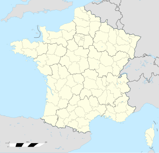
Ouvrage Mont Agel is a work of the Maginot Line's Alpine extension, the Alpine Line, also called the Little Maginot Line. The 1930s ouvrage was built in and around the earlier mountaintop Fortress of Mont Agel. The ouvrage forms a backup to the main curtain of Alpine Line forts, and was not initially planned as part of the Alpine Line proper. Its intended function was primarily to provide heavy, long-range artillery support from a location well to the rear of the line. However, the planned 145mm heavy guns were never installed. Its site on Mont Agel, at an altitude of 1,118 metres (3,668 ft), is the highest point in the vicinity of Nice and Menton and commands the entire coastline, as well as the approaches from Sospel to the north. The site is now occupied by Base Aérienne 943 of the French Air Force and functions as an air defense control station.
Nice Air Base of the French Air Force is divided between two sites: one at the summit of Mont Agel near Nice in the Alpes-Maritimes département, and the other at Gardanne barracks in Roquebrune-Cap-Martin. The Mont Agel base uses the facilities of the former Ouvrage Mont Agel of the Alpine Line. Its mission is the surveillance of aviation movements in southeastern France, operating as Centre de Détection et de Contrôle (CDC) 05.943, tactical call sign “Rhodia radar”. A similar facility is located at Drachenbronn Air Base in northeastern France. The Gardanne base houses administrative functions and personnel housing in a former Chasseur Alpins barracks.

The Fort des Adelphes, or Fort Richepance, is part of the fortifications of Épinal. It was built near the village of Deyvillers between 1883 and 1885, and was modernized beginning in 1907. It is an example of a Séré de Rivières system fortification. During World War II the fort surrendered to German forces and was then used by the Germans to fire on neighboring forts Longchamp and Dogneville. The fort is now occupied by an activity of the French Air Force associated with Base aerienne 133 Nancy-Ochey and is not accessible to the public.
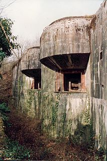
The Fortified Sector of Thionville was the French military organisation that in 1940 controlled the section of the Maginot Line immediately to the north of Thionville. The sector describes an arc of about 25 kilometres (16 mi), about halfway between the French border with Luxembourg and Thionville. The Thionville sector was the strongest of the Maginot Line sectors. It was surrounded but not seriously attacked in 1940 by German forces in the Battle of France, whose main objective was the city of Metz. Despite the withdrawal of the mobile forces that supported the fixed fortifications, the sector successfully fended off German assaults before the Second Armistice at Compiègne. The majority of the positions and their garrisons finally surrendered on 27 June 1940, the remainder on 2 July. Following the war, many positions were reactivated for use during the Cold War. Four locations are now preserved and open to the public.
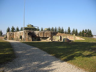
The Fortified Sector of Haguenau was the French military organization that in 1940 controlled the most easterly section of the Maginot Line, to the north of Strasbourg. The left (western) wing of the Haguenau sector adjoined the Fortified Sector of the Vosges, includes two of the largest Maginot fortifications, Ouvrage Hochwald and Ouvrage Schoenenbourg. The right wing, started after 1931, was progressively scaled back in order to save money during the Great Depression, abandoning plans for four petit ouvrages and substituting casemates. The sector's northern and eastern sides bordered on Germany. To the south the sector borders the Fortified Sector of the Lower Rhine, from which it received several casemates in a boundary shift in 1940.

The Fortified Sector of the Vosges was the French military organization that in 1940 controlled the section of the Maginot Line at the northern end of the Vosges Mountains in northeastern France. The sector was bordered to the west by the Fortified Sector of Rohrbach and to the east by the Fortified Sector of Haguenau. The sector featured two gros ouvrages mounting heavy artillery at either end of the sector and one petit ouvrage mounting infantry weapons, linked by a line of casemates. The sector was attacked in 1940 by German forces in the Battle of France. German forces penetrated the casemate line and moved behind French lines. Despite the withdrawal of the mobile forces that supported the fixed fortifications, the three ouvrages successfully fended off German assaults before the Second Armistice at Compiègne, but were unable to hinder German activities to their south. The positions and their garrisons finally surrendered on 1 July 1940. Following the war several positions were reactivated for use during the Cold War. One position, Ouvrage Four-à-Chaux, is open to the public and may be visited.

The Musée Pierre-Jost is situated near the Ouvrage Hochwald, one of the major fortifications of the Maginot Line in France, near to the village of Drachenbronn in the commune of Drachenbronn-Birlenbach, Alsace. It documents the story of the fortification before, during and after World War II.
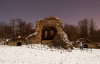
From 1949 to March 10, 1967, France's military operated within the NATO command structure, integrating its air defense system with that of NATO through the indirect use of American aid funds. Between 1953 and 1958, the D.A.T. built a radar station in an old troops shelter near the fort, called Ouvrage "G". Called "Station Maître Radar 60/921", it was used beginning in 1959, covering an area on the surface of three times the area of the troops shelter.

The Air Forces Command is a command of the French Air and Space Force. It is headquartered at Bordeaux-Mérignac Air Base.
The Centre de détection et de contrôle militaire (CDC) are the French military air traffic control regional centres, that would respond to a threat within French airspace.


