Related Research Articles

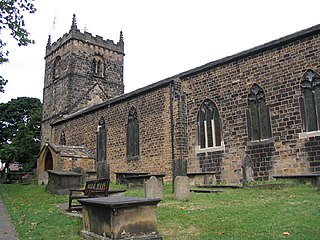
Bolton Abbey in Wharfedale, North Yorkshire, England, takes its name from the ruins of the 12th-century Augustinian monastery now known as Bolton Priory. The priory, closed in the 1539 Dissolution of the Monasteries ordered by King Henry VIII, is in the Yorkshire Dales, next to the village of Bolton Abbey.

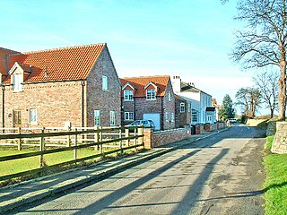
Marton-cum-Moxby is a civil parish in North Yorkshire, England. The population of the parish was less than 100 at the time of the 2011 Census, therefore its details were included with Farlington. It lies to the east of the villages of Stillington and Farlington, near Easingwold. The settlements are the hamlets of Marton-in-the-Forest and Moxby, both agricultural in character.

Drax is a village and civil parish in the Selby District of North Yorkshire, England, about 6 miles (10 km) south-east of Selby, best known today as the site of Drax power station. It was historically part of the West Riding of Yorkshire until 1974. The village primary school closed in 2017.

The Selby–Goole line was a standard gauge branch line connecting Selby and Goole, built in 1910 by the North Eastern Railway. The line closed in the 1960s as part of the Beeching cuts.
Bedford Abbey was a short-lived Benedictine monastery, recorded in 10th century England. Bedford Priory, perhaps representing the same institution two centuries later, was an Augustinian priory that within two decades of its foundation moved to nearby Newnham.

Otterton Priory was a priory in Otterton, Devon founded before 1087 and suppressed in 1414. The tower of the parish church is the major remaining structure of the monastery. The manor house probably reuses parts of the monastery's fabric.

St. Mary Magdalen was a Benedictine priory in Lincoln, England. Along with Sandtoft Priory and Hanes Cell, it was a Lincolnshire cell of St Mary's Abbey in York, England. A surviving building, once owned by the priory, is Monks' Abbey, Lincoln.
Markby Priory was a priory in the village of Markby, Lincolnshire, England.
Torksey Priory was a priory in Lincolnshire, England. It was an Augustinian house and was dedicated to St Leonard. It is thought that the priory was founded in the time of King Henry II, possibly by the king himself. It had the three parish churches in Torksey annexed to it - All Saints, St Peter, St Mary.

Embsay Priory was a medieval monastic house in North Yorkshire, England.

Healaugh Park Priory was an Augustinian priory in Healaugh, North Yorkshire, England, some 2 miles north of Tadcaster.

Marton Priory was a priory in North Yorkshire, England. It was founded in 1154 and was occupied by Augustinian Monks and Benedictine nuns though the nuns were moved to Moxby in 1167. The priory had a water mill on the River Foss, the earthworks to this can still be seen today in the fields of the farmhouse that occupy the site. The farmhouse also has evidence in its walls of having the original stones from the priory used in its construction.
Moxby Priory is the commonly used name of the former Augustinian nunnery of S. John the Apostle in today's parish of Marton-cum-Moxby, North Yorkshire, England.

Woodkirk Priory was a cell of Augustinian Canons in West Yorkshire, England. William, second earl of Warenne, had granted the land for its foundation in 1135. It was a cell of Nostell Priory. Woodkirk became the site of a fair, granted by King Henry I and confirmed by King Stephen, which was particularly famous during the reign of King Edward II. The cell was dissolved in 1539, and the property later passed to the Savile family.

Upavon Priory was a small priory in Wiltshire, England.
William Paynel was an Anglo-Norman nobleman and baron. Son of a Domesday landholder, William inherited his father's lands in Yorkshire, Lincolnshire, and Normandy after the death of an older brother during their father's lifetime. After the death of King Henry I of England, Paynel supported Henry's daughter Matilda in her attempts to take the throne from her cousin Stephen, who had seized it. Matilda entrusted Nottingham Castle to Paynel's custody, although he lost it within two years when it was captured by a supporter of Stephen's. Paynel also founded two religious houses - one in England and one in Normandy. After Paynel's death around 1146, his lands were split between two sons.

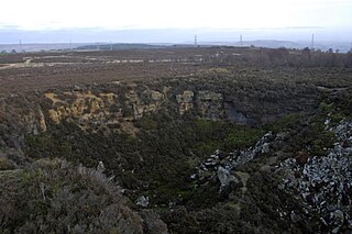
Harden Moor is an expanse of moorland that lies north of the village of Harden in West Yorkshire, England. The moor encompasses stretches of heather, woodland and former quarry workings and is bordered by Airedale to the east, the Worth Valley to the north and Catstones Moor and the village of Cullingworth to the west. Historically, Harden Moor occupied the high ground between Bingley, Keighley, Cullingworth and Harden. Altar Lane, an unmade road which runs from the Brown Cow Inn in Bingley to Keighley Road on Harden Moor is an unofficial border between the estate of St Ives and Harden Moor, but when the St Ives Estate was created, a large swathe of Harden Moor was taken over.

Ryecroft is a hamlet near to the village of Harden in West Yorkshire, England. The hamlet is on the road between Harden and Haworth, 1.9 miles (3 km) south of Keighley, 1.9 miles (3 km) west of Bingley and 0.6 miles (1 km) west of the centre of Harden.

Long Drax is a small hamlet and civil parish in the Selby District of North Yorkshire, England, about 2 miles north-east of Drax. In 2011 it had a population of 125.
References
- ↑ Jeffreys, Susan (4 February 2015). "Drax Augustinian Priory". Ancient Monuments. Retrieved 30 November 2015.
- ↑ Historic England. "Drax Priory (57907)". Research records (formerly PastScape). Retrieved 30 November 2015.
- ↑ "Ryecroft Conservation Area Assessment" (PDF). Bradford Council. BC. December 2005. p. 9. Retrieved 30 November 2015.
- ↑ "History". Friends of St Ives. Archived from the original on 3 March 2016. Retrieved 30 November 2015.
Coordinates: 53°44′55.5″N0°59′22.1″W / 53.748750°N 0.989472°W