Related Research Articles

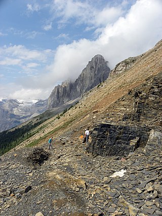
The Burgess Shale is a fossil-bearing deposit exposed in the Canadian Rockies of British Columbia, Canada. It is famous for the exceptional preservation of the soft parts of its fossils. At 508 million years old, it is one of the earliest fossil beds containing soft-part imprints.

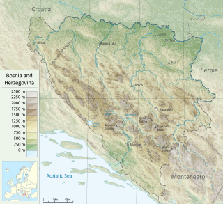
Bosnia and Herzegovina is located in Southeastern Europe. Situated in the western Balkans, it has a 932 km (579 mi) border with Croatia to the north and southwest, a 357 km (222 mi) border with Serbia to the east, and a 249 km (155 mi) border with Montenegro to the southeast. It borders the Adriatic Sea along its 20 km (12 mi) coastline.

The geologic time scale or geological time scale (GTS) is a representation of time based on the rock record of Earth. It is a system of chronological dating that uses chronostratigraphy and geochronology. It is used primarily by Earth scientists to describe the timing and relationships of events in geologic history. The time scale has been developed through the study of rock layers and the observation of their relationships and identifying features such as lithologies, paleomagnetic properties, and fossils. The definition of standardised international units of geological time is the responsibility of the International Commission on Stratigraphy (ICS), a constituent body of the International Union of Geological Sciences (IUGS), whose primary objective is to precisely define global chronostratigraphic units of the International Chronostratigraphic Chart (ICC) that are used to define divisions of geological time. The chronostratigraphic divisions are in turn used to define geochronologic units.
The Army of Republika Srpska, commonly referred to in English as the Bosnian Serb Army, was the military of Republika Srpska, the self-proclaimed Serb secessionist republic, a territory within the newly independent Bosnia and Herzegovina, which it defied and fought against. Active during the Bosnian War from 1992 to 1995, it continued to exist as the armed forces of RS, one of two entities making up Bosnia and Herzegovina, until 2006 when it was integrated into the Armed Forces of Bosnia and Herzegovina. Forces of the VRS engaged in several campaigns, including Operation Corridor 92, Operation Vrbas '92, Operation Bura, and Operation Spider; they were also involved in the siege of Sarajevo, as well as the Srebrenica massacre.

The Bridge on the Drina is a historical novel by the Yugoslav writer Ivo Andrić. It revolves around the Mehmed Paša Sokolović Bridge in Višegrad, which spans the Drina River and stands as a silent witness to history from its construction by the Ottomans in the mid-16th century until its partial destruction during World War I. The story spans about four centuries and covers the Ottoman and Austro-Hungarian occupations of the region, with a particular emphasis on the lives, destinies, and relations of the local inhabitants, especially Serbs and Bosnian Muslims.

Podrinje is the Slavic name of the Drina river basin, known in English as the Drina Valley. The Drina basin is shared between Bosnia and Herzegovina and Serbia, with majority of its territory being located in Eastern Bosnia, entire Upper Drina course and majority of the Middle course, while the Lower Drina course is shared between two countries, with the river representing border. The part of the Drina basin located in Bosnia and Herzegovina is also called Eastern Bosnia.
The geology of Illinois includes extensive deposits of marine sedimentary rocks from the Palaeozoic, as well as relatively minor contributions from the Mesozoic and Cenozoic. Ice age glaciation left a wealth of glacial topographic features throughout the state.

The Stephen Formation is a geologic formation exposed in the Canadian Rockies of British Columbia and Alberta, on the western edge of the Western Canada Sedimentary Basin. It consists of shale, thin-bedded limestone, and siltstone that was deposited during Middle Cambrian time. It is famous for the exceptional preservation of soft-bodied fossils: the Burgess Shale biota. The formation overlies the Cathedral escarpment, a submarine cliff; consequently it is divided into two quite separate parts, the 'thin' sequence deposited in the shallower waters atop the escarpment, and the 'thick' sequence deposited in the deeper waters beyond the cliff. Because the 'thick' Stephen Formation represents a distinct lithofacies, some authors suggest it warrants its own name, and dub it the Burgess Shale Formation. The stratigraphy of the Thin Stephen Formation has not been subject to extensive study, so except where explicitly mentioned this article applies mainly to the Thick Stephen Formation.

The regional geology of Serbia describes the geologic structure and history inside the borders of Serbia.

The Blessed Martyrs of Drina are the professed Sisters of the Congregation of the Daughters of Divine Charity, who died during World War II. Four were killed when they jumped out of a window in Goražde on 15 December 1941, reportedly to avoid being raped by Chetniks, and the last was killed by the Chetniks in Sjetlina the following week. The five nuns were later declared martyrs and beatified by Pope Benedict XVI on 24 September 2011.

The Potsdam Sandstone, more formally known as the Potsdam Group, is a geologic unit of mid-to-late Cambrian age found in Northern New York and northern Vermont and Quebec and Ontario. A well-cemented sandstone of nearly pure quartz, in the 19th century it was widely used in construction and in refractory linings for iron furnaces.

The Cathedral Formation is a stratigraphic unit in the southern Canadian Rockies of Alberta and British Columbia, on the western edge of the Western Canada Sedimentary Basin. It is a thick sequence of carbonate rocks of Middle Cambrian age. It was named for Cathedral Mountain in Yoho National Park by Charles Doolittle Walcott, the discoverer of the Burgess shale fossils.

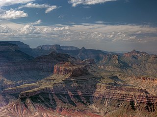
The Tonto Group is a name for an assemblage of related sedimentary strata, collectively known by geologists as a Group, that comprises the basal sequence Paleozoic strata exposed in the sides of the Grand Canyon. As currently defined, the Tonto groups consists of the Sixtymile Formation, Tapeats Sandstone, Bright Angel Shale, Muav Limestone, and Frenchman Mountain Dolostone. Historically, it included only the Tapeats Sandstone, Bright Angel Shale, and Muav Limestone. Because these units are defined by lithology and three of them interfinger and intergrade laterally, they lack the simple layer cake geology as they are typically portrayed as having and geological mapping of them is complicated.

The Neoproterozoic Nankoweap Formation, is a thin sequence of distinctive red beds that consist of reddish brown and tan sandstones and subordinate siltstones and mudrocks that unconformably overlie basaltic lava flows of the Cardenas Basalt of the Unkar Group and underlie the sedimentary strata of the Galeros Formation of the Chuar Group. The Nankoweap Formation is slightly more than 100 m in thickness. It is informally subdivided into informal lower and upper members that are separated and enclosed by unconformities. Its lower (ferruginous) member is 0 to 15 m thick. The Grand Canyon Supergroup, of which the Nankoweap Formation is part, unconformably overlies deeply eroded granites, gneisses, pegmatites, and schists that comprise Vishnu Basement Rocks.

The Shackleton Limestone is a Cambrian limestone formation of the Byrd Group of Antarctica. The age of the formation is established to be Cambrian Stage 3, dated at ranging from 520 to 516 Ma. This period correlates with the End-Botomian mass extinction. Fossils of trilobites and Marocella mira and Dailyatia have been found in the formation, named after Ernest Shackleton, who led a failed expedition into Antarctica. At time of deposition, the Antarctic Plate has been established to be just south of the equator as part of the supercontinent Pannotia, contrasting with its present position at 82 degrees southern latitude.

The Church of Saint George, Sopotnica is a Serbian Orthodox church and the protected National Monument located at the village of Donja Sopotnica in the Municipality of Novo Goražde in eastern Republika Srpska, Bosnia and Herzegovina. The church stands on the left bank of the Drina River, four kilometres from the town of Goražde. The church was built in 1454 and expended in 1455. Its benefactor was Stjepan Vukčić Kosača, while the patron saint of this church is Saint George of Lydda.

The Jordan Formation is a siliciclastic sedimentary rock unit identified in Illinois, Michigan, Wisconsin, Minnesota, and Iowa. Named for distinctive outcrops in the Minnesota River Valley near the town of Jordan, it extends throughout the Iowa Shelf and eastward over the Wisconsin Arch and Lincoln anticline into the Michigan Basin.
The Mount Whyte Formation is a stratigraphic unit that is present on the western edge of the Western Canada Sedimentary Basin in the southern Canadian Rockies and the adjacent southwestern Alberta plains. It was deposited during Middle Cambrian time and consists of shale interbedded with other siliciclastic rock types and limestones. It was named for Mount Whyte in Banff National Park by Charles Doolittle Walcott, the discoverer of the Burgess shale fossils, and it includes several genera of fossil trilobites.
One of the major depositional strata in the Himalaya is the Lesser Himalayan Strata from the Paleozoic to Mesozoic eras. It had a quite different marine succession during the Paleozoic, as most parts of it are sparsely fossiliferous or even devoid of any well-defined fossils. Moreover, it consists of many varied lithofacies, making correlation work more difficult. This article describes the major formations of the Paleozoic – Mesozoic Lesser Himalayan Strata, including the Tal Formation, Gondwana Strata, Singtali Formation and Subathu Formation.

Zemlja, was a term used in the Balkans during much of the Middle Ages as a unit in political-territorial state division, based on feudal social hierarchy, local administrative control and the feudal distribution of land. It was the largest unit of administration, which constituted a feudal state among South Slavic peoples of the Balkans at the time, Bosnia, Croatia, Montenegro (Zeta) and Serbia. The same term is known to be used among other Slavic nations of medieval Europe, namely Poles and Russians, who called it Zemlya, Ziemlia, or Ziemia, and although it has a similar meaning and significance it is not the same.
References
- 1 2 (ed.), Jingwen Mao ; Frank P. Bierlein (2005). Mineral deposit research: meeting the global challenge (1st ed.). Berlin: Springer. ISBN 978-3540279457.
{{cite book}}:|last1=has generic name (help)CS1 maint: multiple names: authors list (link) - ↑ Hrvatović, Hazim (2005). Geologic Guidebook through Bosnia and Hercegovina. Sarajevo: Geological Survey Sarajevo. ISBN 9789958935138.
- 1 2 3 4 Jurković, Ivan (2006). "Geology and Metallogeny of the Drina-Ivanjica Metamorphic Complex in Eastern Bosnia – Western Serbia". Rudarsko-geološko-naftni Zbornik. 18. Retrieved 29 August 2014.