
The letter yogh (ȝogh) was used in Middle English and Older Scots, representing y and various velar phonemes. It was derived from the Insular form of the letter g, Ᵹᵹ.
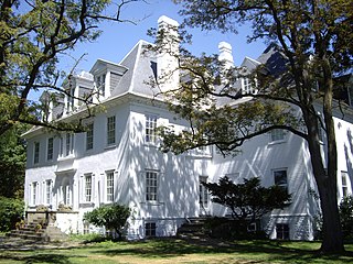
Clermont is a town in Columbia County, New York, United States. The population was 2,058 at the 2020 census. The name of the town is French for "Clear Mountain", in reference to the mountain views in the town.

Ringwood State Park is a 4,444 acres (17.98 km2) state park in Passaic County in northeastern New Jersey, USA. The Park is located in the heart of the Ramapo Mountains in Ringwood. Its forests are part of the Northeastern coastal forests ecoregion.
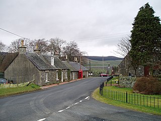
Drumelzier, is a village and civil parish on the B712 in the Tweed Valley in the Scottish Borders.

Duns Castle, Duns, Berwickshire is a historic house in Scotland, the oldest part of which, the massive Norman Keep or Pele Tower, supposedly dates from 1320. The castle and most of the structures on the property are designated as a scheduled ancient monument.

Anthony's Nose is a 900+ ft (270 m) peak in the Hudson Highlands along the east bank of the Hudson River in the hamlet of Cortlandt Manor, New York. It lies at the extreme northwest end of Westchester County, and serves as the east anchor of the Bear Mountain Bridge.

Tweedie or Tweedy is a Scottish clan name. The Clan Tweedie does not currently have a chief recognized by the Lord Lyon King of Arms and is therefore considered an Armigerous clan. However the surname is also considered a sept of the Clan Fraser. The name is derived from the lands of Tweedie which were along the Valley of the River Tweed in Peebleshire in the Scottish Borders.
Manor is a parish in Peeblesshire in the Scottish Borders, whose church lies on the west bank of Manor Water 3 miles south-west of Peebles.

Broughton, Glenholm and Kilbucho is a parish in Peeblesshire in the Scottish Borders, 11 miles south-west of Peebles, lying in the upper part of the valley of the River Tweed in the Southern Uplands. It is a union of three former parishes of bearing these names and the united parish is bound by Kirkurd on the north, Stobo on the east, Drumelzier on the south-east, Culter and Biggar, South Lanarkshire on the west and by Skirling in the north-west. For 4½ miles the eastern border of the parish follows the northward flowing Tweed. It is 9½ miles long north-to-south and 3½ miles wide. The only village is Broughton.
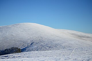
Cramalt Craig is a hill in the Manor Hills range, part of the Southern Uplands of Scotland. The second highest in the range and third highest in southern Scotland, it was previously also a Corbett until a 2013 survey by Alan Dawson found the col between it and Broad Law to be a few metres short of 500 feet. It is climbed almost solely from its southern sides at the Megget Stane or Cramalt Farm, taking in the neighbouring hills.
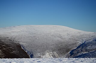
Dollar Law is a hill in the Manor Hills range, part of the Southern Uplands of Scotland. The third highest in the range and the Scottish Borders and fifth highest in southern Scotland, it is frequently climbed with its neighbours Broad Law and Cramalt Craig to the southwest from their direction or as a detour from the hills to the northwest near Drumelzier. Thief's Road, a historic heritage path, passes just south of the summit.
Pykestone Hill is a hill in the Manor Hills range, part of the Southern Uplands of Scotland. The highest of a small group of hills near the village of Drumelzier, they are themselves a western portion of the Manor Hills. The summit is characterised by a series of sharp, protruding stones, from which the hill likely derives its name. It is often climbed from Drumelzier itself or Stanhope farm to the west, but ascents from the Manor Valley to the east are also possible.
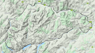
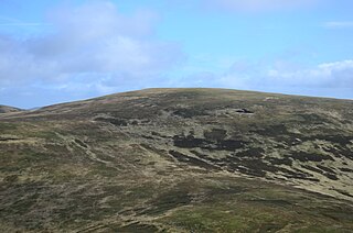
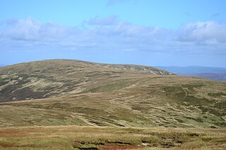
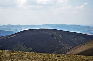
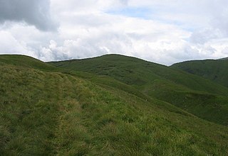
The Manor Hills, also known as the Tweedsmuir Hills, are a range of hills south of Peebles in the Scottish Borders, one of the ranges which collectively form the Southern Uplands. They are separated from the Moffat Hills by the Talla Reservoir, Megget Reservoir and St. Mary's Loch, the Moorfoot Hills by the A72 and the Culter Hills in South Lanarkshire by the A701. The western portion of the hills are designated as the 'Tweedsmuir Hills' Site of Special Scientific Interest and the 'Upper Tweeddale' National Scenic Area, with the major tributary rivers designated as Special Areas of Conservation.
Middle Hill is a hill in the Manor Hills range, part of the Southern Uplands of Scotland. It is often climbed from Drumelzier to the north or Stanhope Farm to the west, but ascents from the Manor Valley to the east are also possible.

Black Law is a hill in the Manor Hills range, part of the Southern Uplands of Scotland. One of the more remote Donalds, it does not easily combine into a round with other hills in the area and requires traversing rough terrain to reach the top. Common ascents are as part of an extended Dun Rig Horseshoe to the north-east, from the south at the Megget Reservoir or, most easily, from the Manor Valley itself.
Talla Cleuch Head is a hill in the Manor Hills range, part of the Southern Uplands of Scotland. As ascents are either long or steep from all other sides, Talla Cleuch Head is normally climbed from the Megget Stane to the southeast, which allows for a deer fence to be followed to the summit.
Stob Law is a hill in the Manor Hills range, part of the Southern Uplands of Scotland. It is normally climbed as an outlier of the Dun Rig horseshoe, starting from Peebles.

Birkscairn Hill is a hill in the Manor Hills range, part of the Southern Uplands of Scotland. It is the lowest, and normally first, Donald in a round of hills known as the Dun Rig Horseshoe, south of Peebles.
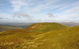
Greenside Law is a hill in the Manor Hills range, part of the Southern Uplands of Scotland. The lowest Donald hill in the range, it is situated at the head of the Manor Valley, with its position somewhat in-between the adjacent ridges on its west and east. The easiest ascents are from the Manor Valley itself to the north, or Craigierig Farm to the south.

