Moreau is a town in Saratoga County, New York, United States. The population was 13,826 at the 2000 census. The town is located in the northeast part of the county, north of Saratoga Springs. Moreau is named after Jean Victor Moreau, a French general, who visited the area just before the town was formed. The town contains a village called South Glens Falls.

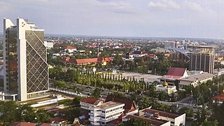
Pekanbaru is the capital of Indonesian province of Riau, and a major economic center on the eastern part of Sumatra Island. Its name is derived from the Malay words for 'new market' . It has an area of 632.26 km2 (244.12 sq mi), with a population of 897,767 at the 2010 Census, and 983,356 at the 2020 Census. It is located on the banks of the Siak River, which flows into the Strait of Malacca, Pekanbaru has direct access to the busy strait and has long been known as a trading port.

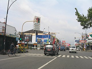
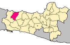
Pemalang Regency is a regency on the north coast of Central Java province in Indonesia. Its capital is the town of Pemalang. The regency is bordered by the Java Sea in the north, in the east by Pekalongan Regency, by Purbalingga Regency in the south, and by Tegal Regency in the west. It covers an area of 1,115.30 km2, and it had a population of 1,261,353 at the 2010 Census and 1,471,489 at the 2020 Census.

Purwokerto is a large but non-autonomous town on the island of Java, Indonesia. It is the capital of Banyumas Regency, Central Java province. The population of the town at the 2010 Census was 233,951 and 229,271 at the 2020 Census.

Salatiga is a city in Central Java province, Indonesia. It covers an area of 56.781 km2 and had a population of 192,322 at the 2020 Census. Located between the cities of Semarang and Surakarta, and administratively an independent city enclaved within Semarang Regency, it sits at the foot of Mount Merbabu (3,142 m) and Mount Telomoyo, and has a relatively cool climate due to its elevated position. Salatiga is a part of the Semarang metropolitan area.

Dumai, is a city in Riau province on the island of Sumatra, Indonesia. The city has an area of 1,727.38 km² and had 253,803 inhabitants at the 2010 Census, 285,448 at the 2015 Census and 316,782 at the 2020 Census. Dumai has a domestic airport, Pinang Kampai Airport. Dumai is an important transport and trade centre, both regionally and internationally, especially to Malaysia. Dumai is rich in oil.

Ciamis is a district which serves as the regency seat of Ciamis Regency in West Java, Indonesia.

Kebayoran Baru is a district of South Jakarta, Indonesia. The name of the district was derived from an area which was developed in the post-war period as a new suburb town of Jakarta, Kebayoran Baru. Kebayoran Baru was the last residential area to be developed by the Dutch colonial administration. The urban planning was laid in a concept of the Garden city movement, consisting of a well-planned residential area, a shopping center, and a business district, supported with civic facilities e.g. schools, places of worship, hospitals, and parks. Many important governmental institutions are located in Kebayoran Baru, such as the Indonesia Stock Exchange building, the ASEAN Secretariat building, the Criminal Investigation Agency of the National Police, and the City Hall of South Jakarta. Sudirman Central Business District is also located in Kebayoran Baru sub-district.

Tegal Regency is one of the regencies in the northwest part of Central Java province of Indonesia, with an area of 878.79 km2 (339.30 sq mi). The administrative center used to be in Tegal City, in the northwest corner of the regency, but then Tegal City was administratively separated from the regency and formed into its own territory. The city was later replaced as the administrative center of Tegal Regency by Slawi Town, which is a suburb about 20 km (12 mi) to the south of the city and within the district boundary. The regency had a population of 1,394,839 at the 2010 Census and 1,596,996 at the 2020 Census.
Grobogan Regency is a regency located in northeastern part of the Central Java province in Indonesia.

Pati Regency is a regency in the northeastern region of Central Java Province, on the island of Java in Indonesia. The regency covers an area of 1,503.68 km2, on the coast of the Java Sea. It had a population of 1,193,202 at the 2010 Census and 1,324,188 at the 2020 Census, comprising 660,484 males and 663,704 females. The administrative capital of Pati Regency is the town of Pati.

Purworejo is a regency in the southern part of Central Java province in Indonesia. It covers an area of 1,034.82 km2 and had a population of 695,427 at the 2010 Census and 769,880 at the 2020 Census. Its capital is the town of Purworejo.

Candi Plaosan, also known as the 'Plaosan Complex', is one of the Buddhist temples located in Bugisan village, Prambanan district, Klaten Regency, Central Java, Indonesia, about 1 kilometre to the northeast of the renowned Hindu Prambanan Temple.
Kiyangkongrejo, more commonly referred to as Kiyangkong, is a village in the district of Kutoarjo, Purworejo, Central Java, Indonesia. Located less than 5 kilometers from the city of Kutoarjo.
Gesang is a small town located the Tempeh subdistrict of East Java, approximately 30 minutes drives from Lumajang and 4 hours from Surabaya. It borders the towns of Jokarto (North), Pulo (East), Jatisari, Semumu (South) and Nguter (West).
Indonesian National Route 1 is a major road in Java, Indonesia. It passes through 5 provinces along the north coast, Banten, Jakarta, West Java, Central Java and East Java. It connects Merak and Ketapang. Merak is a ferry terminal to Sumatra and Ketapang is ferry terminal to Bali. This national route is also called "Pantura" or "Trans-Java". Besides the arterial roads, the route also includes the entirety of the Trans-Java Toll Road.
Indonesian National Route 2 connects Jakarta and Cibadak, Sukabumi. It runs from north to south. It passes two provinces, namely Jakarta and West Java.
Kemang is a neighborhood in southern part of Jakarta, Indonesia. The area is located mostly in Bangka subdistrict of Mampang Prapatan and partly within Pejaten subdistrict of Pasar Minggu. The main area of Kemang is marked by the roads of Kemang Raya, Prapanca, and Bangka Streets.

Kedungbanteng is a sub-district located in part of eastern of Tegal, Central Java, Indonesia. Kedungbanteng Sub-district is 8 km drive from the center of regency namely Slawi Town through southern of Pangkah sub-district. The central government is located in the village of Kedungbanteng.


