Huntingdonshire is a non-metropolitan district of Cambridgeshire and a historic county of England. The district council is based in Huntingdon. Other towns include St Ives, Godmanchester, St Neots and Ramsey. The population was 169,508 at the 2011 Census.

Ouse Washes is a linear 2,513.6 hectare biological Site of Special Scientific Interest stretching from near St Ives in Cambridgeshire to Downham Market in Norfolk. It is also a Ramsar internationally important wetland site, a Special Protection Area under the European Union Birds Directive, a Special Area of Conservation, and a Nature Conservation Review site, Grade I. An area of 186 hectares between March and Ely is managed by the Wildlife Trust for Bedfordshire, Cambridgeshire and Northamptonshire, and another area near Chatteris is managed by the Royal Society for the Protection of Birds. The Wildfowl & Wetlands Trust manages another area near Welney.

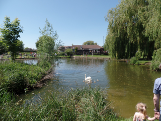
St Neots is a town in the Huntingdonshire District of the county of Cambridgeshire, England. It lies about 50 miles (80 km) north of London and about 18 miles (29 km) west of Cambridge. The districts of Eynesbury, Cambridgeshire, Eaton Ford and Eaton Socon were formerly independent but nowadays are considered merged into St Neots.

Eynesbury is an urban area forming part of St Neots in Cambridgeshire, England. It mainly consists of housing, although there is an area of light industry, and a large supermarket. Eynesbury is home to Ernulf Academy and a fitness centre called One Leisure. In addition there is a large area of open grassland and a caravan park. In earlier times Eynesbury was a distinct area, but nowadays it is considered to be a subdivision of St Neots.
Eaton Ford is an area of St Neots, Cambridgeshire, England. It is a mainly residential area also containing Riverside Park, a large area of riverside parkland. Much of the housing stock dates from the period of London overspill during the 1960s and subsequently. The former village green is still in place.
Eaton Socon is a community in south-west Cambridgeshire. Eaton Socon is a component of the town of St Neots, located on its south-west margin. Eaton Socon lies on the west side of the River Great Ouse, and is bounded on the west by the A1 road and on the south by the A428 road. On the north side Duloe Brook delineates the boundary with Eaton Ford, which is also part of St Neots.

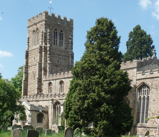
St Neots is one of the largest towns in Cambridgeshire, England, after the cities of Cambridge and Peterborough. There is evidence of very early occupation in the area. In Roman times a fortified settlement was established, and present-day Eynesbury in particular became important, in addition to scattered settlements west of the River Great Ouse. A holy man named Saint Neot had died about the year 877 AD and his relics were held for a century in a parish in Cornwall. About 974 AD a Priory was established in the northern part of Eynesbury; the landowner took the relics of Saint Neot from the Cornish church and conveyed them to Eynesbury. This brought fame to the Eynesbury Priory, and gradually that part of the town became known as St Neots.

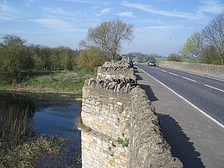
Little Barford is a hamlet and civil parish in the Borough of Bedford in Bedfordshire, England about 7 miles (11 km) northeast of the county town of Bedford.

The Ouse Valley Way is a 150-mile footpath in England, following the River Great Ouse from its source near Syresham in Northamptonshire to its mouth in The Wash near King's Lynn. The path begins outside the King's Head pub in Syresham (52.0683°N 1.0807°W) and ends on the Green Quay in King's Lynn (52.7512°N 0.3935°E).
The River Ouzel, also known as the River Lovat, is a river in England, and a tributary of the River Great Ouse. It rises in the Chiltern Hills and flows 20 miles north to join the Ouse at Newport Pagnell.
The A428 road is a major road in central and eastern England. It runs between the cities of Coventry and Cambridge by way of the county towns of Northampton and Bedford. Together with the A421,, the eastern section of the A428 forms the route between Cambridge and Oxford. The A428 was formerly part of the main route from Birmingham to Felixstowe before the A14 was fully opened in 1993.

The River Kym is a river in Cambridgeshire, England. It flows through the village of Tilbrook, to Kimbolton, and joins the Great Ouse at St Neots. It is known as the River Til in its upper reaches, tributaries include the Pertenhall Brook.
Wyboston is a village in the English county of Bedfordshire. The eastern part of the village is dominated by the A1 Great North Road. Approaching the Black Cat Roundabout from the Bedford direction, the parish boundary is in the centre of the A421 road. The northern junction of these roads is grade-separated. The Black Cat Roundabout is therefore partly within Wyboston parish.
Eaton Socon was a rural district in Bedfordshire, England from 1894 to 1934.

Eaton Socon Castle was a Norman fortification. It was constructed next to the River Great Ouse in what is now Eaton Socon, Cambridgeshire, England.

Begwary Brook in Bedfordshire is a four mile long tributary of the River Great Ouse. Its source is half a mile north of Duck's Cross, and it then flows east to join the Great Ouse in Wyboston. The Environment Agency classes its water quality as good.
Roxton is a small village and civil parish in the Borough of Bedford, Bedfordshire, England about 7 miles (11 km) north-east of the county town of Bedford.

Staploe is a village and civil parish located in the Borough of Bedford in Bedfordshire, England.

St Neots Common is a 33.4 hectare biological Site of Special Scientific Interest in St Neots in Cambridgeshire.

St Neots was a rural district in Huntingdonshire, England from 1894 to 1974, around the northern and eastern sides of the urban area of St Neots.
