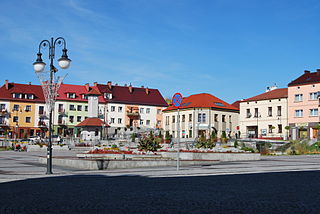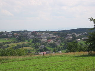
Trzebinia is a town in Chrzanów County, Lesser Poland, Poland with an Orlen oil refinery and a major rail junction of the Kraków - Katowice line, with connections to Oświęcim and Spytkowice. The town became part of Lesser Poland Voivodeship after being part of Katowice Voivodeship (1975–1998). With population of 20,175, Trzebinia is an important industrial center. The town lies in the Kraków-Częstochowa Upland, 269 to 407 m above sea level. Trzebinia is a rail and road hub, and lies at a junction of the A4 Motorway and National Road Nr. 79. The distance to John Paul II International Airport Kraków-Balice is 30 kilometres.

Chrzanów County is a unit of territorial administration and local government (powiat) in Lesser Poland Voivodeship, southern Poland. It came into being on January 1, 1999, as a result of the Polish local government reforms passed in 1998. Its administrative seat and largest town is Chrzanów, which lies 40 kilometres (25 mi) west of the regional capital Kraków. The county contains three other towns: Trzebinia, 8 km (5 mi) north-east of Chrzanów, Libiąż, 8 km (5 mi) south-west of Chrzanów, and Alwernia, 12 km (7 mi) south-east of Chrzanów.

Kraków Voivodeship was a unit of administrative division and local government in Poland in years 1919–1939. Back then, it covered a big chunk of the southern part of the country, including such cities as Kraków, Jaworzno and Tarnów. Capital city: Kraków.
Gmina Chrzanów is a rural gmina in Janów Lubelski County, Lublin Voivodeship, in eastern Poland. Its seat is the village of Chrzanów, which lies approximately 15 kilometres (9 mi) north-east of Janów Lubelski and 53 km (33 mi) south of the regional capital Lublin.

Gmina Chrzanów is an urban-rural gmina in Chrzanów County, Lesser Poland Voivodeship, in southern Poland. Its seat is the town of Chrzanów, which lies approximately 40 kilometres (25 mi) west of the regional capital Kraków.
Gmina Alwernia is an urban-rural gmina in Chrzanów County, Lesser Poland Voivodeship, in southern Poland. Its seat is the town of Alwernia, which lies approximately 12 kilometres (7 mi) south-east of Chrzanów and 31 km (19 mi) west of the regional capital Kraków.
Gmina Babice is a rural gmina in Chrzanów County, Lesser Poland Voivodeship, in southern Poland. Its seat is the village of Babice, which lies approximately 8 kilometres (5 mi) south-east of Chrzanów and 36 km (22 mi) west of the regional capital Kraków.
Gmina Trzebinia is an urban-rural gmina in Chrzanów County, Lesser Poland Voivodeship, in southern Poland. Its seat is the town of Trzebinia, which lies approximately 8 kilometres (5 mi) north-east of Chrzanów and 35 km (22 mi) west of the regional capital Kraków.

Tenczynek Landscape Park is a protected area in southern Poland, established in 1981, and covering an area of 117.47 square kilometres (45.36 sq mi).
Poręba Żegoty is a village in the administrative district of Gmina Alwernia, within Chrzanów County, Lesser Poland Voivodeship, in southern Poland. It lies approximately 4 kilometres (2 mi) east of Alwernia, 15 km (9 mi) south-east of Chrzanów, and 27 km (17 mi) west of the regional capital Kraków.

Regulice is a village in the administrative district of Gmina Alwernia, within Chrzanów County, Lesser Poland Voivodeship, in southern Poland. It lies approximately 3 kilometres (2 mi) north-east of Alwernia, 11 km (7 mi) south-east of Chrzanów, and 30 km (19 mi) west of the regional capital Kraków.
Bolęcin is a village in the administrative district of Gmina Trzebinia, within Chrzanów County, Lesser Poland Voivodeship, in southern Poland. It lies approximately 4 kilometres (2 mi) south of Trzebinia, 6 km (4 mi) east of Chrzanów, and 34 km (21 mi) west of the regional capital Kraków.

Czyżówka is a village in the administrative district of Gmina Trzebinia, within Chrzanów County, Lesser Poland Voivodeship, in southern Poland. It lies approximately 5 kilometres (3 mi) north of Trzebinia, 10 km (6 mi) north-east of Chrzanów, and 38 km (24 mi) northwest of the regional capital Kraków. The village is located in the historical region, Galicia.

Karniowice is a village in the administrative district of Gmina Trzebinia, within Chrzanów County, Lesser Poland Voivodeship, in southern Poland. It lies approximately 3 kilometres (2 mi) east of Trzebinia, 10 km (6 mi) north-east of Chrzanów, and 33 km (21 mi) west of the regional capital Kraków.

Młoszowa is a village in the administrative district of Gmina Trzebinia, within Chrzanów County, Lesser Poland Voivodeship, in southern Poland. It lies approximately 3 kilometres (2 mi) south-east of Trzebinia, 8 km (5 mi) east of Chrzanów, and 33 km (21 mi) west of the regional capital Kraków.

Myślachowice is a village in the administrative district of Gmina Trzebinia, within Chrzanów County, Lesser Poland Voivodeship, in southern Poland. It lies approximately 2 kilometres (1 mi) north of Trzebinia, 9 km (6 mi) north-east of Chrzanów, and 36 km (22 mi) north-west of the regional capital Kraków.
Piła Kościelecka is a village in the administrative district of Gmina Trzebinia, within Chrzanów County, Lesser Poland Voivodeship, in southern Poland. It lies approximately 5 kilometres (3 mi) south-west of Trzebinia, 4 km (2 mi) east of Chrzanów, and 36 km (22 mi) west of the regional capital Kraków.

Płoki is a village in the administrative district of Gmina Trzebinia, within Chrzanów County, Lesser Poland Voivodeship, in southern Poland. It lies approximately 5 kilometres (3 mi) north-east of Trzebinia, 12 km (7 mi) north-east of Chrzanów, and 34 km (21 mi) north-west of the regional capital Kraków. The village is located in the historical region Galicia.

Psary is a village in the administrative district of Gmina Trzebinia, within Chrzanów County, Lesser Poland Voivodeship, in southern Poland. It lies approximately 4 kilometres (2 mi) east of Trzebinia, 11 km (7 mi) north-east of Chrzanów, and 32 km (20 mi) north-west of the regional capital Kraków.

The Jewish cemetery of Chrzanów in the Lesser Poland Voivodeship is located outside the centre.


