Sierra County is a county located in the U.S. state of California. As of the 2020 census, the population was 3,236, making it California's second-least populous county. The county seat is Downieville; the sole incorporated city is Loyalton. The county is in the Sierra Nevada, northeast of Sacramento on the border with Nevada.

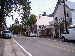
Downieville is a census-designated place in and the county seat of Sierra County, California, United States. Downieville is on the North Fork of the Yuba River, at an elevation of 2,966 feet (904 m). The 2020 United States census reported Downieville's population was 290.

The Gold Country is a historic region in the northern portion of the U.S. state of California, that is primarily on the western slope of the Sierra Nevada. It is famed for the mineral deposits and gold mines that attracted waves of immigrants, known as the 49ers, during the 1849 California Gold Rush.

State Route 49 is a north–south state highway in the U.S. state of California that passes through many historic mining communities of the 1849 California gold rush and it is known as the Golden Chain Highway. The highway's creation was lobbied by the Mother Lode Highway Association, a group of locals and historians seeking a single highway to connect many relevant locations along the Gold Rush to honor the 49ers. One of the bridges along SR 49 is named for the leader of the association, Archie Stevenot.

The Yuba River is a tributary of the Feather River in the Sierra Nevada and eastern Sacramento Valley, in the U.S. state of California. The main stem of the river is about 40 miles (64 km) long, and its headwaters are split into three major forks. The Yuba River proper is formed at the North Yuba and Middle Yuba rivers' confluence, with the South Yuba joining a short distance downstream. Measured to the head of the North Yuba River, the Yuba River is just over 100 miles (160 km) long.

The Bridgeport Covered Bridge is located in Bridgeport, Nevada County, California, southwest of French Corral and north of Lake Wildwood. It is used as a pedestrian crossing over the South Yuba River. The bridge was built in 1862 by David John Wood. Its lumber came from Plum Valley in Sierra County, California. The bridge was closed to vehicular traffic in 1972 and pedestrian traffic in 2011 due to deferred maintenance and "structural problems".

Sierra City is a census-designated place in Sierra County, California, United States. The elevation of Sierra City is 4,147 feet (1,264 m), and the town is situated in the canyon of the North Yuba River on California State Route 49, twelve miles northeast of the county seat of Sierra County, Downieville. The population was 221 at the 2010 census.

The 19th Street Bridge is a two-span through Pratt truss road bridge in Denver, Colorado, over the South Platte River, now used for pedestrians. It was built in 1888 to replace a wooden structure and carried automobile traffic until 1986. The bridge is listed on the National Register of Historic Places.

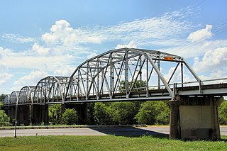
The Montopolis Bridge is a historic Parker through truss bridge in Austin, Texas. It is located in the Montopolis neighborhood where a bicycle and pedestrian walkway crosses the Colorado River in southeastern Travis County. The bridge consists of five 200-foot Parker through truss spans and four 52-foot steel I-beam approach spans resting on reinforced concrete abutments. It was added to the National Register of Historic Places on October 10, 1996. The Montopolis Bridge sits at the best crossing of the Colorado River in the area with the historic crossing of the El Camino Real de los Tejas National Historic Trail just to the east.

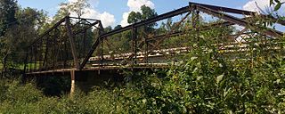
The Bell Road Bridge is a Pratt through truss bridge in Dexter Township, Washtenaw County, Michigan. Built in 1891, the bridge carried Bell Road over the Huron River. From 1997 to 2018, the bridge sat on the riverbank, overgrown with brush. The bridge is a Michigan State Historic Site and is listed on the National Register of Historic Places.

The Dinkey Creek Bridge, also known as Fresno County Bridge No. 42C-04, is a single-span, timber bowstring arch truss bridge that crosses Dinkey Creek in Fresno County, California, within Sierra National Forest. Built in 1938, it closed to automobile traffic in 1965 and was renovated in 1988 to replace rotting timbers. Designed by T.K. May, it was built by the U.S. Forest Service with Civilian Conservation Corps (CCC) labor. The structure was listed on the National Register of Historic Places in 1996.

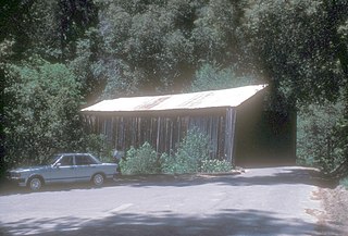
Oregon Creek Covered Bridge is a historic bridge that spans Oregon Creek just above its confluence with Middle Yuba River. It is located approximately 3 miles northeast of the community of North San Juan just off California State Route 49 within the Oregon Creek Day Use Area of the Tahoe National Forest.

The South Street Bridge is a historic Pratt truss bridge, carrying Vermont Route 31 across the Poultney River just south of the village center of Poultney, Vermont. Built in 1923, it is one of a small number of surviving Pratt through trusses in the state, and one of just three that survives from the period before the state's devastating 1927 floods. It was listed on the National Register of Historic Places in 2009 as Bridge 4.

The Powell Bridge is a National Register of Historic Places site that crosses Big Sugar Creek near the community of Powell, Missouri, a rural hamlet in McDonald County, Missouri in the Ozark Mountains region. The bridge was built by the East St. Louis Bridge Co. and was opened to traffic on August 16, 1915. The single-lane pin-connected Pratt through truss was open to vehicular traffic from 1915 until a new two-lane bridge was built and opened beside it in 2015. It is currently owned by the Powell Historic Preservation Society and is one of three sites in McDonald County on the National Register of Historic Places, which also includes the Old McDonald County Courthouse. The community of Powell itself is best known as the home of famed gospel writer Albert E. Brumley.

The Gould's Mill Bridge is a historic Baltimore through truss bridge, carrying Paddock Street across the Black River in Springfield, Vermont. The bridge was built by the Boston Bridge Works Company in 1929 after major flooding in 1927, and is one of the state's few examples of a Baltimore truss. It was listed on the National Register of Historic Places in 2006.

Arch Street Bridge is Parker truss bridge over the Passaic River in Paterson, New Jersey. It was built in 1907 and rehabilitated in 1997. It was the third structure built at the location within a few years; the prior bridges were destroyed by floods in 1902 and 1903.

The Railroad Street Bridge is a historic Pratt through truss bridge, carrying Railroad Street across the Lamoille River in Johnson, Vermont. It was built in 1928, after the state's devastating 1927 floods, and is one of its few surviving Pratt through truss bridges. It was listed on the National Register of Historic Places in 2007 as Bridge 6.

Hospital Bridge, in Downieville, California, was built in 1910. It brings Upper Main St. over the Downie River. It was listed on the National Register of Historic Places in 2012.

The Hansen Bridge is a truss bridge that spans the Downie River, connecting Upper Main and Pearl Streets in Downieville, California. Constructed in 1935, it is a rare surviving example of a one-lane, side-panel steel Pratt truss bridge. On July 10, 2012, the bridge was added the National Register of Historic Places in recognition of its historical and architectural importance. Also known as Scott's Bridge, or the Peral Street Bridge, it was the only bridge in the area to survive the 1937 flood.

The Jersey Bridge is a truss bridge that carries traffic connecting Main and Commercial Streets over the Downie River in Downieville, California. Constructed in 1938, it is a rare surviving example of a one-lane, steel, rigid-connected polygonal Parker through Pratt truss span. On July 10, 2012, the bridge was listed on the National Register of Historic Places, recognizing its historical and architectural significance. The bridge is also known as the Highway 49 Bridge, or Downie River Bridge and continues to carry California State Route 49.


