
Durundur Mission was an Aboriginal reserve in Queensland, Australia. It operated from 1877 to 1905 in the area now known as Woodford in the City of Moreton Bay.
Durundur Mission was an Aboriginal reserve in Queensland, Australia. It operated from 1877 to 1905 in the area now known as Woodford in the City of Moreton Bay.
Since colonisation, Aboriginal people and Torres Strait Islander people have been subject to a range of legislative and other forms of control. Prior to the separation of Queensland from New South Wales on 10 December 1859, the Native Police were the main instrument of colonial authority and order in relation to Aboriginal people on the mainland. Torres Strait Islander people initially came under the jurisdiction of the Police Magistrate on Thursday Island, and later, for a short time, the Government Resident of the island. After separation, the administration of Indigenous affairs was transferred to the Colonial Secretary's Office for Queensland and from 1896 the Home Secretary's Office. [1]
In 1897 the Queensland Government introduced legislation called the Aboriginals Protection and Restriction of the Sale of Opium Act 1897 (Qld). This Act created the positions of Protectors of Aboriginals, and in 1904, the Office of the Chief Protector of Aboriginals. The 1897 Act and the subsequent amending Acts of 1901, 1927, 1928 and 1934 gave the Chief Protector of Aboriginals, as well as the individual Protectors, enormous control over almost all aspects of the lives of Aboriginal and Torres Strait Islander people in Queensland. [1]
Prior to the introduction of the Aboriginals Protection and Restriction of the Sale of Opium Act 1897 (Qld.), a number of Aboriginal and Torres Strait Islander mission stations had been established by religious organisations in Queensland and small amounts of land throughout Queensland had been gazetted as reserves for the use of Aboriginal people. With the passing of the 1897 'Protection' Act, all Aboriginal reserves became subject to the Act. For a number of these reserves Superintendents were appointed to carry out the provisions of the Act. Missionaries in charge of Aboriginal settlements also became Superintendents. [2]
The majority of Aboriginal reserves in Queensland were never "managed" reserves; that is no Superintendent was appointed. Unmanaged reserves were usually controlled by the Local Protector of Aborigines. [2]
In March 1877, 3,000 acres (1,200 ha) of land were gazetted as an Aboriginal reserve in the parish of Durundur near Monkeybong Creek. [3] [4] [5] At that time more than two hundred Aboriginal people were camped there under the supervision of the Rev Duncan McNab. In 1878 an amendment to the original notice was made noting the size of the reserve as 2,130 acres (860 ha). [6] [2]
In January 1905, the Queensland Government decided to close Durundur Mission. [7] It was closed on 1 March 1905 and the remaining inmates transferred to Barambah Mission. 61 people were forced to walk to Barambah, with the remaining 115 inmates taken by train. [8] [2]
The Torres Strait Islands are an archipelago of at least 274 small islands in the Torres Strait, a waterway separating far northern continental Australia's Cape York Peninsula and the island of New Guinea. They span an area of 48,000 km2 (19,000 sq mi), but their total land area is 566 km2 (219 sq mi).

Wujal Wujal, sometimes spelt Wudjil Wudjil, is a rural town and locality in the Wujal Wujal Aboriginal Shire, Queensland, Australia. It is an Aboriginal community. In the 2021 census, the locality of Wujal Wujal had a population of 276 people.
The Australian colonies in the nineteenth century created offices involved in managing the affairs of Indigenous people in their jurisdictions.

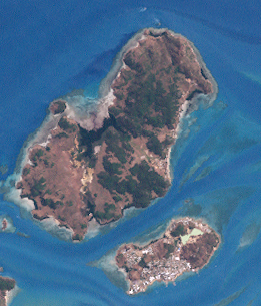
Saibai Island, commonly called Saibai, is an island of the Torres Strait Islands archipelago, located in the Torres Strait of Queensland, Australia. The island is situated north of the Australian mainland and south of the island of New Guinea. The island is a locality within the Torres Strait Island Region local government area. The town of Saibai is located on the north-west coast of the island.

Seisia is a coastal town and a locality in the Northern Peninsula Area Region, Queensland, Australia. In the 2021 census, the locality of Seisia had a population of 293 people.

Pormpuraaw is a coastal town and a locality in the Aboriginal Shire of Pormpuraaw, Queensland, Australia. Pormpuraaw is an Aboriginal community situated on the west coast of Cape York Peninsula approximately halfway between Karumba and Weipa on the Edward River. It is 650 kilometres (400 mi) by road from Cairns. Pormpuraaw currently has a 4-man police station.
Doomadgee is a town and a locality in the Aboriginal Shire of Doomadgee, Queensland, Australia. It is a mostly Indigenous community, situated about 140 kilometres (87 mi) from the Northern Territory border, and 93 kilometres (58 mi) west of Burketown.
Hammond Island is an island with a town of the same name, in the Torres Strait, Queensland, Australia. It is the only island within the locality of Keriri Island within the local government area of Torres Strait Island Region. In the 2021 census, Hammond Island had a population of 261 people, of whom 253 (96.9%) identified as Indigenous Australians.

Moa Island, also called Banks Island, is an island of the Torres Strait Islands archipelago that is located 40 kilometres (25 mi) north of Thursday Island in the Banks Channel of Torres Strait, Queensland, Australia. It is also a locality within the Torres Strait Island Region local government area. This island is the largest within the "Near Western" group. It has two towns, Kubin on the south-west coast and St Pauls on the east coast, which are connected by bitumen and a gravel road. In the 2021 census, Moa Island had a population of 432 people.

Coconut Island, Poruma Island, or Puruma in the local language, is an island in the Great North East Channel near Cumberland Passage, Torres Strait, Queensland, Australia. One of the Torres Strait Islands, Coconut Island is 130 kilometres (81 mi) northeast of Thursday Island. Administratively, Coconut Island is a town and Poruma Island is the locality within the Shire of Torres.

Mossman Gorge is a rural locality in the Shire of Douglas, Queensland, Australia. In the 2021 census, Mossman Gorge had a population of 248 people.
The Aboriginals Protection and Restriction of the Sale of Opium Act 1897(Qld), was an Act of the Parliament of Queensland. It was the first instrument of separate legal control over Aboriginal peoples, and was more restrictive than any contemporary legislation operating in other states. It also implemented the creation of Aboriginal reserves to control the dwelling places and movement of the people.

Stephens Island, called Ugar in the local Meriam language, lies in the eastern group of the Torres Strait Islands archipelago of Queensland, Australia. The island is within the locality of Ugar Island within the local government area of the Torres Strait Island Region.

Cherbourg, formerly known as Barambah, Barambah Aboriginal Settlement and Cherbourg Aboriginal Settlement, is a rural town and locality in the Aboriginal Shire of Cherbourg, Queensland, Australia.

The Aboriginal Shire of Doomadgee is a special local government area in North West Queensland, Queensland, Australia. It is managed under a Deed of Grant in Trust under the Local Government Act 2004.
In Australia, Indigenous land rights or Aboriginal land rights are the rights and interests in land of Aboriginal Australians and Torres Strait Islander people; the term may also include the struggle for those rights. Connection to the land and waters is vital in Australian Aboriginal culture and to that of Torres Strait Islander people, and there has been a long battle to gain legal and moral recognition of ownership of the lands and waters occupied by the many peoples prior to colonisation of Australia starting in 1788, and the annexation of the Torres Strait Islands by the colony of Queensland in the 1870s.
An Aboriginal reserve, also called simply reserve, was a government-sanctioned settlement for Aboriginal Australians, created under various state and federal legislation. Along with missions and other institutions, they were used from the 19th century to the 1960s to keep Aboriginal people separate from the white Australian population. The governments passed laws related to such reserves that gave them much power over all aspects of Aboriginal people’s lives.

Dauan Island is an island in the Torres Strait, Queensland, Australia; it is also known as Cornwallis Island. Dauan Island is also a town and locality in the Torres Strait Island Region, Queensland, Australia. In the 2021 census, the locality of Dauan Island had a population of 131 people.

Masig Island is an island and locality in the Torres Strait Island Region, Queensland, Australia. In the 2021 census, Masig Island had a population of 283 people.

Palm Island Aboriginal Settlement, later officially known as Director of Native Affairs Office, Palm Island and also known as Palm Island Aboriginal Reserve, Palm Island mission and Palm Island Dormitory, was an Aboriginal reserve and penal settlement on Great Palm Island, the main island in the Palm Island group in North Queensland, Australia. It was the largest and most punitive reserve in Queensland.
![]() This Wikipedia article incorporates text from Community History published by the State Library of Queensland under CC BY licence , accessed on 14 April 2019.
This Wikipedia article incorporates text from Community History published by the State Library of Queensland under CC BY licence , accessed on 14 April 2019.
![]() This Wikipedia article incorporates text from Aboriginal and Torres Strait Islander missions and reserves in Queensland published by the State Library of Queensland under CC BY licence , accessed on 14 April 2019.
This Wikipedia article incorporates text from Aboriginal and Torres Strait Islander missions and reserves in Queensland published by the State Library of Queensland under CC BY licence , accessed on 14 April 2019.
![]() Media related to Durundur Mission at Wikimedia Commons
Media related to Durundur Mission at Wikimedia Commons