
The Patuxent River is a tributary of the Chesapeake Bay in the state of Maryland. There are three main river drainages for central Maryland: the Potomac River to the west passing through Washington, D.C., the Patapsco River to the northeast passing through Baltimore, and the Patuxent River between the two. The 908-square-mile (2,352 km2) Patuxent watershed had a rapidly growing population of 590,769 in 2000. It is the largest and longest river entirely within Maryland, and its watershed is the largest completely within the state.

Savage is an unincorporated community and census-designated place located in Howard County, Maryland, United States, approximately 18 miles (29 km) south of Baltimore and 21 miles (34 km) north of Washington, D.C. It is situated close to the city of Laurel and to the planned community of Columbia. As of the 2020 census, it had a population of 7,542. The former mill town is a registered historic place, and has several original buildings preserved within and around the Savage Mill Historic District.
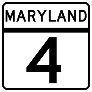
Maryland Route 4 is a state highway in the U.S. state of Maryland. The highway runs 64.85 miles (104.37 km) from MD 5 in Leonardtown north to Southern Avenue in Suitland at the District of Columbia boundary, beyond which the highway continues into Washington as Pennsylvania Avenue. MD 4 is a four- to six-lane highway that connects Washington and communities around Interstate 95 (I-95)/I-495 with southern Prince George's County with southwestern Anne Arundel County. The highway is the primary highway for the length of Calvert County, during most of which the route runs concurrently with MD 2. MD 4 also connects Calvert and St. Mary's counties via the Governor Thomas Johnson Bridge across the Patuxent River. The highway connects the Southern Maryland county seats of Leonardtown, Prince Frederick, and Upper Marlboro.

The Patuxent Wildlife Research Center is a biological research center in Laurel, Maryland, part of the Eastern Ecological Science Center (EESC) of the U.S. Geological Survey (USGS). The EESC is the largest of the 15 USGS research centers. The Patuxent facility is located on the grounds of the 12,841-acre (51.97 km2) Patuxent Research Refuge, managed by the U.S. Fish and Wildlife Service (FWS). This is the only National Wildlife Refuge in the United States initially established to support wildlife research.

Maryland Route 175 is a state highway in the U.S. state of Maryland. The highway runs 17.01 miles (27.37 km) from Little Patuxent Parkway in Columbia east to MD 3 in Millersville. MD 175 is a major highway through the large unincorporated community of Columbia; the highway connects U.S. Route 29 next to Columbia Town Center with Interstate 95 (I-95) and an industrial area on the eastern side of Howard County. MD 175 also connects Fort Meade with Jessup and Odenton in western Anne Arundel County, where it links MD 295 and MD 32 with the eastern part of the U.S. Army base.
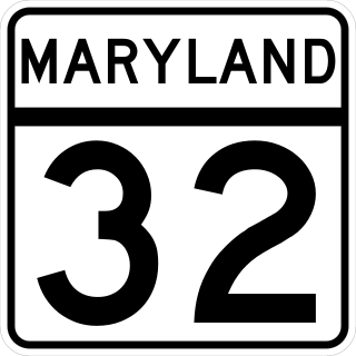
Maryland Route 32 (MD 32) is a state highway in the U.S. state of Maryland. The road runs 51.79 miles (83.35 km) from Interstate 97 (I-97) and MD 3 in Millersville west and north to Washington Road in Westminster. The 30 mile four- to six-lane freeway portion of MD 32 is the Patuxent Freeway between I-97 and I-70 in West Friendship. The freeway passes through Odenton and Fort Meade, the site of Fort George G. Meade and the National Security Agency (NSA), in western Anne Arundel County and along the southern part of Columbia in Howard County. Via I-97, MD 32 connects those communities with U.S. Route 50 (US 50)/US 301 in Annapolis. MD 32 also intersects the four primary highways connecting Baltimore and Washington: the Baltimore–Washington Parkway, US 1, I-95, and US 29. MD 32's north–south section, Sykesville Road, connects West Friendship and Westminster by way of Sykesville and Eldersburg in southern Carroll County.
The Washington, Baltimore and Annapolis Trail (WB&A) is a 10.25-mile (16.50 km) long, discontinuous rail trail from Lanham to Odenton in Maryland. The trail gets its name from the Washington, Baltimore and Annapolis Electric Railway on whose right-of-way it runs, but does not connect to any of the cities in its name.
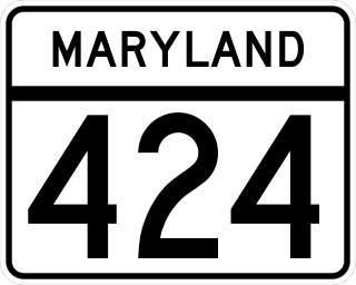
Maryland Route 424 is a state highway in the U.S. state of Maryland. Known as Davidsonville Road, the highway runs 8.24 miles (13.26 km) from MD 214 in Davidsonville north to MD 3 in Crofton. MD 424 connects U.S. Route 50 /US 301 with the two communities in central Anne Arundel County. The highway was constructed from Davidsonville to what is now MD 450 in the late 1920s. MD 424 was extended to what is now MD 3 in the late 1940s. The highway's interchange with US 50 opened in the early 1950s when the U.S. Highway was relocated between Bowie and Annapolis. MD 424 temporarily extended south to MD 2 in the early to mid-1950s and north to the Little Patuxent River in the 1970s and early 1980s.
Davidsonville is an unincorporated community in central Anne Arundel County, Maryland, United States. It is a semi-rural community composed mostly of farms and suburban-like developments and is a good example of an "exurb." Davidsonville has relatively little commercial development and no high-density housing. The community is generally not served by public water, sewer or natural gas utilities, so homes generally employ well-and-septic systems. The nominal, if not geographic, center of Davidsonville is the intersection of Maryland routes 424 and 214, located at 38.9229°N 76.6284°W. The Davidsonville Historic District was listed on the National Register of Historic Places in 1992.
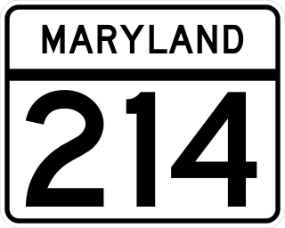
Maryland Route 214 is a state highway in the U.S. state of Maryland. Known for most of its length as Central Avenue, the highway runs 24.97 miles (40.19 km) from Southern Avenue and East Capitol Street at the District of Columbia boundary in Capitol Heights east to Beverley Beach. MD 214 connects the central Prince George's County suburbs of Capitol Heights, Seat Pleasant, Largo, and Bowie with the southern Anne Arundel County communities of Davidsonville and Edgewater and several beach villages along the Chesapeake Bay. The highway connects Interstate 95 (I-95)/I-495 to Northwest Stadium, Six Flags America, and several stations of the Washington Metro's Blue and Silver lines, which the route parallels between Capitol Heights and Largo.
Queen Anne in Prince George's County, Maryland, United States, is a former port on the Patuxent River. It was delineated as a CDP for the 2010 census, at which time it had a population of 1,280. Per the 2020 census, the population was 1,405.

Mareen Duvall (1625–1694) was a French Huguenot and an early American settler.
Jacob Henderson was an Irish clergyman and philologist who emigrated to the colonial Provinces of Pennsylvania, then Maryland, where he became a prominent land owner and church leader.

Snowden Hall is a historic house located on the grounds of the Patuxent Wildlife Research Center, outside Laurel in Prince George's County, Maryland, United States. It stands on open rolling ground approximately 3⁄4-mile west of the Patuxent River.

Whiskey Bottom Road is a historic road north of Laurel, Maryland that traverses Anne Arundel and Howard Counties in an area that was first settled by English colonists in the mid-1600s. The road was named in the 1880s in association with one of its residents delivering whiskey after a prohibition vote. With increased residential development after World War II, it was designated a collector road in the 1960s; a community center and park are among the most recent roadside developments.

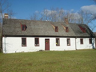
Mattaponi, also known as the John Bowie Jr. House, is a historic home in Croom, Maryland, built c. 1820 on the foundation of an earlier house dating to the 1730s, three miles northwest of Nottingham, Prince George's County, Maryland.
Governor Bridge is an historic single-lane bridge over the Patuxent River near Bowie, Maryland. The river marks the boundary between Prince George's and Anne Arundel counties. A bridge has been located on this site since the mid-18th century.
Queen Anne Bridge is an historic bridge over the Patuxent River near Queen Anne in Prince George's County, Maryland in the United States of America. It is the only surviving example of a Pratt truss bridge with Phoenix sections in the county.
Middle Plantation is a historic house and plantation in Davidsonville, Maryland, originally owned by the Huguenot, Mareen Duvall. The original 600-acre tract was patented to him near the South River in 1664.
The Duvall Farm was a historic farm located in North Laurel, Howard County, Maryland, United States, now the site of Coastal Sunbelt Produce.
