Dyfi Bridge

Last updated

Dyfi Bridge

Welsh: Pont ar Ddyfi
Machynlleth - panoramio (1).jpg
West side of the bridge
Coordinates 52°36′02″N3°51′21″W / 52.6005°N 3.8557°W / 52.6005; -3.8557
OS grid reference SH744019
Carries UK traffic sign 967.svg 82
Crosses River Dyfi
Locale Machynlleth
Heritage status
Characteristics
Total length64 m (210 ft)
Width5.5 m (18 ft)
No. of spans5
History
Inaugurated1681
Rebuilt1805
Location
Dyfi Bridge
Crossing between Powys and Gwynedd Pont ar Ddyfi - geograph.org.uk - 240512.jpg
Crossing between Powys and Gwynedd

The Dyfi Bridge (Welsh : Pont ar Ddyfi), also known as the Machynlleth Bridge, Dovey Bridge, Pont Dyfi or Pont ar Dyfi, is a road bridge across the River Dyfi north of Machynlleth, Powys, Wales. It is described as "one of the finest bridges in Montgomeryshire" by the Gwynedd Archaeological Trust. [1]

Contents

History and description

The bridge was initially a timber bridge, built in 1533 using £6 13s 4d (10 marks) given by London merchant Geoffry Hughes. [1] It was rebuilt in stone in 1681 [1] and rebuilt again in 1805. [2] The bridge is a scheduled monument and received a Grade II* heritage listing in 1952. [3]

The bridge carried the A487 road across the River Dyfi between Machynlleth (Montgomeryshire/Powys) and the Corris community (Merionethshire/Gwynedd) prior to the opening of the new bridge upstream, after which it was closed off to vehicular traffic at the northern end and the access route on the south side downgraded to a secondary route (currently unclassified) with responsibility for maintenance transferred to the local authorities. [1] [3] The bridge has five arches, with the two arches at the Machynlleth end reinforced with modern steelwork. [2] It is 5.5 metres (18 ft) wide and 64 metres (210 ft) long. [1]

New bridge

In 2011 a report was drawn up recommending the bridge was replaced or widened because of its strategic importance, as it had unsafe low parapets and a lack of footways, and had been repeatedly damaged by motor vehicles because of its poor sightlines. The recommendations were dismissed in favour of looking at options for a new bridge at a different location. [4]

On 19 May 2017 the Welsh government published a statement that a new bridge would be constructed about 500 m upstream from the current bridge. Work was scheduled to start near the end of 2018 and the completion of the bridge (being ready for traffic) was envisaged in the summer of 2020. [5] The start date was subsequently delayed till at least 2019, with a public enquiry possibly required depending on the results of consultation. [6] On 13 January 2020 the Welsh government announced that there would be no public enquiry, and construction would start in the summer of 2020 with estimated completion in summer 2022. [7] Construction started in spring 2021 and the new bridge opened on 2nd February 2024 to vehicle traffic and pedestrians. [8] [9]

Related Research Articles

<span class="mw-page-title-main">Corris Railway</span> Narrow gauge railway in Wales

The Corris Railway is a narrow gauge preserved railway based in Corris on the border between Merionethshire and Montgomeryshire in Mid-Wales.

<span class="mw-page-title-main">Montgomeryshire</span> Historic county of Wales

Until 1974, Montgomeryshire was an administrative county in mid Wales, later classed as one of the thirteen historic counties of Wales. It was named after its county town, Montgomery, which in turn was named after one of William the Conqueror's main counsellors, Roger de Montgomerie, who was the 1st Earl of Shrewsbury.

<span class="mw-page-title-main">A487 road</span> Trunk road in Wales

The A487, officially the Fishguard to Bangor Trunk Road, is a trunk road in Wales that follows the coast from Haverfordwest, Pembrokeshire, in the south, to Bangor, Gwynedd, in the north.

<span class="mw-page-title-main">Machynlleth</span> Market town in Powys, Wales

Machynlleth is a market town, community and electoral ward in Powys, Wales and within the historic boundaries of Montgomeryshire. It is in the Dyfi Valley at the intersection of the A487 and the A489 roads. At the 2001 Census it had a population of 2,147, rising to 2,235 in 2011. It is sometimes referred to colloquially as Mach.

<span class="mw-page-title-main">North Wales</span> Geographic region in Wales

North Wales is a region of Wales, encompassing its northernmost areas. It borders mid Wales to the south, England to the east, and the Irish Sea to the north and west. The area is highly mountainous and rural, with Snowdonia National Park and the Clwydian Range and Dee Valley, known for its mountains, waterfalls and trails, wholly within the region. Its population is concentrated in the north-east and northern coastal areas, with significant Welsh-speaking populations in its western and rural areas. North Wales is imprecisely defined, lacking any exact definition or administrative structure. It is commonly defined administratively as its six most northern principal areas, but other definitions exist, with Montgomeryshire historically considered to be part of the region.

<span class="mw-page-title-main">Pennal</span> Village in Gwynedd, Wales

Pennal is a village and community on the A493 road in southern Gwynedd, Wales, on the north bank of the River Dyfi, near Machynlleth.

<span class="mw-page-title-main">Dovey Junction railway station</span> Railway station in Powys, Wales

Dovey Junction is a railway station on the Cambrian Line in Wales. It is the junction where the line splits into the line to Aberystwyth and the Cambrian Coast Line to Pwllheli. Passenger services are provided by Transport for Wales. There is a single island platform.

<span class="mw-page-title-main">Corris</span> Village in Gwynedd, Wales

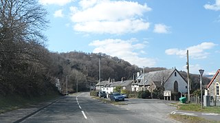
Corris is a village in the county of Gwynedd, Wales, about 4.5 miles (7 km) north of the town of Machynlleth. The village lies on the west bank of the Afon Dulas, around that river's confluence with the Afon Deri. Its railway station is the headquarters and museum of the Corris Railway, a preserved narrow gauge railway.

<span class="mw-page-title-main">Esgairgeiliog</span> Village in Wales

Esgairgeiliog is a village in Powys, Wales, UK. It is situated at the junction of the Afon Glesyrch's and Afon Dulas' valleys.

<span class="mw-page-title-main">River Dyfi</span> River in Mid Wales

The River Dyfi, also known as the River Dovey, is an approximately 30-mile (48-kilometre) long river in Wales.

<span class="mw-page-title-main">Ffridd Gate railway station</span> Former railway station in Wales

Ffridd Gate was a station on the Corris Railway in Merioneth, Wales, UK. It was built at the level crossing over the B4404 road to Llanwrin, near the hamlet of Fridd. A small hamlet also grew up around the station and a nearby (pre-existent) toll-house. The hamlet and former station are near to the confluence of the Afon Dulas and the River Dyfi, around 2+14 miles (3.6 km) west of the village of Llanwrin and 1 mile (1.6 km) north of the town of Machynlleth.
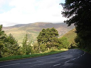
<span class="mw-page-title-main">Corris Uchaf</span> Village in Gwynedd, Wales

Corris Uchaf is a village in the south of Snowdonia National Park in Gwynedd, Wales. The slate quarries that surround Corris Uchaf are its most prominent feature.

Derwenlas is a hamlet in northern Powys, Wales. It is part of the community of Cadfarch.

<span class="mw-page-title-main">Morben</span> Village in Powys, Wales

Morben is a hamlet in northern Powys, Wales. Part of the historic county of Montgomeryshire from 1536 to 1974, it lies on the Afon Dyfi and was once the home of a number of riverside quays, including Cei Ward and Y Bwtri. The site of Cei Ward lies alongside the A487 opposite Plas Llugwy, where the road, railway and river run close together. Y Bwtri lay on the bend of the river opposite Pennal and was the site of a shipyard.

<span class="mw-page-title-main">Afon Dulas</span> River in Wales

The Afon Dulas, or North Dulas, is a river forming the border between Merionethshire/Gwynedd and Montgomeryshire/Powys in Wales. Another river called Afon Dulas joins the Dyfi from the south, upstream of its confluence with the North Dulas: locally this is referred to as the South Dulas.

<span class="mw-page-title-main">Garneddwen</span> Human settlement in Wales

Garneddwen is a hamlet in the south of the county of Gwynedd, Wales. It lies in the historic county of Merionethshire/Sir Feirionnydd, in the valley of the Afon Dulas.

<span class="mw-page-title-main">Pantperthog</span> Village in United Kingdom

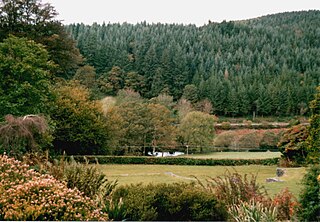
Pantperthog is a hamlet in southern Gwynedd in Wales, 2 miles north of Machynlleth and 14 miles southeast of Dolgellau. Nearby is the former Llwyngwern quarry, which is now the Centre for Alternative Technology.

Mathafarn is a house and farm near Llanwrin, in Wales. The earliest house here was built before 1485, and Mathafarn plays a significant role in Welsh and English history.

References

  1. 1 2 3 4 5 "Pont ar Ddyfi Bridge, Machynlleth". Gwynedd Archaeological Trust. Retrieved 28 August 2017.
  2. 1 2 "Machynlleth Bridge; Pont ar Ddyfi (24236)". Coflein. RCAHMW . Retrieved 28 August 2017.
  3. 1 2 "Pont-ar-Dyfi (Partly in Corris community)". British Listed Buildings. Retrieved 28 August 2017.
  4. "A487 Fishguard to Bangor Trunk Road: Pont Ar Dyfi Improvement Machynlleth" (PDF). Mid Wales Trunk Road Agency. February 2011. Retrieved 28 August 2017.
  5. "A487: new Dyfi bridge". GOV.WALES. Retrieved 3 February 2020.
  6. Antony Gedge (8 August 2018). "Concern at 'delays' to new Dyfi Bridge scheme". Cambrian News. Retrieved 30 September 2018.[ permanent dead link ]
  7. "£46m Dyfi bridge replacement given go-ahead". BBC. 13 January 2020. Retrieved 3 February 2020.
  8. "A487: new Dyfi Bridge (overview)". Welsh Government. Retrieved 23 May 2021.
  9. "Dyfi bridge: New road opens tackling long diversion". BBC News. 2 February 2024. Retrieved 3 March 2024.