| Designations | |
|---|---|
| Official name | Cors Fochno & Dyfi |
| Designated | 5 January 1976 |
| Reference no. | 66 [1] |

Dyfi Estuary Mudflats are mudflats on the estuary of the River Dyfi in Ceredigion, Wales, and are part of the Dyfi National Nature Reserve.
| Designations | |
|---|---|
| Official name | Cors Fochno & Dyfi |
| Designated | 5 January 1976 |
| Reference no. | 66 [1] |

Dyfi Estuary Mudflats are mudflats on the estuary of the River Dyfi in Ceredigion, Wales, and are part of the Dyfi National Nature Reserve.
The Dyfi Estuary is located on the conjunction of the counties of Ceredigion, Gwynedd and Powys. The area is designated a Special Protection Area (SPA), a protected site for wild birds under the EC Birds Directive. The area comprises the estuary and adjoining salt marsh and includes sandbanks, mudflats, peat bogs, river channels, meanders and creeks, with an extensive sand dune complex across the mouth of the estuary at Ynyslas.
A large part of the western shore is owned and managed by the RSPB. The site is an established wintering area for Greenland white-fronted geese, this area being the most southerly regularly used the UK. [2]
The estuary is also a feeding ground for large numbers of dunlin, oystercatcher, sanderling, Manx shearwater and terns. [3]

Breydon Water is a 514.4-hectare (1,271-acre) biological Site of Special Scientific Interest at Great Yarmouth, Norfolk. It is a Local Nature Reserve, a Ramsar site and a Special Protection Area. It is part of the Berney Marshes and Breydon Water nature reserve, which is managed by the Royal Society for the Protection of Birds (RSPB).
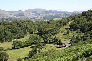
Ceredigion, historically Cardiganshire, is a county in the west of Wales. It borders Gwynedd across the Dyfi estuary to the north, Powys to the east, Carmarthenshire and Pembrokeshire to the south, and the Irish Sea to the west. Aberystwyth is the largest settlement and, together with Aberaeron, is an administrative centre of Ceredigion County Council.

Afon Rheidol is a river in Ceredigion, Wales, 19 miles (31 km) in length. The source is Plynlimon. Receiving an average annual rainfall of 40 inches (1.02 m), Plynlimon is also the source of both the Wye and the Severn.

Chessel Bay is a 12.9-hectare (32-acre) Local Nature Reserve on the east bank of the River Itchen in Southampton in Hampshire. It is owned and managed by Southampton City Council. It is part of Solent and Southampton Water Ramsar site and Special Protection Area, and of Lee-on-The Solent to Itchen Estuary, which is a Site of Special Scientific Interest. It has been a local nature reserve since 1989

The River Dyfi, also known as the River Dovey, is an approximately 30-mile (48-kilometre) long river in Wales.

Ynyslas is a small village about 1.5 miles north of Borth and 8 miles north of Aberystwyth, within the county of Ceredigion, Wales. It is sandwiched between a long sandy beach in Cardigan Bay and the beach in the Dyfi Estuary. The area between the sea and the estuary beach is made up of the Ynyslas Sand Dunes which are part of the Dyfi National Nature Reserve and home to many rare plants and animals. The sands of the estuary beach can be driven onto and parked upon. The nature reserve has a visitor centre with toilets and a small shop. At the start of some BBC 1 programmes, it shows people flying kites on the sand dunes, this was filmed at Ynyslas.

Ynys-hir RSPB reserve is a nature reserve of the RSPB situated beside the Dyfi estuary in Ceredigion, mid Wales between Aberystwyth and Machynlleth. The reserve covers 550 hectares and includes a variety of habitats extending inland from mudflats and salt marsh through farmland and pools to oak woodland and hillside scrub. Facilities include a small visitor centre and seven hides.

Tan-y-Bwlch beach near Aberystwyth, Wales, forms part of the Pen Dinas and Tan-y-Bwlch Local Nature Reserve (LNR). The majority of which is located in the village of Penparcau. The area was designated in 1999 following a public meeting which attracted more than 100 local people. The 100-acre (0.40 km2) site contains the Bronze Age burial mound and Iron Age Hillfort named Pen Dinas. The site is managed by Ceredigion County Council and is publicly owned, it is the largest Local nature reserve in the Dyfi Biosphere. The Wales Coastal Path runs along the top of the shingle beach. The beach is sometimes referred to as Penparcau Beach by locals in the area, the name is used on some mapping services.

The Dyfi National Nature Reserve, managed by Natural Resources Wales, the successor body to the Countryside Council for Wales, is located 7 miles (11 km) north of Aberystwyth in the county of Ceredigion, Wales on the Dyfi estuary.

Ynyslas Sand Dunes are sand dunes located in Ceredigion, Wales. They border Cardigan Bay and the Dyfi Estuary between Ynyslas, Ceredigion and Aberdyfi, Gwynedd. The sand dunes are part of the Dyfi National Nature Reserve.
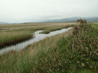
Cors Fochno is a raised peat bog near the village of Borth, in the county of Ceredigion, Wales. Lying on the south side of the Dyfi estuary, it forms a component part of the Dyfi National Nature Reserve. It was designated a UNESCO biosphere reserve in 1976, and is the only such reserve in Wales.

Dyfi Furnace is a restored mid 18th century charcoal fired blast furnace used for smelting iron ore. It has given its name to the adjoining hamlet of Furnace.

Afon Leri is a river in Ceredigion, Wales. It rises at Llyn Craig-y-Pistyll and is joined at Talybont by Afon Ceulan before passing behind Borth to its mouth in the Dyfi estuary at Ynyslas.

Alde–Ore Estuary is a 2,534 hectare biological and geological Site of Special Scientific Interest which stretches along the Suffolk coast between Aldeburgh and Bawdsey, and also includes parts of the Alde, Ore and Butley Rivers. It is in the Suffolk Coast and Heaths Area of Outstanding Natural Beauty, and is a Grade I Nature Conservation Review site, a Special Area of Conservation, a Ramsar internationally important wetland site, and a Special Protection Area under the European Union Directive on the Conservation of Wild Birds. It includes two Geological Conservation Review sites, "Orfordness and Shingle Street" and "The Cliff, Gedgrave", and two nature reserves managed by the Suffolk Wildlife Trust, Alde Mudflats and Simpson's Saltings. The coastal part of the site is Orfordness-Havergate, a National Nature Reserve, and Orford Ness is managed by the National Trust, while Havergate Island is managed by the Royal Society for the Protection of Birds.
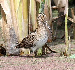
The Hunter Estuary Wetlands comprise a group of associated wetlands at and near the mouth of the Hunter River in the city of Newcastle, New South Wales, Australia. The wetlands are part of Hunter Wetlands National Park. 30 km2 of the wetlands have been recognised as being of international importance by designation under the Ramsar Convention. It was listed on 21 February 1984 as Ramsar site 287. A larger area of the wetlands has been identified by BirdLife International as an Important Bird Area (IBA). The wetlands are recognised as the most important area in New South Wales for waders, or shorebirds.
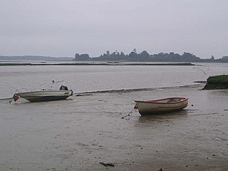
Alde Mudflats is a 22 hectare nature reserve west of Iken in Suffolk. It is owned by the Crown Estate and managed by the Suffolk Wildlife Trust. It is in the Suffolk Coast and Heaths Area of Outstanding Natural Beauty, and part of the Alde-Ore Estuary Site of Special Scientific Interest, Ramsar internationally important wetland site, Special Area of Conservation, Special Protection Area under the European Union Directive on the Conservation of Wild Birds, and Grade I Nature Conservation Review site,
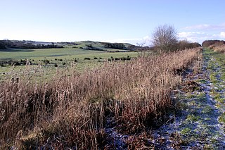
The Dyfi Biosphere is situated at the coast of south-central Wales in the estuary of the River Dyfi, and is a biosphere reserve representative of salt marshes and estuarine systems in the west of the United Kingdom. The estuary forms one of the most important wildfowl and shorebird centres in Wales and also comprises a Ramsar site.
Ysgubor-y-coed is a community in the northernmost part of Ceredigion, Wales, with a population of 310 as of the 2011 UK census. It includes the villages of Eglwys Fach, Glandyfi, and Furnace, Ceredigion. It is 12 miles (19 km) from Aberystwyth.

Hurst Castle and Lymington River Estuary is a 1,077.3-hectare (2,662-acre) biological and geological Site of Special Scientific Interest near Lymington in Hampshire. It is a Nature Conservation Review site and two areas are Geological Conservation Review sites. Three areas are local nature reserves, Boldre Foreshore, Sturt Pond and Lymington and Keyhaven Marshes; the latter site is managed by the Hampshire and Isle of Wight Wildlife Trust. Part of it is North Solent National Nature Reserve. It is part of Solent and Southampton Water Ramsar site and Special Protection Area. Parts of it are in Solent Maritime and Solent and Isle of Wight Lagoons Special Areas of Conservation.

Upper Hamble Estuary and Woods is a 151.2-hectare (374-acre) biological Site of Special Scientific Interest east of Southampton in Hampshire. It is part of Solent and Southampton Water Ramsar site and Special Protection Area, and of Solent Maritime Special Area of Conservation. Part of the site is in Manor Farm Country Park, which is a Local Nature Reserve.