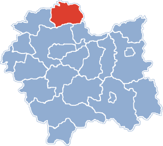
Glinica is a village in the administrative district of Gmina Miechów, within Miechów County, Lesser Poland Voivodeship, in southern Poland. It lies approximately 7 kilometres (4 mi) south-east of Miechów and 29 km (18 mi) north of the regional capital Kraków.
Kalina Mała is a village in the administrative district of Gmina Miechów, within Miechów County, Lesser Poland Voivodeship, in southern Poland. It lies approximately 6 kilometres (4 mi) east of Miechów and 36 km (22 mi) north of the regional capital Kraków.
Kalina-Lisiniec is a village in the administrative district of Gmina Miechów, within Miechów County, Lesser Poland Voivodeship, in southern Poland. It lies approximately 8 kilometres (5 mi) east of Miechów and 35 km (22 mi) north-east of the regional capital Kraków.
Kalina-Rędziny is a village in the administrative district of Gmina Miechów, within Miechów County, Lesser Poland Voivodeship, in southern Poland. It lies approximately 6 kilometres (4 mi) east of Miechów and 35 km (22 mi) north of the regional capital Kraków.
Nasiechowice is a village in the administrative district of Gmina Miechów, within Miechów County, Lesser Poland Voivodeship, in southern Poland. It lies approximately 10 kilometres (6 mi) south-east of Miechów and 32 km (20 mi) north-east of the regional capital Kraków.
Pojałowice is a village in the administrative district of Gmina Miechów, within Miechów County, Lesser Poland Voivodeship, in southern Poland. It lies approximately 7 kilometres (4 mi) south-east of Miechów and 31 km (19 mi) north of the regional capital Kraków.
Zarogów is a village in the administrative district of Gmina Miechów, within Miechów County, Lesser Poland Voivodeship, in southern Poland. It lies approximately 6 kilometres (4 mi) east of Miechów and 34 km (21 mi) north of the regional capital Kraków.
Głogowiany is a village in the administrative district of Gmina Książ Wielki, within Miechów County, Lesser Poland Voivodeship, in southern Poland. It lies approximately 4 kilometres (2 mi) north-west of Książ Wielki, 13 km (8 mi) north-east of Miechów, and 46 km (29 mi) north of the regional capital Kraków.
Konaszówka is a village in the administrative district of Gmina Książ Wielki, within Miechów County, Lesser Poland Voivodeship, in southern Poland. It lies approximately 1 kilometre (1 mi) north of Książ Wielki, 13 km (8 mi) north-east of Miechów, and 45 km (28 mi) north of the regional capital Kraków.
Książ Mały-Kolonia is a village in the administrative district of Gmina Książ Wielki, within Miechów County, Lesser Poland Voivodeship, in southern Poland. It lies approximately 7 kilometres (4 mi) east of Książ Wielki, 17 km (11 mi) north-east of Miechów, and 47 km (29 mi) north-east of the regional capital Kraków.

Mianocice is a village in the administrative district of Gmina Książ Wielki, within Miechów County, Lesser Poland Voivodeship, in southern Poland. It lies approximately 3 kilometres (2 mi) west of Książ Wielki, 11 km (7 mi) north-east of Miechów, and 44 km (27 mi) north of the regional capital Kraków.
Dosłońce is a village in the administrative district of Gmina Racławice, within Miechów County, Lesser Poland Voivodeship, in southern Poland. It lies approximately 2 kilometres (1 mi) north of Racławice, 14 km (9 mi) east of Miechów, and 38 km (24 mi) north-east of the regional capital Kraków.
Janowiczki is a village in the administrative district of Gmina Racławice, within Miechów County, Lesser Poland Voivodeship, in southern Poland. It lies approximately 2 kilometres (1 mi) south of Racławice, 16 km (10 mi) east of Miechów, and 36 km (22 mi) north-east of the regional capital Kraków.
Grzymałów is a village in the administrative district of Gmina Słaboszów, within Miechów County, Lesser Poland Voivodeship, in southern Poland. It lies approximately 7 kilometres (4 mi) south-west of Słaboszów, 13 km (8 mi) east of Miechów, and 38 km (24 mi) north-east of the regional capital Kraków.
Ilkowice is a village in the administrative district of Gmina Słaboszów, within Miechów County, Lesser Poland Voivodeship, in southern Poland. It lies approximately 4 kilometres (2 mi) west of Słaboszów, 15 km (9 mi) east of Miechów, and 42 km (26 mi) north-east of the regional capital Kraków.
Jazdowice is a village in the administrative district of Gmina Słaboszów, within Miechów County, Lesser Poland Voivodeship, in southern Poland. It lies approximately 5 kilometres (3 mi) south-east of Słaboszów, 21 km (13 mi) east of Miechów, and 44 km (27 mi) north-east of the regional capital Kraków.
Kropidło is a village in the administrative district of Gmina Słaboszów, within Miechów County, Lesser Poland Voivodeship, in southern Poland. It lies approximately 4 kilometres (2 mi) south-west of Słaboszów, 15 km (9 mi) east of Miechów, and 40 km (25 mi) north-east of the regional capital Kraków.
Raszówek is a village in the administrative district of Gmina Słaboszów, within Miechów County, Lesser Poland Voivodeship, in southern Poland. It lies approximately 6 kilometres (4 mi) south-west of Słaboszów, 13 km (8 mi) east of Miechów, and 39 km (24 mi) north-east of the regional capital Kraków.
Święcice is a village in the administrative district of Gmina Słaboszów, within Miechów County, Lesser Poland Voivodeship, in southern Poland. It lies approximately 4 kilometres (2 mi) north-west of Słaboszów, 15 km (9 mi) east of Miechów, and 43 km (27 mi) north-east of the regional capital Kraków.
Kamienna is a village in the administrative district of Gmina Opatowiec, within Kazimierza County, Świętokrzyskie Voivodeship, in south-central Poland. It lies approximately 10 kilometres (6 mi) north-west of Opatowiec, 12 km (7 mi) east of Kazimierza Wielka, and 65 km (40 mi) south of the regional capital Kielce.