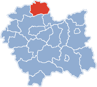
Gmina Słaboszów is a rural gmina in Miechów County, Lesser Poland Voivodeship, in southern Poland. Its seat is the village of Słaboszów, which lies approximately 18 kilometres (11 mi) east of Miechów and 44 km (27 mi) north-east of the regional capital Kraków.

Brzuchania is a village in the administrative district of Gmina Miechów, within Miechów County, Lesser Poland Voivodeship, in southern Poland. It lies approximately 6 kilometres (4 mi) north-east of Miechów and 38 km (24 mi) north of the regional capital Kraków.
Bukowska Wola is a village in the administrative district of Gmina Miechów, within Miechów County, Lesser Poland Voivodeship, in southern Poland. It lies approximately 3 kilometres (2 mi) east of Miechów and 35 km (22 mi) north of the regional capital Kraków.
Dziewięcioły is a village in the administrative district of Gmina Miechów, within Miechów County, Lesser Poland Voivodeship, in southern Poland. It lies approximately 13 kilometres (8 mi) south-east of Miechów and 33 km (21 mi) north-east of the regional capital Kraków.
Glinica is a village in the administrative district of Gmina Miechów, within Miechów County, Lesser Poland Voivodeship, in southern Poland. It lies approximately 7 kilometres (4 mi) south-east of Miechów and 29 km (18 mi) north of the regional capital Kraków.
Kalina Mała is a village in the administrative district of Gmina Miechów, within Miechów County, Lesser Poland Voivodeship, in southern Poland. It lies approximately 6 kilometres (4 mi) east of Miechów and 36 km (22 mi) north of the regional capital Kraków.
Kalina-Rędziny is a village in the administrative district of Gmina Miechów, within Miechów County, Lesser Poland Voivodeship, in southern Poland. It lies approximately 6 kilometres (4 mi) east of Miechów and 35 km (22 mi) north of the regional capital Kraków.
Nasiechowice is a village in the administrative district of Gmina Miechów, within Miechów County, Lesser Poland Voivodeship, in southern Poland. It lies approximately 10 kilometres (6 mi) south-east of Miechów and 32 km (20 mi) north-east of the regional capital Kraków.
Parkoszowice is a village in the administrative district of Gmina Miechów, within Miechów County, Lesser Poland Voivodeship, in southern Poland. It lies approximately 5 kilometres (3 mi) south-east of Miechów and 30 km (19 mi) north of the regional capital Kraków.
Pojałowice is a village in the administrative district of Gmina Miechów, within Miechów County, Lesser Poland Voivodeship, in southern Poland. It lies approximately 7 kilometres (4 mi) south-east of Miechów and 31 km (19 mi) north of the regional capital Kraków.
Sławice Szlacheckie is a village in the administrative district of Gmina Miechów, within Miechów County, Lesser Poland Voivodeship, in southern Poland. It lies approximately 6 kilometres (4 mi) south-east of Miechów and 31 km (19 mi) north of the regional capital Kraków.
Strzeżów Pierwszy is a village in the administrative district of Gmina Miechów, within Miechów County, Lesser Poland Voivodeship, in southern Poland. It lies approximately 4 kilometres (2 mi) north-east of Miechów and 37 km (23 mi) north of the regional capital Kraków.
Zarogów is a village in the administrative district of Gmina Miechów, within Miechów County, Lesser Poland Voivodeship, in southern Poland. It lies approximately 6 kilometres (4 mi) east of Miechów and 34 km (21 mi) north of the regional capital Kraków.
Boczkowice is a village in the administrative district of Gmina Książ Wielki, within Miechów County, Lesser Poland Voivodeship, in southern Poland. It lies approximately 6 kilometres (4 mi) east of Książ Wielki, 15 km (9 mi) north-east of Miechów, and 45 km (28 mi) north-east of the regional capital Kraków.
Giebułtów is a village in the administrative district of Gmina Książ Wielki, within Miechów County, Lesser Poland Voivodeship, in southern Poland. It lies approximately 5 kilometres (3 mi) south-east of Książ Wielki, 11 km (7 mi) north-east of Miechów, and 42 km (26 mi) north-east of the regional capital Kraków.
Książ Mały is a village in the administrative district of Gmina Książ Wielki, within Miechów County, Lesser Poland Voivodeship, in southern Poland. It lies approximately 5 kilometres (3 mi) east of Książ Wielki, 16 km (10 mi) north-east of Miechów, and 47 km (29 mi) north-east of the regional capital Kraków.
Buszków is a village in the administrative district of Gmina Słaboszów, within Miechów County, Lesser Poland Voivodeship, in southern Poland. It lies approximately 3 kilometres (2 mi) south-east of Słaboszów, 20 km (12 mi) east of Miechów, and 44 km (27 mi) north-east of the regional capital Kraków.
Kalina Wielka is a village in the administrative district of Gmina Słaboszów, within Miechów County, Lesser Poland Voivodeship, in southern Poland. It lies approximately 9 kilometres (6 mi) west of Słaboszów, 10 km (6 mi) east of Miechów, and 39 km (24 mi) north-east of the regional capital Kraków.
Łazów is a village in the administrative district of Gmina Krzeszów, within Nisko County, Subcarpathian Voivodeship, in south-eastern Poland. It lies approximately 9 kilometres (6 mi) south-east of Krzeszów, 30 km (19 mi) south-east of Nisko, and 47 km (29 mi) north-east of the regional capital Rzeszów.